Download
1 / 14
140 likes | 234 Vues
SPAIN 2013. Mineral Exploración Network. Why Spain ?. Prospective geological situation Landscape conditions allow quick prospecting Excellent infrastructure Possibility to work during winter and use MEN Finland human and technical resources all year around. Project Extremadura.

E N D
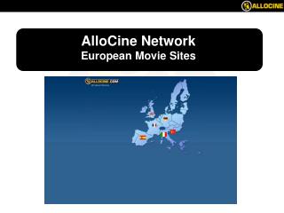
SPAIN2013 Mineral Exploración Network
Why Spain? • Prospective geological situation • Landscape conditions allow quick prospecting • Excellent infrastructure • Possibility to work during winter and use MEN Finland human and technical resources all year around
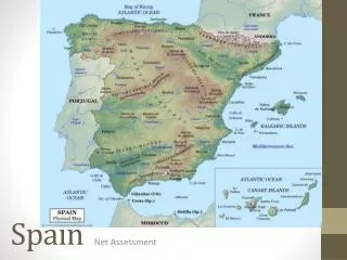
ProjectExtremadura Area of interest is located on the intersection of NW striking regional thrust zone and corridor of faults of SW orientation.
ProjectExtremadura • Pro Mining Government • Quick and transparent licence application process • Easy available geological information
ProjectExtremadura Long mining history starting from prehistoric time till the middle of 20th centaury Augustobriga - Talavera la Vieja
ProjectExtremadura Project licenses 1 – Trojillo – Logrosan, prospecting license, 945 sq. km. 2 – Maria – exploration license, 78 sq. km. 3 – Antonio – exploration license, 85 sq. km. License Applications: 4 – Berzocana – exploration license, 84 sq. km. 5 – St. Cristobal – exploration license, 63,7 sq. km. Total: 1.255,7 sq.km. 1 2 4 5 3 Augustobriga - Talavera la Vieja
ProjectExtremadura Project area is located in inner zone of multistage volcanogenic ring complex active from pre Cambrian till Tertiary period Radiometric survey -Potassium Magnetic survey vertical component
ProjectExtremadura Exploration model
ProjectExtremadura Historical mines: • "El Aguijón. Operational 1850-1950. Zn, Pb, Ag, Au • "La Favorita": Cu, Py, P • "El Aguijoncillo": Mining stopped in 1904. Sb, Cu, Au. • "El Piojo": Mining stopped in 1876. Zn, Pb. • "El Serranillo": Mining stopped in1970. As, Sn, Mo. • “La Costanaza”: Operational in 1907-1946. Phosphorous. 6
ProjectExtremadura MEN Finland had started full scale prospecting in September 2013 By 30th of November following work was done: • Stream sediments sampling - 3014 samples • Soil sampling - 17053 samples • Magnetic survey - 680 line km • Pan concentrates - 69 samples
ProjectExtremadura 1 mm 1 mm 1 mm 1 mm 1 mm 1 mm 1 mm 1 mm
ProjectExtremadura Detailed area Results of soil sampling and ground magnetic survey, Logrosan area.
ProjectExtremadura A B B A
ProjectExtremadura Our plans Minimum Maximum By own financial resources With JV partner investment Minimum + • Expand ground holding • Intensive trenching • Verification drilling • Resource drilling • Finalize stream sediment sampling on existing licenses • Carry out magnetic survey and soil sampling on selected targets • Limited trenching Spring 2014 2014 - 1 M Euro – 25% of the project 2015 - 2 M Euro – 25% of the project