Download
1 / 19
190 likes | 533 Vues
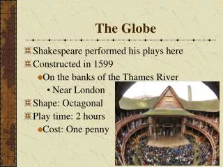
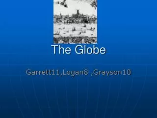
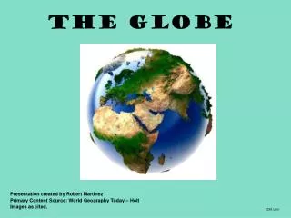
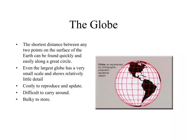
The Globe. The shortest distance between any two points on the surface of the Earth can be found quickly and easily along a great circle. Even the largest globe has a very small scale and shows relatively little detail Costly to reproduce and update. Difficult to carry around. Bulky to store.

E N D
The Globe • The shortest distance between any two points on the surface of the Earth can be found quickly and easily along a great circle. • Even the largest globe has a very small scale and shows relatively little detail • Costly to reproduce and update. • Difficult to carry around. • Bulky to store.
Mercator • Used for navigation or maps of equatorial regions • Any straight line on the map is a rhumb line (line of constant direction). • Directions along a rhumb line are true between any two points on map, but a rhumb line is usually not the shortest distance between points. • Distances are true only along Equator • Areas and shapes of large areas are distorted. Distortion increases away from Equator and is extreme in polar regions • The map is not perspective, equal area, or equidistant • Cylindrical— Mathematically projected on a cylinder tangent to the Equator. (Cylinder may also be secant.)
Transverse Mercator • Used by USGS for many quadrangle maps at scales from 1:24,000 to 1:250,000 • Distances are true only along the central meridian selected by the mapmaker or else along two lines parallel to it • Distortion of distances, directions, and size of areas increases rapidly outside the 15° band. Because the map is conformal, however, shapes and angles within any small area are essentially true. • Equator is straight. Other parallels are complex curves concave toward nearest pole. • Central meridian and each meridian 90° from it are straight. Other meridians are complex curves concave toward central meridian. • Cylindrical—Mathematically projected on cylinder tangent to a meridian. (Cylinder may also be secant.)
Oblique Mercator • Used to show regions along a great circle other than the Equator or a meridian • Distances are true only along the great circle (the line of tangency for this projection), or along two lines parallel to it. • Distortion of areas, distances, and shapes increases away from the great circle. It is excessive toward the edges of a world map except near the path of the great circle. • The map is conformal, but not perspective, equal area, or equidistant. Rhumb lines are curved. • Cylindrical—Mathematically projected on a cylinder tangent, (or secant) along any great circle but the Equator or a meridian.
Space Oblique Mercator • Developed by the USGS for use in Landsat images because there is no distortion along the curved groundtrack under the satellite • Useful only for a relatively narrow band along the groundtrack. • Space Oblique Mercator maps show a satellite's groundtrack as a curved line that is continuously true to scale as orbiting continues. • Extent of the map is defined by orbit of the satellite • Map is basically conformal, especially in region of satellite scanning.
Miller Cylindrical • Used to represent the entire Earth in a rectangular frame. Popular for world maps. • Looks like Mercator but is not useful for navigation. Shows poles as straight lines. • Avoids some of the scale exaggerations of the Mercator but shows neither shapes nor areas without distortion. • Directions are true only along the Equator. Distances are true only along the Equator. Distortion of distances, areas, and shapes is extreme in high latitudes. • Map is not equal area, equidistant, conformal or perspective. • Cylindrical—Mathematically projected onto a cylinder tangent at the Equator.
Robinson • Uses tabular coordinates rather than mathematical formulas to make the world "look right.” • Better balance of size and shape of high-latitude lands than in Mercator • Directions true along all parallels and along central meridian. Distances constant along Equator and other parallels, but scales vary • Not conformal, equal area, equidistant, or perspective • Used in Goode's Atlas, adopted for National Geographic's world maps in 1988, appears in growing number of other publications, may replace Mercator in many classrooms. • Pseudocylindrical or orthophanic ("right appearing") projection.
Sinusoidal Equal Area • Used frequently in atlases to show distribution patterns. • An easily plotted equal-area projection for world maps • Graticule spacing retains property of equivalence of area. • Areas on map are proportional to same areas on the Earth. • Distances are correct along all parallels and the central meridian(s). • Shapes are increasingly distorted away from the central meridian(s) and near the poles. • Map is not conformal, perspective, or equidistant. • Pseudocylindrical—Mathematically based on a cylinder tangent to the Equator.
Orthographic • Used for perspective views of the Earth, Moon, and other planets. The Earth appears as it would on a photograph from deep space. • Directions are true only from center point of projection. • Scale decreases along all lines radiating from center point of projection. Any straight line through center point is a great circle. • Areas and shapes are distorted by perspective; distortion increases away from center point • Map is perspective but not conformal or equal area. • Azimuthal—Geometrically projected onto a plane. Point of projection is at infinity.
Stereographic • Used to map large continent-sized areas of similar extent in all directions. Used in geophysics to solve spherical geometry problems. • Directions true only from center point of projection. • Scale increases away from center point. • Any straight line through center point is a great circle. • Distortion of areas and large shapes increases away from center point. • Map is conformal and perspective but not equal area or equidistant. • Azimuthal—Geometrically projected on a plane. Point of projection is at surface of globe opposite the point of tangency.
Gnomonic • Used along with the Mercator by some navigators to find the shortest path between two points. • Any straight line drawn on the map is on a great circle, but directions are true only from center point of projection. • Scale increases very rapidly away from center point • Distortion of shapes and areas increases away from center point. • Map is perspective (from the center of the Earth onto a tangent plane) but not conformal, equal area, or equidistant. • Azimuthal—Geometrically projected on a plane. Point of projection is the center of a globe.
Azimuthal Equidistant • Distances and directions to all places true only from center point of projection. Distances correct between points along straight lines through center. All other distances incorrect . • Any straight line drawn through center point is on a great circle. • Distortion of areas and shapes increases away from center point. • Azimuthal—Mathematically projected on a plane tangent to any point on globe. Polar aspect is tangent only at pole.
Lambert Azimuthal • Suited for regions extending equally in all directions from center points, such as Asia and Pacific Ocean. • Areas on the map are shown in true proportion to the same areas on the Earth. Quadrangles (bounded by two meridians and two parallels) at the same latitude are uniform in area. • Directions are true only from center point. • Scale decreases gradually away from center point. • Distortion of shapes increases away from center point. Any straight line drawn through center point is on a great circle. • Map is equal area but not conformal, perspective, or equidistant. • Azimuthal—Mathematically projected on a plane tangent to any point on globe. Polar aspect is tangent only at pole.
Albers Equal Area Conic • Well suited for large countries or other areas that are mainly east-west in extent and that require equal-area representation. • All areas on the map are proportional to the same areas on the Earth. • Directions are reasonably accurate in limited regions. • Distances are true on both standard parallels. • Scale true only along standard parallels. • Map is not conformal, perspective, or equidistant. • Conic—Mathematically projected on a cone conceptually secant at two standard parallels.
Lambert Conformal Conic • Retains conformality. • Distances true only along standard parallels; reasonably accurate elsewhere in limited regions. • Directions reasonably accurate. • Distortion of shapes and areas minimal at, but increases away from standard parallels. • Shapes on large-scale maps of small areas essentially true. • Map is conformal but not perspective, equal area, or equidistant. • Conic—Mathematically projected on a cone conceptually secant at two standard parallels.
Equidistant Conic (Simple Cone) • Good for showing regions within a few degrees of latitude and lying on one side of the Equator. • Distances are true only along all meridians and along one or two standard parallels. • Directions, shapes and areas are reasonably accurate, but distortion increases away from standard parallels. • Map is not conformal, perspective, or equal area, • Conic—Mathematically projected on a cone tangent at one parallel or conceptually secant at two parallels.
Polyconic • Now nearly obsolete, Best suited for areas with a north-south orientation. • Directions are true only along central meridian • Distances are true only along each parallel and along central meridian. • Shapes and areas true only along central meridian • Distortion increases away from central meridian. • It is not conformal, perspective, or equal area. • Conic—Mathematically based on an infinite number of cones tangent to an infinite number of parallels.
Bipolar Oblique Conic Conformal • This "tailor-made" projection is used to show one or both of the American continents. • Scale is true along two lines ("transformed standard parallels") that do not lie along any meridian or parallel • Graticule spacing increases away from the lines of true scale but retains the property of conformality except for a small deviation from conformality where the two conic projections join. • Map is conformal but not equal area, equidistant, or perspective. • Conic—Mathematically based on two cones whose apexes are 104° apart and which conceptually are obliquely secant to the globe along lines following the trend of North and South America.
Glossary of Terms • Azimuth—The angle measured in degrees between a base line radiating from a center point and another line radiating from the same point. Normally, the base line points North, and degrees are measured clockwise from the base line. • Aspect—Individual azimuthal map projections are divided into three aspects: the polar aspect which is tangent at the pole, the equatorial aspect which is tangent at the Equator, and the oblique aspect which is tangent anywhere else. (The word "aspect" has replaced the word "case" in the modern cartographic literature.) • Conformality—A map projection is conformal when at any point the scale is the same in every direction. Therefore, meridians and parallels intersect at right angles and the shapes of very small areas and angles with very short sides are preserved. The size of most areas, however, is distorted. • Developable surface—A developable surface is a simple geometric form capable of being flattened without stretching. Many map projections can then be grouped by a particular developable surface: cylinder, cone, or plane. • Equal areas—A map projection is equal area if every part, as well as the whole, has the same area as the corresponding part on the Earth, at the same reduced scale. No flat map can be both equal area and conformal