Download
1 / 53
530 likes | 763 Vues
Questions. What is the theory of plate tectonics? What is the lithosphere? What is the asthenosphere? What is the connection between the two? What are the two types of plates?. The Earth Has 3 Major Layers. Core Inner Outer Mantle Crust (Mantle) Asthenosphere Lithosphere

E N D
Questions... • What is the theory of plate tectonics? • What is the lithosphere? • What is the asthenosphere? • What is the connection between the two? • What are the two types of plates?
The Earth Has 3 Major Layers Core Inner Outer Mantle Crust (Mantle) Asthenosphere Lithosphere Core Linkclick here for book
The Crust • The temperatures of the crust is 1600 degrees Fahrenheit (870 degrees Celsius) in the deepest parts of the crust. • Composed mostly of oxygen, silicon, and aluminum • The seven continents and ocean plates basically float across the mantle which is composed of much hotter and denser material.
What is the Lithosphere? • The crust and part of the upper mantle = lithosphere • 100 km thick • Less dense than the material below it so it “floats” • Continental Crust – granite • Oceanic Crust - Basalt
The oceanic crust consists of a volcanic lava rock called basalt. Basaltic rocks of the ocean plates are much denser and heavier than the granite rock of the continental plates. • Because of this the continents ride on the denser oceanic plates.
The crust and the upper layer of the mantle together make up a zone of rigid, brittle rock called the Lithosphere. • The layer below the rigid lithosphere is a zone of asphalt-like consistency called the Asthenosphere. • The asthenosphere is the part of the mantle that flows and moves the plates of the Earth.
2 Types of Plates • Ocean plates - plates below the oceans • Continental plates - plates below the continents
What is Plate Tectonics? • The theory that the Earth’s lithosphere is divided into plates that move on top of the asthenosphere. • The Earth’s crust and upper mantle are broken into sections called plates • Plates move around on top of the mantle like rafts • Plates move along smoothly but sometimes they stick and build up pressure. The pressure builds and the rock bends until it snaps. When this occurs and Earthquake is the result!
Plate Tectonics • The Earth is divided into layers due to differences in density. These differences are caused by differences in composition, temperature, and pressure.
Plate Tectonics Theory of Continental Drift – continents drift apart from one another and have done so for years.
Continental Drift Theory • Proposed by Alfred Wegener in 1912 • 250 million years ago, all of the continents were combined into one super-continent called “Pangea” • The continents gradually drifted apart to where they are today
Pangaea • Pangaea was a time when all land masses on Earth were once together as “all earth” • Panthalassa was the sea that surrounded all the land – “all sea” • Pangaea Link
Laurasia was the northern part of Pangea composed of N. America and Eurasia • Gondwana was the southern part of Pangea composed of the remaining continents.
135 Million Years Ago • About 135 million years ago Laurasia was still moving, and as it moved it broke up into the continents of North America, Europe and Asia (Eurasian plate). • Gondwanaland also continued to spread apart and it broke up into the continents of Africa, Antarctica, Australia, South America, and the subcontinent of India. • Arabia started to separate from Africa as the Red Sea opened up. • The red arrows indicate the direction of the continental movements.
Evidence of Continental Drift • Shapes of continents fit like a puzzle • Matching fossils found on different continents • Matching rock formations in Africa and S. America • Glacier patterns
The Same Plant and animal Fossils found on different coastlines.
Same rock patterns found in South America, India, Africa, Antarctica and Australia
Ancient Climates • Tropical plant remains (coal deposits) found in Antarctica • Glaciation in Africa, South America, India, and Australia during the same time
Supporting Evidence • Many years later (1950’s-1960’s) new evidence provided better support like: • Earthquake belts • Locations of volcanoes • Magnetic reversal showed in igneous rocks on the ocean floor, Mid-Ocean Ridge
Mid-Ocean Ridge • Seafloor Spreading click here for link and then show Magnetic Reversal after seafloor spreading.
Iceland straddles the Mid-Atlantic Ridge, and offers a natural laboratory for studying on land the processes that occur along the submerged parts of the Mid-Atlantic Ridge. Splitting along the N. American and Eurasian Plates as N. America moves westward relative to Eurasia.
Lava fountains (10 m high) spouting from eruptive fissures during the October 1980 eruption of Krafla Volcano. (Photograph by Gudmundur E. Sigvaldason, Nordic Volcanological Institute, Reykjavik, Iceland.)
Aerial view of the area around Thingvellir, Iceland, showing a fissure zone (in shadow) that is the on-land exposure of the Mid-Atlantic Ridge. Right of the fissure, the North American Plate is pulling westward away from the Eurasian Plate (left of the fissure). Large building (near top) marks the site of Lögberg, Iceland's first parliament, founded in the year A.D. 930. (Photograph by Oddur Sigurdsson, National Energy Authority, Iceland.)
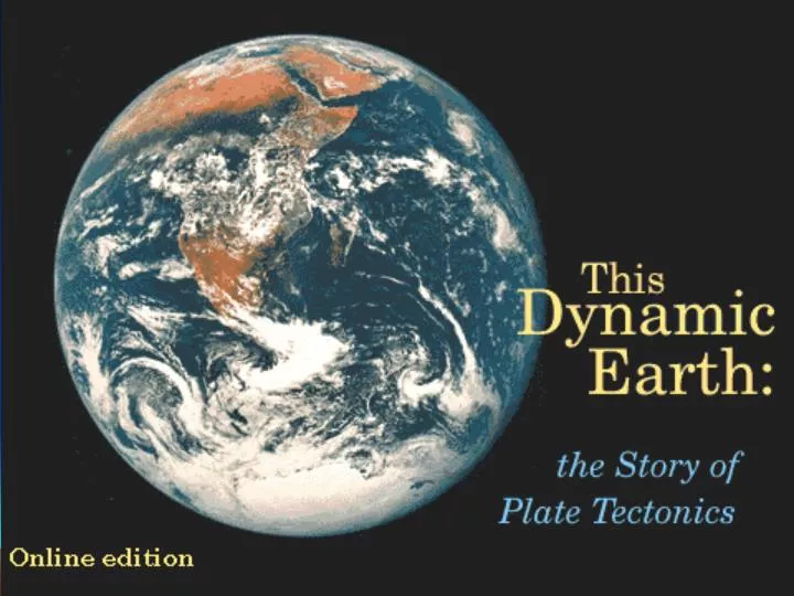
More Interesting Stuff! • Developing the theory [This Dynamic Earth, USGS] • Also read magnetic striping and polar reversal, and seafloor spreading.
Convection Currents – the reason why plates move! • Causes of Tectonic Movement click here for interactive link.
Types of Plate Boundaries: Convergent, Divergent, Transformclick here for interactive book.
Diverging Plates • Diverging Plate Boundary is where the seafloor spreads. • Two plates moving in opposite directions
Divergent Boundaries • Boundary between two plates that are moving apart or rifting • RIFTING causesSeafloor Spreading, Fissure Volcanoes, Rift Valleys
Diverging Boundarycontinent / continent • Rifting happens as they pull apart • Rift valleys and seas form • Great African Rift, Red Sea, Baja California
Convergent Boundaries • Boundaries between two plates that are colliding • There are 3 types • Ocean/Ocean • Continent/Continent • Continent/Ocean
Converging Boundary - ocean/ocean • Subduction – more dense plate slides under the less dense plates • Forms trenches and volcanic island arcs • Aleutian Islands, Mariana Islands, Mariana Trench (deepest)
Where does the Krakin Live? • Most likely in the Trenches! • These are the deepest parts of the ocean floor and are created by subduction! http://blindkat.hegewisch.net/pirates/Nautical_Myths.html#djl
Converging- continent/ocean • Subduction • Forms trenches and volcanic mtn. ranges • Peru-Chile Trench (longest), Andes Mtns.
Peru-Chile Trench Nazca Plate South American Plate Off the coast of South America along the Peru-Chile trench, the oceanic Nazca Plate is pushing into and being subducted under the continental part of the South American Plate. The South American Plate is being lifted up, creating the towering Andes mountains. Strong, destructive earthquakes and the rapid uplift of mountain ranges are common in this region. The Nazca Plate is sinking smoothly and continuously into the trench, the deepest part of the subducting plate breaks into smaller pieces that become locked in place for long periods of time before suddenly moving to generate large earthquakes. Such earthquakes are often accompanied by uplift of the land by as much as a few meters.
The convergence of the Nazca and South American Plates has deformed and pushed up limestone strata to form towering peaks of the Andes, as seen here in the Pachapaqui mining area in Peru. (Photograph by George Ericksen, USGS.)
Holy Cow !!! On June 9, 1994, a magnitude-8.3 earthquake struck about 320 km northeast of La Paz, Bolivia, at a depth of 636 km. This earthquake, within the subduction zone between the Nazca Plate and the South American Plate, was one of deepest and largest subduction earthquakes recorded in South America. Fortunately, even though this powerful earthquake was felt as far away as Minnesota and Toronto, Canada, it caused no major damage because of its great depth
Converging- continent/continent • Collision zones where folding and thrust fault mountains form • Himalayan Mtn (tallest), Appalachian Mtns (oldest)
Convergence of Continent to Continent The collision between the Indian and Eurasian plates has pushed up the Himalayas and the Tibetan Plateau.
Before and After Cross sections showing the meeting of these two plates before and after their collision. The reference points (small squares) show the amount of uplift of an imaginary point in the Earth's crust during this mountain-building process.
Transform Boundaries • Boundary between two plates that are sliding past each other • EARTHQUAKES along faults • Most are found under the ocean floor.
Transform Boundary • Zones between two plates sliding horizontally past one another.
Transform Boundary The Blanco, Mendocino, Murray, and Molokai fracture zones are some of the many fracture zones (transform faults) that scar the ocean floor and offset ridges. The San Andreas is one of the few transform faults exposed on land.This fault moves approx. 5 cm/yr.
San Andreas Fault, California • Pacific plate moving NW with respect to the North American plate
Good-bye California The San Andreas fault zone, which is about 1,300 km long and in places tens of kilometers wide, slices through two thirds of the length of California. Along it, the Pacific Plate has been grinding horizontally past the North American Plate for 10 million years, at an average rate of about 5 cm/yr. Land on the west side of the fault zone (on the Pacific Plate) is moving in a northwesterly direction relative to the land on the east side of the fault zone (on the North American Plate).