Download
1 / 15
150 likes | 304 Vues
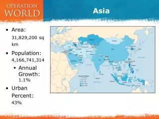
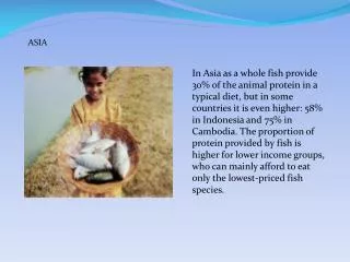
Asia. Asia . World’s Largest continent Home to 2/3 of the world’s population Divided into several distinct regions. Middle East. Middle East. Crossroads of 3 continents: Europe, Asia, and Africa Contains the world’s most important waterway, the Suez Canal.

E N D
Asia • World’s Largest continent • Home to 2/3 of the world’s population • Divided into several distinct regions.
Middle East • Crossroads of 3 continents: Europe, Asia, and Africa • Contains the world’s most important waterway, the Suez Canal. • It shortens the travel time from Europe to Asia. • Most of it is a desert. • Major bodies of water: Jordan, Tigris, and Euphrates Rivers. • These rivers were the center of some of the world’s earliest civilizations due to the fertile soil and mild climate. • Other bodies of water include Mediterranena Sea, Black Sea, Red Sea, and Persian Gulf • Most of the Middle East is located near the Equator. Has warm winters and hot, dry summers. They lack water but have about half of the world’s known oil reserves.
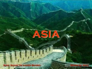
Northern and Central Asia • Northern Asia is occupied by Russia – the world’s largest country in area. • Most of Russia’s population is located in Europe and most of its land is in Asia. • Central Asia, south of Russia, consists of mountains, deserts, and steppes (treeless grasslands). • The steppes are good for grazing. • Siberia, in northeastern Russia, is a cold region with forests. • The northernmost area of Russia is a tundra, where the ground is frozen most of the year. • Afghanistan is a dry, mountainous country in Central Asia. It separates Iran and Russia from Pakistan.
Northern and Central Asia • Bodies of Water • Arctic Ocean – north of Russia is frozen most of the time • The major rivers are the Ob and Lena • Mountains • Ural Mountains separate European and Asian Russia • Pamir Mountains separate Russia from China • Climate • Most of Russia has long, cold winters and short mild summers.
East Asia • Includes three important countries: • China • Korea • Japan • China – world’s third largest country in area (Russia and Canada are bigger). It is the world’s most populous nation. • Korea – a peninsula extending from the north-eastern coastline of China • Japan – consists of four main islands and a number of smaller islands. Separated from the Asian mainland by the Sea of Japan.
East Asia • Bodies of Water • Rivers – were the birthplace of early civilizations • Hwang Ho (yellow river) • Yangtze • Mountains • China’s southern and western borders are ringed by the Himalayan, Kunlun, and Tianjin Mountains. • To the west is the mountainous plateau of Tibet. • Japan and Korea are also mountainous. 85% of Japan is covered by mountains and hills. Mount Fuji, an extinct volcano, is the highest and most infamous mountain in Japan. • Deserts • Gobi Desert – north of China in Mongolia
South and Southeast Asia • Most of South Asia is a subcontinent (a large piece of land smaller than a continent). • The Indian subcontinent is about the size of the US. • Southeast Asia consists of a peninsula (land surrounded by water on three sides) and a series of islands on the southeast corner of the Asian mainland.
South and Southeast Asia • Mountains • The Himalayas, north of India, are the highest mountains in the world. They separate India from the rest of Asia. • Mountains also separate the people of Southeast Asia from the rest of the continent. • Vietnam, Laos, and Cambodia all have their own language, customs, and cultures. • Bodies of Water • Rivers – Indus and Ganges rivers in the Indian subcontinent. • Mekong, Salween, and Irrawaddy rivers are major rivers of Southeast Asia. • Climate • Warm winters and hot summers • Subject to monsoons. • Monsoons are violent winds that blow over the region and bring heavy rain during the summer. • Can cause flooding, landslides, property damage, and death.
Mount Everest It is 29,035 feet high. It is the tallest mountain in the world. It is located in the Himalayas on the Nepal/China border.
Rivers in India Gangus River Indus River