Download
1 / 30
310 likes | 482 Vues
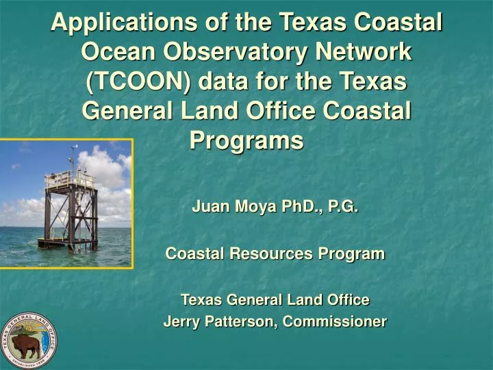
Applications of the Texas Coastal Ocean Observatory Network (TCOON) data for the Texas General Land Office Coastal Programs. Juan Moya PhD., P.G. Coastal Resources Program Texas General Land Office Jerry Patterson, Commissioner. Texas General Land Office (GLO).

E N D
Applications of the Texas Coastal Ocean Observatory Network (TCOON) data for the Texas General Land Office Coastal Programs • Juan Moya PhD., P.G. • Coastal Resources Program • Texas General Land Office • Jerry Patterson, Commissioner
Texas General Land Office (GLO) The Republic of Texas Congress established the General Land Office in 1836 shortly after Texas won its independence. Mission is the management of state lands and mineral-right properties totaling 20.3 million acres. Included in that portfolio are the beaches, bays, estuaries and other "submerged" lands out to 10.3 miles in the Gulf of Mexico. Texas General Land Office Jerry Patterson, Commissioner
Texas GLO GLO leases drilling rights for oil and gas production on state lands, producing revenue and royalties which are funneled into the state's Permanent School Fund. The dividends and interest from Permanent School Fund investments go into the Available School Fund, and from there money is distributed to school districts on a per-pupil basis, helping to offset local property taxes. Texas General Land Office Jerry Patterson, Commissioner
TCOON-GLO GLO interested in the conservation of natural resources, public access and safety of public infrastructure in State public lands.
GLO & Coastal Water Levels Subsidence has vertical and horizontal implications
TCOON Participants TCOON is managed through cooperative agreements: • Texas General Land Office (GLO) • Texas Water Development Board (TWDB) • U.S. Army Corps of Engineers (Corps) • National Oceanic and Atmospheric Administration (NOAA) The network is operated by the Division of Nearshore Research (DNR) at Texas A&M University-Corpus Christi (TAMU-CC).
TCOON Standards • The GLO established this water-monitoring system following a Texas legislative mandate in 1991. • Requires that it be operated using the national standards and procedures guidelines developed by NOAA. • These legally recognized standards and procedures ensure that state and federal agencies, academic institutions, and the general public can validate the data obtained through this system.
TCOON Facts The network served 7,367 absolute unique visitors requesting data during the month of March 2008. One of the best tide systems in the US coastal states. One of the most visited coastal sites in the Gulf of Mexico http://lighthouse.tamucc.edu/TCOON/HomePage
TCOON Common Users • TCOON provides critical data to sponsoring federal and state agencies, the public, commercial shipping industry, marine construction companies, recreational boaters, marine safety, emergency evacuations, oil companies, coastal engineering companies, water and atmospheric modelers, planners, lawyers, and many non-profit organizations.
TCOON Common Users • TCOON also uses data from the Physical Oceanographic Real-Time System (PORTS), which was developed by the National Ocean Service (NOS).
Historic Background • 1988, National Ocean Service (NOS) and GLO entered into a Memorandum of Agreement in recognition of common interests in the determination of tidal datums and other related activities in coastal waters of the State of Texas. • State-federal partnership created a multi-million dollar state-of-the-art program, providing real-time data for measuring and monitoring tidal changes on the Texas coast.
Historic Background • The system started in 1989 with the Conrad Blucher Institute for Surveying and Science TAMU-CC installed three water-monitoring stations for the City of Corpus Christi. • Through partnerships among the GLO, NOAA, TAMUCC, TWDB, and the Corps, the system has expanded to over 50 tide gauge stations. • The number of active stations varies over time due to funding, priorities, and natural events.
Historic Background • The Texas Legislature, by authority of S.B. 1392 passed in 1991, designated TCOON as an official entity of the state. • The legislatively mandate of TCOON is to collect data on natural processes affecting the Texas Coast for the purpose of studying, planning for, and managing human uses of the coast as they are affected by those natural processes. • Statute requires participating entities to coordinate these activities with NOAA.
GLO & State Statue Government officials must have accurate, legally defensible data relating to water levels and tides in the event of litigation resulting from a legal boundary dispute, imposing beach-dune rules, enforcing the Texas Open Beaches Act, litigating collisions of vessels, deepening the Gulf Inter-Coastal Waterway, or litigating the collapse of a bridge or causeway.
GLO Coastal Applications for TCOON Data • The GLO Surveying, Coastal Resources, and Professional Services divisions use TCOON data to establish the physical boundaries for the approximately five million acres of submerged tidelands and Gulf submerged lands that are regulated by the GLO.
GLO Coastal Applications for TCOON Data • Accurately locate the Three-Marine League Line, 10.36 miles offshore Texas, which is the boundary between state and federal waters. • The precise location of the boundary aids in calculating the acreage of submerged state tracts leased for mineral exploration, which results in state revenue for the Permanent School Fund.
GLO Coastal Applications for TCOON Data • Accurately locate the state's shoreline in order to identify submerged state-owned land for the proper issuance of coastal easements and leases encumbering submerged land. • Accurately measure the shoreline to calculate acreage of submerged state tracts leased for mineral exploration and development. Adjusted acreage may result in new royalty income to the State.
GLO Coastal Applications for TCOON Data • Identify the correct and legal shoreline to aid in the protection of submerged state-owned land from encroachments and illegal activities, such as fill and dredging. • Use water level data to establish the accurate boundary between submerged state-owned land and upland private ownership for projects along the Texas coast and in the event of boundary disputes resulting in litigation.
GLO Coastal Applications for TCOON Data • Monitor the highest reach of the water in a high water event to provide justification for the GLO to impose emergency rules in conjunction with state-regulated Beach and Dune Protection Rules. • Emergency rules allow landowners to take emergency measures to restore property after high water or a storm event.
GLO Coastal Applications for TCOON Data • Use wave height and direction data to collect accurate water level data to aid in the design of beach nourishment projects. • The location of Mean High Water or Mean Higher High Water is needed to document the state's ownership prior to any nourishment project.
GLO Coastal Applications for TCOON Data • Texas Natural Resources Code, Section 33.136 requires a boundary survey of the shoreline to be completed before any alteration is made to the shoreline. • The survey must be filed at the GLO and approved by the GLO Surveying Division before any beach nourishment or erosion response work can begin. • Tidal datums obtained from the TCOON network are required for such a survey.
GLO Coastal Applications for TCOON Data • Use the TCOON datum to aid in the documentation of beach erosion for planning in conjunction with beach protection projects. • TCOON was recommended for CIAP funding for $1 Million to expand, upgrade, and develop new technologies.
GLO Oil Spill Applications for TCOON Data • GLO is the lead state agency for preventing and responding to oil spills in marine environment. • Create trajectory and hydrodynamic models to predict oil movements should a spill occur in the Gulf of Mexico or its bays. • Predict where oil spills will likely travel. Oil-spill emergency response teams use this information to deploy clean-up teams and other resources to minimize a spill's impact.
Other Applications for TCOON Data • Monitor water quality in the bays and estuaries, including salinity, dissolved oxygen, turbidity, and the presence of brown tide. • Monitor currents in the vicinity of roads and bridges to determine impacts on circulation. • Dredging project planners and contractors use the data in selecting channel depths and disposal sites that will cause the least impact on those resources.
Other Applications for TCOON Data • Using tidal measurements to drive computer models for solving environmental and management issues related to bays and estuaries. • Allowing utility companies to use tide data in monitoring circulation and water quality in the vicinity of cooling water intakes and discharge areas through hydrographic modeling and monitoring.
Other Applications for TCOON Data • Provides port authorities and pilots in the shipping industry with accurate, real-time wind, current, water level and tidal information at the entrance of ship channels. • Enhances the navigation safety of commercial vessels transiting, entering, or leaving port. • Provides the real-time water height providing pilots the knowledge and ability to know exactly when it's safe to enter and exit the port, saving considerable time, which equate to millions of dollars saved.
Future Needs Where to go from here?
Suggestions http://www.glo.state.tx.us/coastal/tcoon/ http://lighthouse.tamucc.edu/TCOON/HomePage
Contact Information Dr. Juan Moya 512/475-3735 juan.moya@glo.state.tx.us Ms. Kathy Smartt 512/475-1552 kathy.smartt@glo.state.tx.us