Download
1 / 21
210 likes | 381 Vues
Global Observation of Forest Cover (GOFC): Fire . S. E. Asia Fire Cal/Val Workshop January 22-24, 2002 Phuket, Thailand A special session of the APAN Earth Monitoring Working Group. Background to GOFC.

E N D
Global Observation of Forest Cover (GOFC): Fire S. E. Asia Fire Cal/Val Workshop January 22-24, 2002 Phuket, Thailand A special session of the APAN Earth Monitoring Working Group
Background to GOFC • Developed originally under the Committee on Earth Observation Satellites (CEOS) initially as a pilot to test the concept of an Integrated Global Observing System • IGOS goals • To improve use of Earth Observation data to address major problems of global concern; • To improve coordination of national programs; • To improve co-operation between providers and users of Earth Observation data for regional and global applications. • Has become one of the Panels of the Global Terrestrial Observing System GTOS (FAO GTOS Secretariat) • Helping to address the Carbon Theme of the IGOS Partners • Providing observations for the emerging Assessments
Status of GOFC • Design Phase completed initiating Implementation Phase • Scope of GOFC: transitioning from GOFC (Global Observations of Forest Cover) to GOLD (Global Observations of Landcover Dynamics) extending beyond areas of forest cover • Principal Role of GOFC/GOLD is to act as a coordinating mechanism for national and regional activities. • GOFC/GOLD regional networks developing as part of the program implementation • Linkages being developed to the emerging Assessments Carbon, Millennium Ecosystems Assessment • Series of Implementation Team workshops planned
The Organization of GOFC Implementation Teams, Activities and Projects * Fire Monitoring and Mapping.. * Cover Characteristics and Changes.. * Biophysical Parameters Scientific and Technology Board Regional Activities and Networks Collaborations e.g. WGISS and WGCV
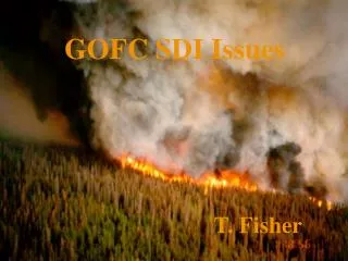
GOFC Fire Implementation Team The GOFC Forest Fire Monitoring and Mapping Implementation Team is responding to a critical need by fire management agencies, international agencies, and policy makers at national, regional and global levels, for accurate and timely information regarding wildfires in forestland and other vegetated areas. The Fire IT consists of a number of contributory activities from different research groups and organizations, which demonstrate the operational utility of satellite observations of fire, making the case for long-term observations of fire and the research and development necessary to improve these capabilities to meet user needs.
GOFC Fire: IT Members • Olivier Arino, ESA/ESRIN, Italy • Emilio Chuvieco, U. Alcala, Spain • Chris Elvidge, NOAA/NGDC, USA • Johann Goldammer, GFMC, Germany • Jean-Marie Gregoire, JRC, Italy • Chris Justice (Chairman), UMd, USA • Bryan Lee, CFS, Canada • Mastura Mahmud, UKM, Malaysia • Elaine Prins, NOAA/NESDIS/ASPT, USA • Brian Stocks, CFS/GLFC/IRM, Canada • Anatoly Sukhinin, RAS, Russia ------------------------------------------------------- • Joao Periera, IBAMA, Brazil, GOFC/GOLD Science and Technical Board • Amy Friese, START, GOFC/GOLD Executive Committee - GOFC/GOLD Fellowships
Summary of GOFC-Fire goals • User awareness increased understanding of the utility of satellite fire products for resource management and policy (UN, Regional, National, Local) and Global Change Research • Product accuracyoperational network offire validation sites and protocols established providing accuracy assessment for operational products and test bed for new or enhanced products leading to standard products of known accuracy • Enhanced use of products and data access - operational multi-source fire / GIS products being made available including Web based data access • Geostationary global fire networkproviding operational standard fire products (active fire) in a timely fashion • Polar orbiters (with operational fire monitoring capability) • providing operational moderate resolution long-term global fire products to meet user requirements and distributed ground stations providing enhanced regional products (fuel moisture content/active fire/burned area) • operational high resolution acquisition allowing post-fire assessments • Fire Emissions product suites - developed and implemented providing annual estimates with available input data and real time emissions products
GOFC-Fire Workshops • GOFC Fire Coordination Workshop JRC Ispra (1999) • Fire Book (papers and discussion groups ) • S Africa Miombo GOFC Fire Workshop Matopos (1999) • Burned Area Validation Protocols (SAFARI 2000) Zambia (2000) • Southeast Asia GOFC Fire Workshop Tokyo (2001) • WGISS TF GOFC Workshops Bangkok/ Tokyo (2000/2001) • GOFC presentation / discussion EARSEL / Paris (2001) • GOFC Fire Validation Workshop Lisbon (July 01) • GOFC SEARIN Fire Validation Workshop, Thailand (Jan 02) • GOFC Fire Presentation / discussion Brazil (Mar 02) • GOFC Fire Emissions Models Workshop - Washington (June 02) • GOFC Fire and Forest Cover Siberia (July 02)
Fire Remote Sensing: What do the users expect? * Location and timing of active fires * Fire intensity / combustion efficiency * Return frequency * Burned area * Vegetation type (carbon stocks available for burning) * Quantity of biomass consumed by fire * Vegetation condition (fire risk) * Aerosol optical thickness / aerosol characteristics
Fire remote sensing is viewed as one of the primary sources of data for modeling the: * Location, timing and quantity of smoke generation for input into transport models * Quantity of trace gas emissions (CO2, CO, CH4 and others)
Fire in S.E. Asia * Fire affects all of the nations in S.E. Asia. * Nearly all the fires in the region are man made. * During dry years fires can rage uncontrollably. * Fire is widely used to dispose of agricultural residues, short term enhancement of grazing conditions, and in the conversion of forests to agricultural land. *Fire is one of the major factors in the region associated with global change. * Impacts include transboundary smoke, loss of forests, loss of biodiversity, land degradation. * Fire management is now recognized as an important function of government, requiring local and regional communication and cooperative effort. * Fire management includes prediction of risk, prevention, detection, suppression, post fire assessment and recovery.
Workshop Objectives While a number of resource management and scientific applications for satellite fire observations have been identified, little is known about the accuracy and validity of the various data sources and products or how they might be used together for an improved depiction of fire events. The objective of the workshop is to initiate and plan the intercomparison, calibration, and validation of active fire and burn scar products from primary sensor systems capable of making frequent wide area observations of S.E. Asia. In addition, the topics of building a regional capability to generate satellite fire products and widening the use of these products through open access and interactive overlay of multiple data sources will be explored.
Why Accuracy Assessment? "There are many reasons for performing an accuracy assessment. Perhaps the simplest reason is curiosity - the desire to know how good something is. In addition to the satisfaction gained from knowledge, we also need to increase the quality of the map information by identifying and correcting the sources of errors. Third, analysts often need to compare various techniques, algorithms, analysts, or interpreters to test which is best. Finally, if the information derived from the remotely sensed data is to be used in some decision-making process, then it is critical that some measure of its quality be known." Quotation from " Assessing the Accuracy of Remotely Sensed Data: Principles an Practices", Russell G. Congalton and Kass Green, 1999, Lewis Publishers.
GOFC Fire Partnerships in S.E. Asia CEOS WG on Cal/Val (WGOCV) Land Product Validation Subgroup (LPV) CEOS Working Group on Information Systems and Services (WGISS) Asia Pacific Advanced Network (APAN) SINGAREN SEARIN ASEAN Program to address ASEAN Regional Transboundary Smoke (PARTS) Providers of satellite data and products Universities, governments and NGO's Others.....
Fire validation site network • GOFC/CEOS Land Product Validation (LPV) joint activity towards • international standards and protocols for field sampling, scaling, error budgeting, data exchange and product evaluation • mission-long validation programs for current and future earth observing satellites
GOFC / LPV White paper on "Establishing validation site network for remote sensing applications to fire research" December 2001 Lists four areas of fire remote sensing calibration / validation: 1)Active fire detections 2)Measurement of burnt area 3)Estimation of combusted biomass 4)Estimation of gas emissions (should also list aerosols?)
December 2001White Paper Defines criteria for selecting a global set of fire cal/val sites: * Representation from the biomes most affected by fires. * Provide a wide variation in fire sizes and types. * Cover a wide range of land uses * Data rich sites where fire remote sensing groups are concentrating efforts. * Commitment to collection and analysis of ground truth and satellite data. * Willingness to share data within network of participants.
December 2001 White Paper Sites nominated through a letter of commitment from the "Site Contact" to the GOFC Fire Implementation Team. Letter contains: * Name and geographical coordinates for site. * Commitment to produce high resolution fire and burn scar reference data sets. * Description of field data to be collected. * Request for high spatial resolution imagery listing locations (e.g. Landsat path/rows) and time period for collection.
December 2001 White Paper Defines: Site Contact: Responsible for generating letter and coordinating cal/val activities, including access to baseline data, ground truth, remote sensing products and results. GOFC Fire Sites Coordinator: Resposible for maintaing and updating the list of participating sites, requests for satellite imagery, and site activities. LPV Satellite Data Coordinator: Submits and tracks requests for high spatial resolution image acquisitions and distribution to participants. Coordinates access to satellite fire and burns scar data from global suppliers.
Importance of Accuracy Assessment for Fire and Burn Scar Products * Documenting the detection limits for various sensors. * Understanding the errors for each sensor. * Improving the algorithms. * Developing confidence in the use of the data. * Developing calibrations for more accurate input into models. * Others.....
MODIS ASTER Active Fire Validation