Download
1 / 2
20 likes | 160 Vues
PILOT CASE STUDIES. OBJECTIVES. CONTACT.

E N D
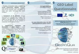
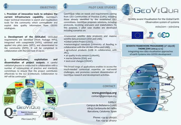
PILOT CASE STUDIES OBJECTIVES CONTACT • GeoViQua relies on needs and requirements coming from GEO Communities of Practice (CoPs), including those already identified by the established GEO committees. GeoViQua proposes solutions, including protocols, involving end-users and stakeholders. To this purpose, 7 pilot case studies are developed including scenarios on: • transversal satellite data producers and massive satellite data processors (ESA and UAB), • Global Carbon Project (LSCE), • meteorological reanalysis (University of Reading in collaboration with the UK Met Office and UAB), • agricultural products (UAB in collaboration with JRC), • air quality in-situ sensors (52North), • marine fisheries (ESA), and • land cover changes (CREAF). • This broad range of applications enables to access the much-needed contextual expertise on real-world challenges, and promotes constant dissemination of GeoViQua research and development activities. 1. Provision of innovative tools to enhance the current infrastructure capability. GeoViQua’s major technical innovation is search and visualization tools for the community which communicate and exploit data quality information from GEOSS catalogues. 2. Development of the GEOLabel. GEOLabel requirements are identified (Work Package WP2), integrated with components (WP6), validated and applied into pilot cases (WP7), and disseminated to the community (WP8). It will be completed in collaboration with the GEO task ST-09-02. 3. Harmonization, exploitation and dissemination of project outputs. A careful validation process is conducted in collaboration with a number of communities of practice and standards committees to ensure that the project contributes effectively to the GCI architecture. Collaboration to AIP will be continuous. QUAlity aware VIsualisation for the Global Earth Observation system of systems 01/02/2011 – 31/01/2014 SEVENTH FRAMEWORK PROGRAMME (nº 265178) THEME [ENV.2010.4.1.2-2] Integrating new data visualisation approaches of earth Systems into GEOSS development www.geoviqua.org contact@geoviqua.org Edifici C Campus de Bellaterra (UAB) 08193 Cerdanyola del Vallès Barcelona, Catalonia. Spain Phone: +34 93 5811312 Fax: +34 93 5814151 Pilot Cases (PC)
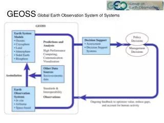
STRUCTURE & WORK PLAN THE ROLE OF QUALITY WP1: Project management RTD WP2: Requirements for data quality visualisation Components WP3: Data quality elicitation mechanism WP6: Delivery of solutions to end users WP8: Dissemination and Capacity Building constrained by WP4: Enhanced geo-search tools WP5: Quality aware visualisation tools harmonised by validated in limits WP7: Pilot case studies 2011 2012 2014 2013 1 1 2 2 3 3 4 4 5 5 6 6 7 7 8 8 9 9 10 10 11 11 12 12 13 13 14 14 15 15 16 16 17 17 18 18 19 19 20 20 21 21 22 22 23 23 24 24 25 25 26 26 27 27 28 28 29 29 30 30 31 31 32 32 33 33 34 34 35 35 36 36 Extraction from Best practices Direct extraction from Metadata Quality elicitation categorical User feedback quality encoding extraction continuous variables TOPICS COVERED INTRODUCTION variables 00 Validation Search & Visualisation Prototypes Start Mobile Solutions Quality Data Quality Pilot cases recommendations ready parameterization User & technical User & technical Workshops requirements to CoP solutions to CoP CoP Proposals evaluation Final document GeoLabel Elicit from metadata Elicit from provenance Quantify (CAL/VAL, in situ) User feedback Standard encoding Elicitation derivation Encoding Label Qualityvisualisation Quality based search GEO Portal and mobile devices Link to data Embed in data Search and Visualisation Embedding and linking GeoViQua scientifically explores methodologies for extending the Global Earth Observation System of Systems (GEOSS) Common Infrastructure (GCI) adding rigorous data quality in search and visualisation GEOPortal. GeoViQua provides innovative components for augmenting the GEOSS and its adoption by the communities, contributing to catalyze research and development (R&D) activities on GEO (GEO task ST-09-01) and contributing to the GEOLabel development (GEO task ST-09-02). Methodologies for extending the current GCI will be explored and the new components validated through Architecture Implementation Pilots (AIP) to come (GEO 2009-2011 WORK PLAN). • Consortium Management and assessment of progress and results (WP1). • Collection of User Requirements and translation into Technical Requirements (output: Preliminary design, WP2). • Research and Development (output: Developed components ready for integration, WP3, WP4, WP5). • Components integration and validation (output: Integrated system, WP6). • Validation through pilot use cases studies (output: Validated system, WP7). • Outreach, sustainability, exploitation and contribution to standards (WP8). • Information sharing: • 2D and 3D data visualisation • Data quality, trust and low-bandwidth access • Web 2.0 and Volunteered Geographic • Quality assessment and quality metadata: • Relating data, metadata and quality • Data quality indicators; quality elicitation methods • Standards: • Standards for metadata and quality • Inclusion of data quality information into standards for data visualisation • Enhancing the GEOSS environment: • Data quality aware geo-search components • Advancing in the use of GEOSS visualisation tools • Quality information based on provenance information describing the processing and quality control applied to data: development of the GEOLabel. • Quality information also based on quantitative assessment of the uncertainty associated to data (QA4EO documentation). • Quality information based on user feedback related to user view of data utility in the form of subjective qualitative statements and reviewing mechanisms.