Download
1 / 41
410 likes | 516 Vues
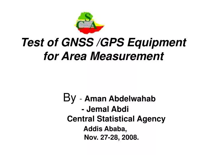
Test of GNSS /GPS Equipment for Area Measurement By - Aman Abdelwahab - Jemal Abdi Central Statistical Agency Addis Ababa, Nov. 27-28, 2008. Outline I. Background II. Disadvantages of Compass-Rope method III. Objective of this presentation

E N D
Test of GNSS /GPS Equipment for Area Measurement By - Aman Abdelwahab - Jemal Abdi Central Statistical AgencyAddis Ababa, Nov. 27-28, 2008.
Outline I. Background II. Disadvantages of Compass-Rope method III. Objective of this presentation IV. GPS and CSA V. Testing the GPS Equipment ( pre-tests) a) first pre-test - results of the first pre-test - drawbacks encountered b) second pre-test - types of GPS used in the test - results observed in the test - recommendations based on the two pre-tests c) third pre-test - results VI. Pilot Survey in West Showa VII. Comparative costs of GPS with Compass and tape VIII. Lessons learned using GARMIN 72 receiver
I. BACKGROUND • In Ethiopia, there is no complete set of cadastral and/or land registers from which to get data on the area under different land uses. • Since 1980/81 CSA uses Compass-Rope Method for the measurement of the area under different land uses when conducting Agricultural Sample Survey/Census. • Why measure ? • Most holders not able to tell the size of each field under different land uses in metric units but only in local area measurement units • Unavailability of standard conversion coefficient for local measurement units.
II. Disadvantage of Compass-Rope Method - Very time consuming (average 40 minutes per field) • Expensive • Need programmable calculator • Enumerator need assistance for tape • Too much workload for enumerators, hence may invites cheating
III. OBJECTIVE OF THE PRESENTATION • To share the experience of the pre- test exercise on GPS for measuring field under different land uses with varying sizes and conditions.
IV.GPS and CSA • CSA used GPS for the cartographic work for the third Population and Housing Census of Ethiopia conducted in May, 2007 Elsewhere, • There was an exercise by the Oromia Region in collaboration with USAID for land cadastre using GPS (Garmin 60) • However, they use GPS for measuring a parcel and not a field
V. TESTING THE GPS EQUIPMENT (pre-tests) As a starting point: • CSA staff received orientations on GPS (Garmin 60 from experts in West Shewa Agriculture Research Institute • Near the town two parcels were measured using GPS-60 and Compass-Rope methods. • The results show no significant difference between the two methods • However the Agency planned to test more fields on different slopes and land use in different areas.
a) First pre-test • Two Zones (North Shewa in Amhara and Jimma in Oromiya) were selected in order to test the devise for more area measurement using GPS-60 (two times for each field) and once using Compass-Rope method. • Two groups were arranged each with 5 members. • It was planed to measure 100 fields by each group with different slopes and weather condition. But 137 fields were measured. • The two GPS readings of the same field were not the same. But the sums of the areas were not significantly different. The GPS measurement and the compass and rope result differ for the two groups.
Results of the first pre-test i) In North Shewa Zone the total sum of the area of the fields were 1. Total area using GPS for the first measurement is 140,727.5 m2 2. Total area using GPS for the second measurement is 140,478.5 m2 3. Total area using compass-Tape method is 138,451.9m2 ii) In Jimma Zone 1. Total area using GPS for the first measurement is 47,992.44 m2 2. Total area using GPS for the second measurement is 48,261.30m2 3. Total area using Compass-Rope method is 47,704.54m2
For the north Shewa the difference between the two GPS reading shows 0.18 percent difference and in Jimma Zone the result shows 0.56 percent. This shows there is no significant difference in measurement between the two readings. • For the comparison between compass and tape and the GPS there is a -1.52 percent difference for the North Shewa and -0.88 percent difference in Jimma . • The Compass and Tape measures slope area and the GPS measure projected area, theoretically the result of compass and tape expected to be higher than the GPS result. However, for both zones the groups obtained a unexpected result ,that is the compass and tape result is less than the GPS result.
Drawbacks encountered • Life time of batteries short on the average it stays 3-4 days • Areas under canopy/trees is not constant • GPS for small fields was not reliable ( for less than 1000 sq. m.) Then CSA planned for another pre-test in order to fully understand the procedures and analysis the results.
b) 2nd Pre-test • CSA tested six different GPS equipment in Oromia, West Showa Zone with the help of Consultant from JRC, April 21-25/2008 • In order to fulfill different land escapes and small size as well as larger field and field under cover (trees) five fields were chosen • Artificial borders were marked with the piles of stones for each border • In order to be able to compute reliable statistical parameters describing accuracy and precision of the methods and tools, proper number of repetitions and runs (consists four repetitions one after the other) were done. • Within a run (between repetition) constellation between Satellites is relatively stable and between runs the satellite constellation has changed
Types of GPS used in the test • PDA with a Bluetooth antenna • PDA ASUS P256 with the Haicon external antenna. • Garmin GPS 60Csx • Garmin GPS 60cx • Magellan Explorist500(partially tested) • Garmin 72(only one run with one operator) • Five runs was done for three days for the first four equipment (20 observations for each field by an operator and there are four operators each operating only one of the devices
Figure 1.PDA (Pocket Loox Fujitsu Siemens) with a Bluetooth GPS antenna – (Fortuna, Slim)
Figure 2. PDA ASUS P256 (F@rmphone with the U-blox) external antenna and Surveyomat
Figure 7. Field B: relatively big:0.2757ha, field, open horizon, almostflat, forest on the western border
Figure 9. Field D – area of: 0.1119ha, moderate slope, open horizon
Figure 10. Field E: area of: 0.0745ha, highly sloped, open horizon
Bias and reproducibility standard deviation of the measurements on 95% confidence level(Figure 11)
The smallest overall bias was reported for ASUS (with an exception of the Field A – afforested parcel). The measurements taken with Garmin GPS map60CSX using Stop & go method gave the bigger bias than Garmin GPS map60Cx using kinematic method. • Results of Garmin GPS 72, with the negative bias (measures smaller area than the reference), are significantly different from the rest. This fact could be related to a change in technology (different antenna types in Garmin 72 and series of GPS map 60 and different sensitivity of the antennas
Reproducibility standard deviation (random error of the measurements) on a 95% confidence level was computed and is presented on the graph below (Figure 12.). • The best overall reproducibility was reported for the ASUS device. • Magellan eXplorist 500 gave the worst reproducibility results. • Garmin 72 was reported as the second worst.
Recommendations based on the pre-tests • The CSA is recommended to perform a full time testing of several Garmin GPS72 devices in order to verify their performance, (CSA has already over 300 of this item. • The problems related to the low batteries and worse performance of the receivers should be further investigated. During the above described testing no similar problems were noticed, • The CSA is recommended to analyze and decide what level of error is acceptable for the project and consider also the fact, that with the significantly time-efficient tool, the sample size (number of fields measured) could be increased, • We are also aware of the change in the area measured: GNSS receivers report the projected (horizontal) area, whereas, the compass and rope method provides the sloped area.
c) The third pre-test • For the third time the pre-test was done on only on GARMIN 72 . Around 300 units of this devices already available and around 60 of them used in the West Showa pilot exercise for area frame. • Five operators are engaged in the testing of the devices. Six fields were chosen for the test and borders are piled with stones and sticks .
GPS 5 runs with 4 repetitions = 20 measurements of one field with one receiver Reality: 3 full runs for Fields A,B,C,E 2 full runs for Field D 1 full run for Field F
Results • From the above figure most of the area measurements has a bias between -0.01 and 0.01 and standard deviation of the measurement is 0.05 except one measurement for the smallest areas which has a standard deviation of 0.11 and which has a bias of 0.04 . • The test was not done for the Compass-Rope method for the reason that some plots are cropped and farmers not allow their field to enter.
VI. PILOT SURVEY IN WEST SHEWA • Now CSA is undertaking Pilot Survey in Oromia Regional State, West Shewa Zone Testing Area Frame and GPS Garmin 72 using for area measurement side by side with the Compass-Tape method. • The pilot coversrs 40 EAs (Enumeration Areas) • In each EA a segment is selected. • In each segment all land uses are measured using the two methods (using GPS and Compass and Tape) • Finally agricultural sample survey result that is conducted at the same time with the pilot survey will be compared by both methods. • Final decision will be made based on the result.
VII. Comparative equipment costs of GPS with Compass-Rope GPS Receiver 1. Fairly Expensive 2. Each unit cost about US150 3. One GPS per operator Is needed. 4. Use 2 expensive high quality AA batteries US $ 1.2 per pair Compass and Rope 1. Tape costs around US $ 25 2. Compass around US $ 100 3. Need a Programmable calculator costs US $ 24 4. Enumerator need assistance for a tape.
VIII. Lessons learned using GARMIN 72 Receiver • Cost efficient tool with acceptable accuracy. • Easy to use trained non –expert • Battery consumption is 8 pairs per month • Time efficient as compared to Compass and Rope Method. (on the average 5 minutes per field) • When there is canopy /tree cover the measurements are not consistent • The receiver is reliable in measuring the area of the field