Download
1 / 22
220 likes | 354 Vues
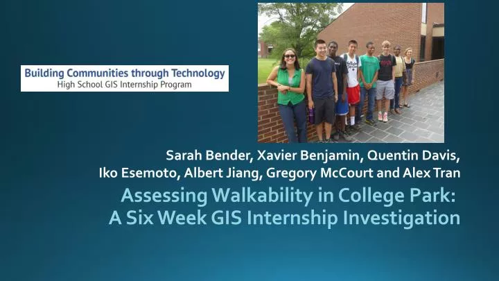
Assessing Walkability in College Park: A Six Week GIS Internship Investigation. Sarah Bender, Xavier Benjamin, Quentin Davis, Iko Esemoto, Albert Jiang, Gregory McCourt and Alex Tran. Internship Background. Ms. Chelsie Miller, Intern coordinator Dr. Alex Chen, Intern Advisor

E N D
Assessing Walkability in College Park: A Six Week GIS Internship Investigation Sarah Bender, Xavier Benjamin, Quentin Davis, Iko Esemoto, Albert Jiang, Gregory McCourt and Alex Tran
Internship Background • Ms. Chelsie Miller, Intern coordinator • Dr. Alex Chen, Intern Advisor • June 24, 2014 – July 31, 2014 • Weeks 1 – 3: Data collection • Weeks 4 – 6: Data analysis
Complete Streets • The National Complete Streets Coalition describes “Complete Streets” as “streets for everyone, no matter who they are or how they travel” (http://www.smartgrowthamerica.org/complete-streets/complete-streets-fundamentals#presentation)Complete • Streets have an unique identity
Walkability Findings • Currently unsafe to walk in College Park • Route 1 and surrounding roads have high accident rate • Lack of parks and places to go • Abundance of strip malls and retail stores • Many roads are in poor condition • Incomplete Streets • No/damaged sidewalk • Lack of street lamps
Data Collection • 6 streets near Route 1 • Berwyn Rd • Berwyn House Rd • Cherokee St • Fox St • Edgewood Rd • Hollywood Rd • 64 segments • Survey Data Collection • street condition survey • sidewalk/street side condition survey • Photo-inventory
SWOT Analysis • Pictures of areas that can be improved • Story of each street • Each street has to have identity
Street Grading Scale • 100 point maximum • Segment – 40 points • Street – 30 points • Area – 30 points (Further Breakdown of the Rubric disclosed in written report)
Berwyn House Road • Overall Grade: B • Pros: Sidewalk present, a small park, one of the better streets in College Park • Cons: Vacant building and a very damaged empty lot, polluted • Proposed Fixes:add trash cans, bike rack, fix empty lot
Berwyn Road • Overall Grade: C • Pros: Sidewalk present, school with park, small town square, well lit • Cons: Front of street is less welcoming retails stores on Route 1, strip mall and motel • Proposed Fixes:More trees/park to block strip mall out, move utility poles a bit further from sidewalk
Cherokee Street • Overall Grade: F • Pros: Church and Church School, • Cons: Recent Shooting nearby, no sidewalk and poorly maintained streets. • Proposed Fixes:Street repair, stricter neighborhood watch, increased police patrol.
Fox Street • Overall Grade: F • Pros: Speed bumps, a few road signs • Cons: No sidewalk, no crosswalks, poorly maintained streets, lackluster, nothing of interest • Proposed Fixes: Park Creation and street repair
Hollywood Road • Overall Grade: F • Pros: A park, crosswalks, a good area for kids • Cons: No sidewalk, park is too close to street • Proposed Fixes: Sidewalk, safer environment for kids, increased road sign regulations
Edgewood Road • Overall Grade: B • Pros: Sidewalk, Crosswalks, Speed Bumps, Low pedestrian/bicyclist rate in regards to traffic activity • Cons: High car Accident rate at the intersection with Route 1, crime is moderate • Proposed Fixes: Add sidewalk buffer, move utility poles further from sidewalk
Mean Score: 65.167/100 Average Score(highest and lowest scores removed, remaining 4 averaged): 64.5/100 Median: 61.5/100 Standard Deviation: 15.79135 Wide variety of street conditions, no outliers. Significant gap between streets with and without sidewalk(50, 52, 52) to (71, 83, 83) Final Evaluation
Adding sidewalks to every street will instantly bring the average from a D to a low B or High C Not economically feasible Baseline Solution: Take the average, round and try to make all streets below that baseline at least the baseline value. Baseline of 65 - Try to bring Cherokee, Hollywood, and Fox Street to this rating. This consists of making the area safer, increasing street condition and more Proposed Solution Plan
Sidewalk/Bike Lanes Street/sidewalk Repair Increased neighborhood patrol to improve safety Increase/utilize open green space, make more parks Increase lighting, move utility poles further from sidewalk Reduce pollution by adding more trash cans Block out strip malls with parks Proposed Solutions
College Park roads have potential Encourage Biking and Walking Safety Identity Presence/Environment Final Conclusions
Chelsie Miller Dr. Alex Chen City of College Park Urban Studies and Planning Program, UMD National Center for Smart Growth Research and Education, UMD University of Maryland Community Mary Kate Cannistra , Eli Knaap, and Niambi Wilder Acknowledgements