Download
1 / 37
370 likes | 569 Vues
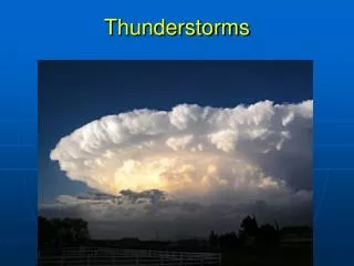
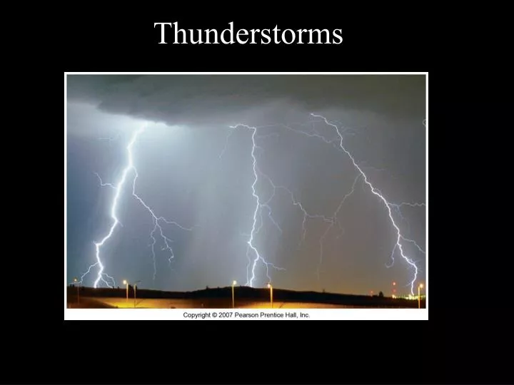
Thunderstorms. Straight Line Winds. This is the sort of wind that comes out of a thunderstorm. They are produced by the downward momentum within the downdraft region of a thunderstorm.

E N D
Straight Line Winds This is the sort of wind that comes out of a thunderstorm. They are produced by the downward momentum within the downdraft region of a thunderstorm. If the air is dry in the middle of the troposphere, the storm has a fast rate of forward movement, and there are strong updrafts and downdrafts, you have the right conditions for strong Straight Line Winds
Dewpoint Depression • Difference between temperature and dewpoint at the surface and aloft
Dewpoint Depression • This has the following practical results: • When the lower level Tdd (temp – dew point) is small and air is being lifted, clouds form low bases • When the lower level Tdd is large and air is being lifted, clouds form bases higher • IOW, it took more lifting to saturate that air adiabatically • Can enhance downdrafting and hail formation by enhancing evaporative cooling
Dewpoint Depression • Suppose T = 15C and the dew point is 9C. What is TDD? • 15C-9C = 6. • It does not equal 6C, it is not a temperature, it’s a difference between temperatures.
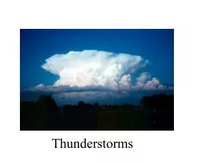
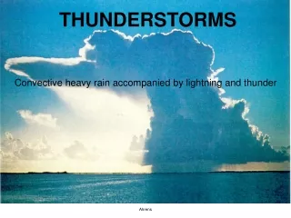
Types of Thunderstorms • Air Mass Thunderstorms • Most Common • Least destructive • Contained within a single air mass
Stages of an air mass thunderstorm • Cumulus Stage • Air begins to rise • Rising air cools adiabatically and forms fair weather cumulus clouds • These initial clouds last for minutes • The initial clouds evaporate and increase the amount of moisture in the air • New clouds with vertical development form • The new clouds extend to the upper troposphere and ice crystals grow by the Bergeron process • The thick clouds cause the sky to darken
Stages of an air mass thunderstorm • Cumulus Stage • Air begins to rise • Rising air cools adiabatically and forms fair weather cumulus clouds • These initial clouds last for minutes • The initial clouds evaporate and increase the amount of moisture in the air • New clouds with vertical development form • The new clouds extend to the upper troposphere and ice crystals grow by the Bergeron process • The thick clouds cause the sky to darken
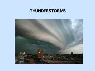
Stages of an air mass thunderstorm 2) Mature Stage • The storm is at its most intense • Overshooting tops form • Lightening and Thunder may be present • Warm Updraft • Cold downdraft • Strong winds at surface via downdraft
Stages of an air mass thunderstorm 3) Dissipative Stage • Falling rain or graupel forces air downward causing down drafts • As precipitation proceeds, downdrafts increase at the base of the cloud. • This cuts off the water supply • Precipitation diminishes and the sky clears
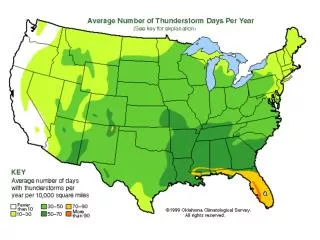
Severe Thunderstorms • Most form along or ahead of cold fronts in Mid-latitude cyclones • Wind speeds exceed 93 km/hr (60mile/hr) • Have hailstones larger then 2 cm in diameter • Spawn tornadoes • Last for 12 hours to several days • Account for ~60% of all annual rainfall in the US and Canada • Typical occur in groups of individual storm cells
Severe Thunderstorms • Mesoscale Convective Systems (MCS) • Mesoscale Convective Clusters (MCC) • Squall Line • Supercell
Severe Thunderstorm Structure http://www.theweatherprediction.com/severe/structure/
MCCs • Occur as circular or oval clusters of storm • But all storms are part of the same system • Defined by satellite images • Responsible for most severe weather in the US and Canada
Satellite Image of Mesoscale Convective Complex
Squall Lines • Consist of a large number of individual storm cells arranged in a linear band, ~500 km in length • Tend to form 300 to 500 km ahead of cold fronts • Form mainly in spring and summer • Last 10 hours to days
Squall-line Thunderstorms
Three types of Super Cells Classic – Great Plains High Precipitation – Eastern Great Plains and Eastward Low Precipitation - leeward side of the Rockies
Supercell Storms • Very violent • Smaller in extent than MCCs or Squall lines (20-50km in diameter) • Consist of a single, extremely powerful cell instead of a number of cells • Undergo large scale rotation • Complex updrafts and downdrafts How do we study storms?
Studying Storms • Doppler Radar - makes use of the Doppler effect to image storms, study their patterns, make predictions and issue watches and warnings. • Doppler Effect • Sound travels in waves • If the object making the sound is traveling toward the listener, the sound waves become compressed (shift toward shorter wavelengths). This results in a higher pitch. • If the object making the sound is moving away from the listener, the sound waves are stretched (shift toward longer wavelengths) and the pitch is lower,
Studying Storms • Doppler Radar takes advantage of the Doppler Effect. • A transmitter/receiver is used to emit a pulse of electromagnetic radiation (l = several centimeters) • Can be used to observe the motion of cloud constituents (raindrops and ice). • Wind speed, direction and cloud structure can be determined.
Studying Storms Doppler Radar • Hook - appearance of the hook usually indicates a tornado will form. • Vault - inflow of warm surface air enters the cell. Vault results from small newly formed cloud drops that are too small to be visible on radar.
Hook Echo http://www.crh.noaa.gov/dtx/images/010521ref_expl.jpg
Pagoda http://www.mir.com.my/leofoo/Burma2005/images/lake_kandagwi.jpg
Pagoda http://www.mir.com.my/leofoo/Burma2005/images/lake_kandagwi.jpg
pagoda http://www.risc.uni-linz.ac.at/people/sgerhold/images/myanmar/shwedagon.jpg
Bogalay Village http://ratchasima.files.wordpress.com
Bogalay Village http://ratchasima.files.wordpress.com
Cyclone Nargis, May 2 2008 Hits the Irrawady delta +22K known dead ~41K missing 10,000 dead in Bogalay 24 million people live in the disaster zone Inaccessible with the damage to infrastructure Military Junta had always justified its control as being needed to respond to disasters and emergencies. Military response to the cyclone has been much slower and weaker than to the monk protests (the saffron revolution) Reports as of a few years ago of diseases like Japanese Encephalistis in the villages of the delta Some US ambasadors reporting possiblity of the death toll being 100K