Download
1 / 24
240 likes | 245 Vues
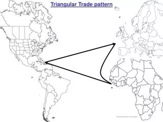
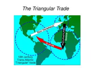
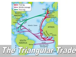
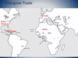
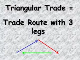
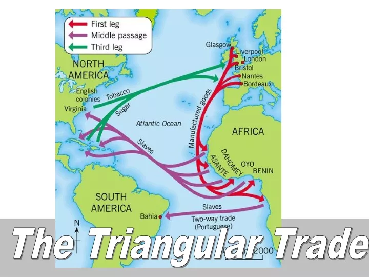
The Triangular Trade. Statistical Source. Letter Source. Map Source. The Map, The Letter, The Statistics. Statistical Source. Letter Source. Map Source. Source 1: The Map. Statistical Source. Letter Source. Map Source. Source 2: The Letter. Statistical Source. Letter Source.

E N D
Statistical Source Letter Source Map Source The Map, The Letter, The Statistics
Statistical Source Letter Source Map Source Source 1: The Map
Statistical Source Letter Source Map Source Source 2: The Letter
Statistical Source Letter Source Map Source Source 3: The Statistics
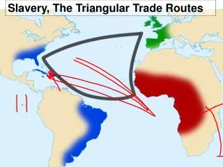
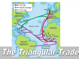
Source A: British Map of the Coast of Africa, 1663-1681 European ‘factories’ on the Gold and Slave Coasts are marked by flags, most of them coloured to indicate nationality
Source A: British Map of the Coast of Africa, 1663-1681 Write down four details that the source tells us about the Slave Trade What does this map tell us about the Slave Trade?
Source A: British Map of the Coast of Africa, 1663-1681 3 sentences are false, 3 are true only copy out the true sentences • The source tells us: • The British were the only nation trading in Africa • Enslaved Africans were taken from along the whole …Coast of Africa • In the second half of the 17th century the British ...... had the most factories in Africa • The British started trading in Africa in the .........…eighteenth century • The British were not the only nation who set up ...‘factories’ in Africa • Enslaved Africans were mainly taken from a small ...…area of the West Coast What does it Say?
Source A: British Map of the Coast of Africa, 1663-1681 Can we infer anything else from the source? • The source suggests to us: What does it Suggest to Us?
Source A: British Map of the Coast of Africa, 1663-1681 Can we infer anything else from the source? • The source suggests to us: • The slave trade was important to Britain • The slave trade was worth a lot of money • Only Britain was doing well in this trade • Maybe.. • Maybe.. • Maybe.. • Maybe.. What does it Tell Us?
How useful is this source to a historian wanting to research the Slave Trade? Source A: British Map of the Coast of Africa, 1663-1681 To what extent would you rely on the details that you have found in this source? Do you think this source provides reliable evidence of Britain’s role in the slave trade? ... 1. Who do you think made this map? Does this affect its use to historians exploring Britain’s role in the slave trade ? 2. When was the map made? Does this affect its use to historians exploring Britain’s role in the slave trade ? 3. For what purpose was the map drawn? How can we be sure? Does this affect its use to historians exploring Britain’s role in the slave trade ?
What is a database? There is a fantastic DATABASE that you can use to check the details suggested in the map source http://www.slavevoyages.org/
Your mission is to check that the source is useful by checking the details it suggests with the facts you can find through the database T database
For example, the map suggests most of the traders were British between 1663 and 1681… European ‘factories’ on the Gold and Slave Coasts are marked by flags, most of them coloured to indicate nationality
For example, the map suggests most of the traders were British between 1663 and 1681… This inference becomes the basis for a hypothesis… How would you phrase the hypothesis? How could the slavevoyages database help check thehypothesis? European ‘factories’ on the Gold and Slave Coasts are marked by flags, most of them coloured to indicate nationality
You can use the database to ask ‘How many trading journeys were being carried out between 1663 and 1681‘ ‘ What is the answer per country?’ ? ? ?
? ? ? Does the Graph support our findings when we compare it to the map source? Or does it contradict them?
You will produce a PowerPoint presentation which includes two slides and two graphs that you can make with the help of the database T database
Sources ? Sources ? Map source Other sources ?