Download
1 / 29
290 likes | 403 Vues
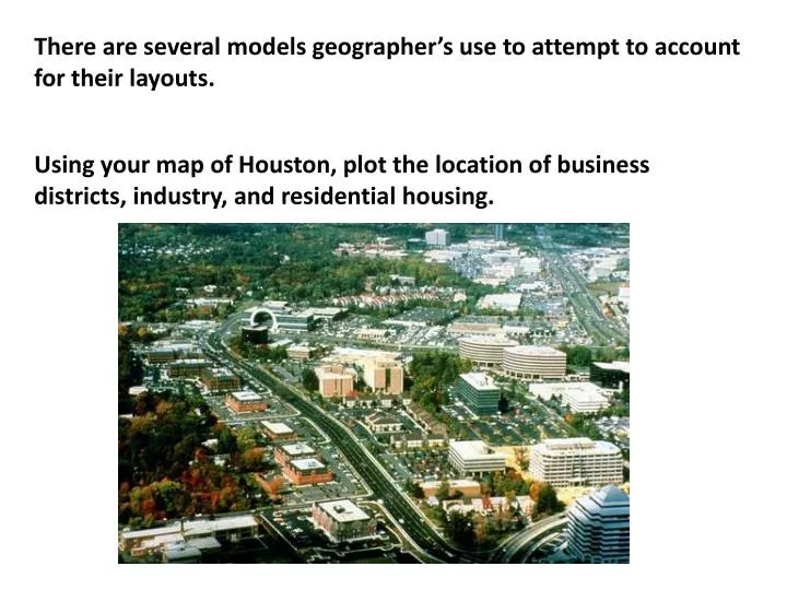
There are several models geographer’s use to attempt to account for their layouts. Using your map of Houston, plot the location of business districts, industry, and residential housing. Modeling the North American city.

E N D
There are several models geographer’s use to attempt to account for their layouts. Using your map of Houston, plot the location of business districts, industry, and residential housing.
Modeling the North American city 1. Central business district (itself broken into theatre, financial, retail, etc. Ernest Burgess’s Concentric Zone Model 2. Zone of transition: residential deterioration and encroachment by business. Includes light manufacturing “villages” like Fairfield and Cole’s Crossing 3. Closely spaced but adequate homes for blue collar workers. Density gradient 4. Zone of better middle class residences 1 2 3 4 5 6 Age increases 5. Suburban residences. Depicts a dynamic city in which over time each zone encroaches on the next zone in the ring. Based on the observation that home value increased with distance from the CBD
Concentric Zone is the oldest of the models. It was developed before the advent of mass car ownership. xxxxxxxxxxxxxxxxxxxx
Homer Hoyt’s Sector Model 1: Central Business District 2: Factories, industry, transition zone 3: Middle class residential 4: Low class residential 5: High Class Residential As areas developed and grew, the expanded in a “corridor.”
Factories, Industries, Transition zone Middle Class residential Low class residential High class residential Development follows transportation routes. Low class residential
Harris and Ulman – Multiple Nuclei Model 1: Central Business District 2. Light Manufacturing 3. Low Class Residential 4. Middle Class Residential 5. High Class Residential 6. Heavy Manufacturing 7. Outlying Business District 8. Residential Suburb 9. Industrial Suburb 9
Multiple Nuclei Model is based on the assumption that the Central Business District is losing its dominant position as the nucleus of a city. XXXXXXXXXXXXXXXXXXXXXXXXXX XXXXXX XXXXXX XXXXXXXXX XXXXX Because the long commute often became untenable, smaller businesses moved their locations to the suburbs. The “new” suburbs like Cy-Fair, Spring, Sugarland, Woodlands.
Periphery or Edge City Model This model is often called the “tenement of the information age” because they are made up of many high density townhomes and apartments for those who work nearby. 1: Central Business District 2. Suburban Residential 3. Shopping Mall 4. Industrial district 5. Office Park 6. Service Center 7. Airport Complex 8. Shopping and Employment Center
In a modern city the density gradient has fewer people downtown so there is a “density gap.” This model is often called the “tenement of the information age” because they are made up of many high density townhomes and apartments for those who work nearby. Willowbrook Galleria CBD Ship Channel Woodlands Office park and employmenet Airport Complex Baybrook Mall Beltway office park
Models of city structure around the world European cities have a high degree of residential, commercial, and indisturial zoning. A major difference comes in the form of intermixed building zoning. There may be a commercial establishment on the ground floor and apartments above.
Unlike the United States where we tend to tear down old buildings and replace them with new building, in European cities they try to preserve historic buildings.
As a result of the cities being much older, the streets are in a “dendritc” pattern, or, they look like the roots of a tree. They go everywhere. On problem this creates is that it is difficult for a stranger to navigate some cities. The streets in the older sections of town were not built for car traffic and are too narrow for two cars in many cases.
The urban structure of European cities is a reverse of what we find in American cities. The wealthier people live in the downtown areas. In most cases the urban core is devoid of skyscrapers.
The urban poor and the high rise buildings are found in the suburbs.
Before the age of elevators wealthier people lived on the ground level, the higher up, the poorer. With elevators, the wealthy moved ‘up.”
In order to limit urban sprawl, they have created “greenbelts” between the cities.
Latin American cities (and most colonial citites) integrate their past with the present. The design and layout of the city was developed hundreds of years ago. Many of the zones in the city radiate from a central core in a “spine” formatin. Cities are laid out with the cbd as the”hub.” Travel from one area to another requries moving through the hub. Note 4: high income residences 3: Industrial district 1: commercial business district 7: squatter districts
Latin American cities are often ringed by slums. These are the people from the countryside that came to the city to find work. LDC cities have a growing population rate due to two factors:
Brazilian cities have slums called “favelas” that literally are built up the side of a hill. These are crime ridden, drug infested areas that the police often avoid.
Economic develoment has made many Asian cities prosperous. Most are built on the coast and are built for trade with the ports playing an important role in their develoment. These cities often have special economic zones that provide inexpensive access to markets. Note how growth extends out from the port.
In only fifty years, Singapore has become a ped, spurred on by their location and export markets. Because many have only bloomed in the recent past, they are “new” cities with a growing infrastructure.
Islamic citeis are found in the Middle East and parts of Indonesia. The focal point of these cities is a Mosque.
The focal point of the cities is religion itself. Streets are characterized as narrow and crooked.
African cities are the fastest growing urban regions in the world. The focus of the city is the colonial core. Citeis show both a colonial cbd and a traditional cbd.
African cities suffer from poor infratstructreand lack adequate transporation systems.
The market or bazaar is the center of importance for many people. Many market places can take up city blocks. This is part of the informal economy.