Download
1 / 21
210 likes | 212 Vues
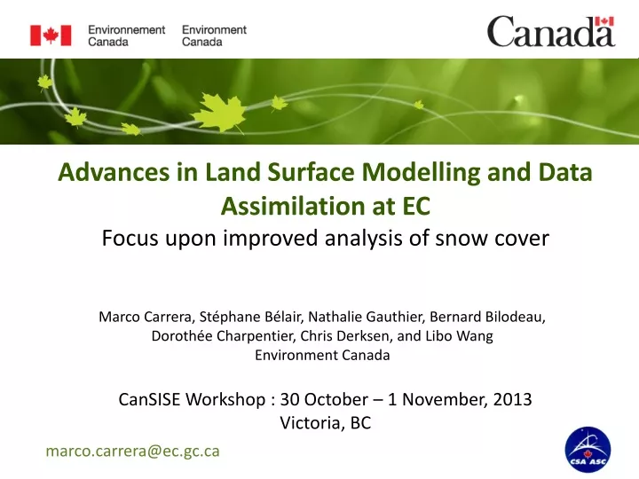
This workshop focuses on the latest advancements in land surface modelling and data assimilation techniques, with a specific emphasis on improved analysis of snow cover. The workshop will explore surface characteristics, databases, space-based remote sensing, modeling of surface processes, interactions with the atmosphere, and the use of external high-resolution systems for assimilation. The Canadian Land Data Assimilation System (CaLDAS) will also be discussed, along with strategies used at Environment Canada to improve snow analyses.

E N D
Advances in Land Surface Modelling and Data Assimilation at EC Focus upon improved analysis of snow cover Marco Carrera, Stéphane Bélair, Nathalie Gauthier, Bernard Bilodeau, Dorothée Charpentier, Chris Derksen, and Libo Wang Environment Canada CanSISE Workshop : 30 October – 1 November, 2013 Victoria, BC marco.carrera@ec.gc.ca
MAIN ASPECTS for LAND SURFACE MODELING and ASSIMILATION Saskatchewan • Surface characteristics • databases • space-based remote sensing • Modeling • surface processes • interactions with atmosphere • external high-resolution system • Assimilation • CaLDAS (Canadian Land Data Assimilation System) Northern Territories Toronto Central Quebec
The CANADIAN LAND DATA ASSIMILATION SYSTEM (CaLDAS) IN OUT CaLDAS Land surface initial conditions for NWP and hydro systems Ancillary land surface data ISBA LAND-SURFACE MODEL Orography, vegetation, soils, water fraction, ... xb ASSIMILATION Land surface conditions for atmospheric assimilation systems Atmospheric forcing y OBS (with ensemble Kalman filter approach) T, q, U, V, Pr, SW, LW Observations Current state of land surface conditions for other applications (agriculture, drought, ... xa = xb+ K { y – H(xb) } Screen-level (T, Td) Surface stations snow depth L-band passive (SMOS,SMAP) MW passive (AMSR-E) Multispectral (MODIS) Combined products (GlobSnow) with K = BHT ( HBHT+R)-1
CMC Operational Snow Analysis (Global, Regional, and LAM) • Uses an Optimum Interpolation (OI) methodology to combine a first-guess snow field with snow depth observations (Brasnett 1999). • Simplistic “snow-model” where previous snow-analysis is used as background and operational precipitation is used to compute the new snow accumulation. • ECMWF has recently revised their operational snow analysis to make use of the OI scheme (instead of Cressman) with the weighting functions of Brasnett (1999).
Strategies used at EC to improve snow analyses • GEM-Surf : High-resolution near-surface and land surface forecast system. Offline system forced with hourly forcing from CMC deterministic prediction system NWP • CaLDAS-EnsOI : Combine Ensemble Kalman filter (EnKF) approach for soil temperature and moisture with ensemble optimal interpolation (OI) for snow depth. • CaLDAS-Snow : EnKF approach to assimilate SWE retrievals from microwave passive measurements into GEM-Surf.
High resolution GEM-Surf systemComponents and validation LOW-RES 3D integration ATMOS MODEL Atmospheric forcing at first atmos. model level (T,q,U,V) Downscaled to 100m Atmospheric forcing at surface.(S,PR, P0) Land surface characteristics specified using High-Res external databases GEM-Surf 100 m 2D integration HIGH-RES Adaptation of T,U,V,q,P0 corrected for difference in elevation between forcing model and GEM-Surf. PR phase is adjusted to be coherent with new T.
SWE – GEM-Surf SWE – GEM-3D High resolution GEM-Surf systemDeveloped for high-resolution environmental prediction over Canada Good forecast of land surface conditions tied to representation of local surface characteristics such as orography, vegetation type, soil type, snow coverage. External model of the land surface and near-surface which evolve separately of the 3D operational forecast model in term of resolution and time-step. Characteristics • Can run at resolution of the most detailed surface characteristics database available. • Integrates only land and near-surface processes • Computational cost of GEM-Surf much less than that of 3D atmospheric models Carrera et al. 2010, Bernier et al. 2011, Leroyer et al. 2011.
DOWNSCALING LAI: SOURCES of INFORMATION 30m 200m 1km 10km Biome-BGC 10-year Clim from runs (LAI) LCC-2000 Land Use / Land Cover (types) MODIS 10-year NDVI climatology TARGET RESOLUTION Grass Forests
GREATER TORONTO AREA Light grey: pavement fraction Dark brown: building fraction LAKE ONTARIO LAI (m2m-2)
Snow data assimilation currently operational at EC Ancillary land surface data CaLDAS Orography, vegetation, soils, water fraction, ... Offline Snow Model Atmospheric forcings Optimal Interpolation SD Analysis T, hu, winds Precipitation Radiation Surface stations snow depth Assimilation based on optimal interpolation Background (first guess) snow depth is given by a simple offline snow model Observations from SYNOP and METAR are used (Brasnett, 1999)
The Canadian Land Data Assimilation System (CaLDAS) Ancillary land surface data EnKF xa = xb+ K { y – H(xb) } CaLDAS Orography, Vegetation, Soils, Water Fraction, ... GEM-Surf with xb K = BHT ( HBHT+R)-1 Atmospheric forcing Assimilation EnsOI (SD) Assimilation EnKF SD Analysis Temp, Humidity, Winds, PR, and Radiation y Observations CaLDAS-Snow : BHT covariance between Snow Depth and SWE HBHT : Model Error Variance
CaLDAS: General strategy Forcing: RUN 12Z6-12hr forecasts Forcing: RUN 12Z12-18hr forecasts Forcing: RUN 00Z6-12hr forecasts Forcing: RUN 00Z12-18hr forecasts Forcing: RUN 12Z6-12hr forecasts 18Z 00Z 06Z 12Z 18Z GEM-Surf GEM-Surf 6h forecasts PR : spatial shift and additive perturbation using CaPA methodology Radiation : spatial shift coherent with PR shift TT : additive Gaussian perturbations
Canadian Precipitation Analysis (CaPA) Generation of an Ensemble of Precipitation analyses Perturbed Precipitation Gauge Observations Measurement + Errors of Representativity Optimum Interpolation Assimilation Spatially perturbed Model forecasts of precipitation Ensemble of precipitation analyses RDPA (Regional Deterministic Precipitation Analysis) http://weather.gc.ca/analysis/index_e.html
CaLDAS-EnsOI • Combine ensemble Kalman filter approach for soil temperature and moisture with ensemble optimal interpolation (OI) for snow depth • Examine impact of CaLDAS initial conditions in forecast mode for the Global Deterministic Prediction System (GDPS) EnKF xa = xb+ K { y – H(xb) } with K = BHT ( HBHT+R)-1 CaLDAS-Snow : BHT covariance between Snow Depth and SWE HBHT : Model Error Variance
Operational 2m temperature vs CaLDAS-Screen with ensemble of OI analyses Winter results – 2m temperature (00Z runs – Northern Canada) Improved forecasts of temperature at 2m with CaLDAS OP STDE Bias CaLDAS
CaLDAS-Snow: General strategy • Snow in CaLDAS: Ensemble Kalman Filter • Observations: SWE retrievals from AMSR-E or GlobSnow (1/day) • Control variable: snow mass • Other snow variables: snow density and snow albedo cycled • Background (first guess): GEM-Surf 6h prediction • Number of members: 24 • Assimilation step: 6h • Ensemble spread obtained by perturbing the atmospheric forcing, the observations and the analysis • Observation errors are constant in time and in space: 20mm • Bias errors (systematic) are removed from SWE observations.
Canadian experiments for snow depth Test period : 1November 2006 – 21 April 2007 Computational domain : Central part of Canada SWE retrieval algorithms developed from field campaigns for this area Hudson Bay The SWE AMSR-E data were re-gridded on the 15km CaLDAS-Snow grid Observation network : 50 surface stations (Environment Canada) Grid spacing : 15 km
Operational snow depth analyses (OI) vs CaLDAS ensemble of OI analyses Mean snow depth Improved analysis of snow depth with CaLDAS(ENS-OI) OBS Bias ENS-OI Open Loop Evaluation against surface snow depth observations. CMC-OP STDE
EnKF Assimilation experiment with SWE from AMSR-E CaLDAS with AMSR-E vs open loop Mean snow depth OBS CaLDAS-AMSRE not as good as ENS-OI shown earlier Bias Open Loop STDE CaLDAS-AMSR-E
Preliminary GlobSnow Mean snow depth OBS Bias Open Loop GlobSnow STDE CaLDAS-GS (CAREFUL… GlobSnow experiments not leave-one-out type)
Summary : Current Status • CaLDAS has been accepted into CMC operations as an experimental product running offline on a global domain at 25 km resolution. • January 2014 : final tests will begin for CaLDAS coupled with the new upper-air assimilation system. Goal is to transfer this coupled system into operations in 2014. • CaLDAS is being coupled with the Global Ensemble Prediction System (GEPS) at 50-km resolution. Individual CaLDAS members providing the surface initial conditions to the GEPS.