Download
1 / 25
260 likes | 271 Vues
The P3DM Process. Various phases. By: Giacomo Rambaldi. Unit: M10U01. Flow of the presentation. Preparatory phase Manufacturing the blank model Data input Data extraction. The Preparatory Phase. Mobilising stakeholders. Defining the area. Preparing the draft legend.

E N D
The P3DM Process Various phases By: Giacomo Rambaldi Unit: M10U01
Flow of the presentation • Preparatory phase • Manufacturing the blank model • Data input • Data extraction
Mobilising stakeholders Defining the area Preparing the draft legend Preparing the agenda Sourcing for spatial data (contours) Choosing the scale Preparing the base map Preparing the logistics Procuring inputs Consulting stakeholders Obtaining FPWIC
Geographical scope • The concerned communities should select the area to be mapped. • Pay attention to the: • purpose of the mapping exercise; • watersheds; • cultural domains; • zones.
Choosing the scale • 1:10,000 scale: 1 cm on the map equals 100 metres on the ground • 1:5,000 scale map: 1 cm on the ground equals 50 metres on the ground • At scales smaller than 1:15,000, informants have difficulty precisely locating features • P3DM is best done at scales > 1:10,000
Choosing the scale • Given a defined project area, the choice of scale will determine the size of the model
Preparing the base map • Ensure that: • contour lines are coloured in a repeating sequence • labels (many) show elevation in metres • a grid is added • the lowest elevation contour line is clearly identified • you get at least two copies of the base map
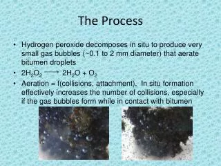
Procuring inputs • Procuring inputs is a critical step in organising a P3DM exercise because you: • cannot run out of materials during the P3DM workshop • must ensure that all participants are given the chance to actively participate and that nobody feels excluded • must have enough materials to accommodate the unexpected
Materials to reproduce contour intervals Carton board Expanded EVA/PE closed-cell foam Images by PAFID
Push and map pins for points • Examples of point features: • Water point • Household • School • Health centre Images by Giacomo Rambaldi
Yarns for linear data • Examples of line features: • Road • Foot trail • Water course • Examples of areas: • Malaria-infested area • Flood-prone area Image by Giacomo Rambaldi
Paint for polygons • Examples of point features: • Grassland • Water body (lake) • Paddy field • Orchard • Dark forest • Bamboo forest • Landslide Image by Giacomo Rambaldi
Overlapping features • Yarns can be used to add data sets on top of other layers • For example, a coastal area (light blue paint) is considered a no-touch zone (orange yarn identifies the boundaries of the zone)
Scaling and referencing Image by Giacomo Rambaldi
P3DM logistics • P3DM logistics are complex because facilitators have to: • convene 20-30 people at a time; • accommodate and feed them for 1-2 days; • ensure that participants represent adjacent villages to facilitate cross-verification; • ensure that all have a role to play during the workshop.
Manufacturing the Blank Model The youth at work
Tracing, cutting and pasting Images by Giacomo Rambaldi
Data Input The turn for the custodians of knowledge
Orientation, here we are! Image by Giacomo Rambaldi
Transfer of spatial knowledge Image by Giacomo Rambaldi
Transfer of spatial knowledge Image by Giacomo Rambaldi
Data extraction • This topic is addressed in detail in M10U04
Digitising, organisingand editing data Cartographicprocessing Plotting thematic maps Thematic maps, GIS and database information Comparing data fromdifferent sources Cross-checking andvalidating Data management Extracting data from the 3D model Various purposes