Download
1 / 43
430 likes | 437 Vues
Geography teaching hints and tips for NQT’s. Simran Jouhal. Simranjouhal78@gmail.com. 1. Starters: Lesson starters should prepare and engage pupils for learning. What?. Where?. When?. E.g. When will this damage be cleared? (L4-5) When will the country fully recover financially? (L6-7).

E N D
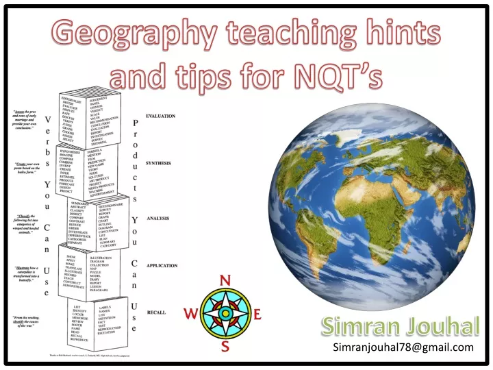
Geography teaching hints and tips for NQT’s SimranJouhal Simranjouhal78@gmail.com
1. Starters:Lesson starters should prepare and engage pupils for learning What? Where? When? E.g. When will this damage be cleared? (L4-5) When will the country fully recover financially? (L6-7) E.g. What is the cause of this? (L4-5) What are the short/long term economic impacts here? (L6-7) • Use this simple starter to create a sense of enquiry for lessons. • Quick and simple • Change the photos for different topics/lessons • Give a broad range of photos within the lesson – differentiate • Higher ability pupils may begin to answer their own questions • The questions can act as prompts for lower ability pupils • Support on board: think about the social impacts (impacts on people). Think about the scale of the damage created What ought? How? What might? Why? Who?
Write a list of questions relating to your image What? Task Where? E.g. When will this damage be cleared? (L4-5) When will the country fully recover financially? (L6-7) E.g. What is the cause of this? (L4-5) What are the short/long term economic impacts here? (L6-7) Success Criteria: When? L4: Simple questions relating to the image What ought? ? How? L5: Same as L4, but links to specific countries in the world (scale) L6: Specific questions, analyzing the image in depth What might? L7: Same as L6, but relates to SEEP (Social, Economic, Environmental, Political) Why? Who?
What? Where? When? How? What ought? What might? Why? Who?
What? Where? When? How? What ought? What might? Why? Who?
What? Where? When? How? What ought? What might? Why? Who?
What? Where? When? How? What ought? What might? Why? Who?
What? Where? When? How? What ought? What might? Why? Who?
2. Linking Blooms Taxonomy to LevelsEach learner will be able to demonstrate a different level of skill Link Blooms Taxonomy to learning objectives, lesson outcomes, and success criteria‘s. Display it on classroom walls and allow pupils to become familiar with it
Task: Produce either a report or an article for a magazine comparing the working conditions, pay and hours for workers doing jobs at different stages in the mobile phone industry. Grade C: Will list the difference in working hours, conditions and pay of workers in the mobile phone industry Grade B: Will effectively compare the difference in working hours, conditions and pay of workers in the mobile phone industry Grade A-A*: Will effectively compare the difference in working hours, conditions and pay of workers in the mobile phone industry (across all 3 sectors). A* will link to SEEP
3. Linking Blooms Taxonomy to Learning ObjectivesEach learner will enter/leave the classroom at a different level Boxing Day Tsunami Lesson 9 Word Bank Epicentre Impact Damage Less Economically Developed Country (LEDC)
Success Criteria: • Describe how supervolcanoes are formed ALL (3-4) • Describe and explain in detail how supervolcanoes are formed MOST (4-5) • All of the above and explain what the effects were of the Yellowstone eruption SOME (5)
4. Scale and MapsDon’t just rely on YouTube videos! Pupils should be thinking about the positive and negative impacts of an issue Higher ability pupils should be considering all four • The importance of scale in Geography is highly studied but often forgotten when teaching • Pupils should be considering the social, environmental, economic and political positive and negative impacts of the issue/topic studied • Photo prompts, YouTube or independent research can aid this • Most lessons should start with a map visualisation demonstrating scale (Easily done on Google Earth by zooming in/out)
Yellowstone Supervolcano Yellowstone National Park, Wyoming (north west) USA • http://www.youtube.com/watch?v=QNcFlaiekDo
Yellowstone Supervolcano • http://www.youtube.com/watch?v=QNcFlaiekDo
5. Pupil IndependenceAllowing pupils to work independently and stay motivated Healthy competition whilst promoting independence Differentiated and targeted to the individual • Create a sense of healthy competition amongst pupils to get them motivated • Pupils answer any questions they like as long as they achieve the target number of points • Questions are differentiated as demonstrated in how many points they are worth • Total target points can be differentiated for pupils • Pupils can work at their own speeds
Each activity is worth points. You must complete enough activities to reach a minimum target of 16 points. Activity 2: Draw detailed diagrams and explain how supervolcanoes are formed (4 points) Activity 1: What are the main characteristics of a supervolcano? (2 points) Activity 3: What is a caldera? (1 points) Activity 4: Where is Yellowstone located and when did it occur? (3 points) Activity 11: What is a geyser? (1 points) Total of 16 points Activity 10: What is a hotspot? (1 points) Activity 5: How do supervolcanoes differ from ‘normal’ volcanoes?Hint: it may be useful to read over your notes from previous lessons. (3 points) Activity 7: Where are supervolcanoes likely to form? Collision or destructive plate margins? (1 points) Activity 9: Select two questions from your starter sheet and answer it (3 points) Activity 8: List 3 possible effects of the Yellowstone eruption (3 points) Activity 6: Draw and label a supervolcano. Include the features: crust, pipe/crack, magma, mantle, caldera, wide top (2 points)
Each activity is worth points. Four points are worth one merit. You do not have to answer all the questions. Activity 2: Draw a detailed diagram explaining how corries are formed (4 points) Activity 1: How do glaciers impact landscapes? (1 point) Activity 3: What is an arête? (1 point) Activity 11: Highlight your key geographical words used (1 point per appropriate key word) Activity 4: What does an arête look like? (1 point) 4 points = 1 merit Activity 10: Add specific named case study examples to all your answers (double points) Activity 5: What is a pyramidal peak? (1 point) Activity 7: What is the difference between a V and U shaped valley? (3 points) Activity 9: What are interlocking and truncated spurs? (3 points) Activity 6: What does a pyramidal peak look like? (1 point) Activity 8: How do glaciers shape V and U shaped valleys? (2 points)
6. Creativity with Play dough Engaging yet educational ways to teach • Used across all key stages – including A-Level • Must have a follow up/purpose! • Engaging alternative to ‘regular’ teaching • Play dough can be easily and cheaply made at home the night before Great for SEN or lower ability pupils and kinesthetic learners Keeps it fun! Alternative way of teaching • Recipe for a bag of play dough: • 1 cup of plain flour (cheapest will do) • ½ cup of salt • 2 table spoons cream of tartar • 2 tablespoons vegetable oil • 1 cup water • Few drops of go
Crack/fault/joints Cave Arch Stump Headland Stack Cave Cave
My Example • A-Level class studying coastal landforms and processes: • Pupils created a coastline using the play dough • They then had to add the labels, showing each landform created • Next they were to rearrange the step by step process of the formation of these landforms • Once complete, pupils completed an exam question
Visual to aid learning. Pupils more confident to apply to exam practice
7. Low Literacy Strategies to support pupils with low literacy or who lack confidence in extended writing Use a sentence structure, as well as starters Use colours to separate each section – this helps! • Low literacy levels can have a huge impact on students, especially when it comes to exam practice and gaining full marks • Use word banks, sentence structures, sentence starters, and group work to improve literacy levels and create confident learners • The following page shows an A4 double-sided help sheet – easily adapted for any topic, lesson or task required. Read the information sheets and decide which use of mountain areas is most important to Peru.
Read the information sheets and decide which use of mountain areas is most important to Peru.
How do people use deserts? Adjectives beautiful Deserted fragile freezing Windy peaceful remote Tranquil Extreme Nouns blizzard desert mountains wilderness F magazine article L Professional AYear 11 students PTo inform Environment Wildlife conservation developed environment fragile global warming Polluted Key Words Use key geographical vocabulary to show understanding Deserts Adaptations Altitude Sustainable Stalinisation Soil erosion Tourism Drought
Introduction Describe the climate (include temperature, wind and precipitation) Hours of daylight in winter and summer? Scenery Describe where they are found. You can use a diagram to even show how some deserts are formed. e.g. Rain shadow desert. Planning Space PEA- The uses of deserts in LEDCs and MEDCs– PEA- What could the problems be on different groups? Conclusion: This is the strongest part of your argument. What could happen in the future. How would people and the environment be affected.
How do people use deserts? West Hot Cold Rainfall Warm Introduction Deserts are found towards the ______________ of continents. The temperatures can be very _______ during the day and very _________ at night. The climate is ________ with very little ___________. Draw a map or diagram to support your answer. Rain shadow Tourism Military Farming Sustainable Tribes Impacts Global Add some more: Main section The Mojave desert is used by .... The reason for this is... This can have an impact because.... The Thar desert is used by .... The reason for this is... This can have an impact because.... Key Words Conclusion: I think that using deserts in this way could have an impact because…
8. Hand outs Laminated sheets that can be used for every and any lesson/learner • Laminate and reuse • Quick and easy resources to support and stretch pupils • Ideas include: • Connectives list (improve literacy) • Suggestions or prompts how to make Social, Environmental, Economic and Political points (supporting lower ability pupils or those who want structure help) • Ideas how to link to sustainability (stretching the higher ability) Generic resources within the classroom Can be used with any class, topic, or learner.
How to link to sustainability Sustainable development is development which meets the needs of the present without compromising the ability of future generations to meet their own needs. Sustainable development attempts to minimise the negative impacts of development by considering the needs of both the environment and future generations of people. • Ask yourself: • Can this go on forever? • Will this damage the economy in the future? • Will it have a negative impact on the environment in the future? • Will it effect the economy? • What will happen to the governmental laws? • Although it may be beneficial now, it may have negative impacts in the future. Discuss
9. Success Criteria’s and Mark SchemesMake an exam board mark scheme accessible for pupils Mark schemes tend to be too vague or inaccessible for pupils to understand. Translate mark schemes to make them understandable and applicable for pupils. This can be done by creating simple lists of things for pupils to include in their answers in order to gain that mark (see next pages for examples) Helps improve peer marking over time too!
www:___________________________________________________________________________________________________________www:___________________________________________________________________________________________________________ EBI:______________________________________________________________________________________________________________ Level before FIT:Level after FIT:
With reference to a product you have studied, explain why workers involved in primary production are paid so much less than workers in shops selling the product. (6 marks + 3 SPaG) List any SPaG errors WWW: EBI:
Level 2 (3-4 marks) • Explains the working conditions of each step of the phone industry production • Explains the pay of each step of the phone industry production • Refers to specific locations • Good reasoning and logic in parts of the answer • Level 3 (5-6 marks) • Explains the pay, working conditions for each step of the phone industry (primary, secondary, tertiary) • Refers to specific places and facts/figures • Compares and justifies each step • Creates a balanced argument • Reasoning is clear and logical with good expression of language. • Level 1 (1-2 marks) • Basic points • No reference to the source • Reasoning may be weak or unclear • Simple statements With reference to a product you have studied, explain why workers involved in primary production are paid so much less than workers in shops selling the product. (6 marks + 3 SPaG) How to start:Many workers involved with primary production of mobile phones are paid far less than workers in shops selling these products. Firstly, primary production of mobile phone mostly occurs in…. Here, they begin…
10. Showing progress in lessonsObnoxious Observations and Ofsted - Ideas how to show progress of the individual in lessons Lego Give pupils a series of questions (must be differentiated). They must stack a Lego piece on top of one another for every question answered. This shows how much work is being done by each pupil, allowing you to monitor the progress made. (Note, this method may not demonstrate the quality of the pupils work here) • Post it notes • One of the best tools to show progress is post-it notes! • Colours can be differentiated for each level, or G&T pupils • Can be used before, during and after content has been taught in the lesson • Can be anonymous if preferred • Post-its can be stuck on a spectrum showing where pupils stand on a viewpoint(see next page)