Download
1 / 9
90 likes | 283 Vues
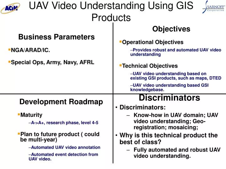
UAV Video Understanding Using GIS Products. Objectives Operational Objectives Provides robust and automated UAV video understanding Technical Objectives UAV video understanding based on existing GSI products, such as maps, DTED UAV video understanding based GSI knowledgebase.

E N D
UAV Video Understanding Using GIS Products • Objectives • Operational Objectives • Provides robust and automated UAV video understanding • Technical Objectives • UAV video understanding based on existing GSI products, such as maps, DTED • UAV video understanding based GSI knowledgebase. • Business Parameters • NGA/ARAD/IC. • Special Ops, Army, Navy, AFRL Discriminators • Discriminators: • Know-how in UAV domain; UAV video understanding; Geo-registration; mosaicing; • Why is this technical product the best of class? • Fully automated and robust UAV video understanding. • Development Roadmap • Maturity • A->A+, research phase, level 4-5 • Plan to future product ( could be multi-year) • Automated UAV video annotation • Automated event detection from UAV video.
UAV Based Automatic Road Following • Objectives • Operational Objectives • Following a road or a pipe, etc in UAV video or by controlling UAV cameras • Technical Objectives • Road or pipe recognition and tracking • UAV sensor control • Business Parameters • Army Night Vision Lab asked us to solve this problem. • Special Ops, Army, Navy • IED detection, road, oil pipe, border protection Discriminators • Discriminators: • Know-how in UAV domain; UAV video understanding; Geo-registration; mosaicing; • Why is this technical product the best of class? • Fully automated UAV operation with adv. video understanding tech. • Development Roadmap • Maturity • A->A+, research phase, level 4-5 • Plan to future product ( could be multi-year) • Detect events related to road, pipe lines or borders.
Information Triage • Objectives • Operational Objectives • Triage vast amount of info from different modality into an integrated intelligence source. • Technical Objectives • Cross-cuing among modalities • Multi-level info triage • Cognitive UI • Business Parameters • Current relationship: NGA/ARDA/IC • Suggested Future Relationships • DARPA/DoD Discriminators • What sets Sarnoff apart from the competition? • Image/video understanding • Geo-registration • WordNet+ from Princeton University • Why is this technical product the best of class? – First integrated info triage solution • Development Roadmap • Current maturity: A->A+, level 4 • Plan to future product ( could be multi-year) • Information triage system that takes in information from different sources and integrates them.
Geo-Spatial Image/Video Management • Objectives • Operational Objectives • Develop geo-spatial image and video management system based on high level image/video understanding • Technical Objectives • Improve effective image/video summarization and indexing capabilities • Develop cognitive GUI that understand user intent and learns from interaction • Business Parameters • NGA, CIA, DIA • Manage vast amount geo-spatial images and videos Discriminators • Discriminators: • User intent estimation (ARDA/VACE) • Video understanding (ARDA/VACE) • DVL • TerraSite • Why is this the best? • High level understanding, cognitive GUI • Development Roadmap • Maturity • A+, research phase, level 5 • Plan to future product ( could be multi-year) • A geo-spatial info. management sys.
Automated Performance Evaluation for Convoy Training • Objectives • Operational Objectives • Develop automated performance evaluation for convoy operation • Technical Objectives • Record info. related to convoy operation using audio/visual, GPS info. and metadata • Develop performance metric and training method for convoy training • Develop convoy operation knowledgebase • Business Parameters • ONR, Army, Marine • Training how to drive convoy Discriminators • Discriminators: • Vision systems for automotive applications • Automated performance evaluation for Military Operations in Urban Terrain (ONR program). • Why is this the best? • Provides feedback for real convoy training • Development Roadmap • Maturity • A->A+, research phase, level 4-5 • Plan to future product ( could be multi-year) • Autonomous convoy operation
SaccadeCam: Pro-Active Motion Imagery Acquisition for Persistent Surveillance Novel Ideas • Automate motion imagery acquisition processing and free cameras from direct operator control. • Inspired by the Saccade motion of eye movement, SaccadeCam moves the “fixation” or Field-Of-View (FOV) of a camera constantly and at high speed. • Where and when to look, also referred as the Saccade motion of the camera, is determined by analyzing acquired imagery, estimating operator’s intent, underlying tasks and other sensor information, such as wide FOV camera, SARS, radar or LIDAR. • Present motion imagery to an analyst based on his/her interests and underlying tasks. Potential Clients: I2WD, NVESD 2006 ROM Estimate: TBD Impacts • Provides wide are persistent surveillance and reconnaissance • Reduces or eliminates missed targets & events. • Significantly increases the area that can be monitored by a single UAV. • Automates motion imagery acquisition and improves the efficiency and effectiveness of the acquisition system. • Greatly reduces the number of sensor operators and analyst needed for a mission. • Provides actionable intelligence instead of raw data using information-push based on user’s intent. • Significantly reduces the response time and enables total situational awareness. Tasks and Efforts TasksEfforts 1. Proof-of-concept demonstration 5 month 2. System design 2 months 3. Software system development 9 months a) Saccade motion planning b) Multi-layer mosaic representation c) Operator intent understanding 4. Prototype system development 12 months 5. Advance capability demonstration 6 months 6. Final system integration 2 months Total 36 months
25W Fuel Cell Power System Objectives Business Parameters • Teamed with a Fuel Cell System Integrator and a Supplier of Military Equipment. Contracted to build two (2) 15 W metal plate PEM fuel cell stacks (TRL5 level) using hydrogen as fuel. • Demonstrate the metal bipolar plates using methanol (direct & reformed) as fuel. • Sarnoff focuses on lightweight high performance fuel cells stack development ,and we will team with a experienced fuel cell system integrator to demonstrate the fuel cell power system. • Soldier Portable Power Requirements: • Power Density: 600-1000 Wh/kg • Life: 2000-5000hrs • Sarnoff Technical Objective • Power Density: 1000 Wh/kg • Life: 5000-6000 hrs • Use multiple fuel to provide power • Hydrogen/Methanol/other hydrocarbons (diesel) Current Soldier Batteries (LM-145, LI-145): ~ 150 Wh/kg • Lightweight fuel cell stacks enabled by the Sarnoff’s proprietary metal/ceramic bipolar plate technology saves weight and volume, increasing Power Density. • Sarnoff’s Technology will enable system: • 20-50% reduction in system weight and volume • 30% reduction in system start-up time • 10% higher energy efficiency Potential Client: C2D, I2WD 2006 ROM Estimate: TBD Discriminators • Development Roadmap • Current Status: • Demonstrated metal/ceramic bipolar • plates for lightweight fuel cell stacks • -- >5000 hrs stable operation • -- 50% reduction in weight stack and volume • Project Plan (24 Months): Sarnoff FC Stack Traditional FC Stack
Position / Navigation for Situational Awareness Location Receiver Ad Hoc Network Interface Node Reference Beacon Client: C2D 2006 ROM Estimate: TBD • Purpose: • Extend position, navigation and C2 capabilities to the dismounted Land Warrior operating in an indoor or urban environment. Merge enhanced commercial location technology and ACIN networking technology to provide Blue Force pos/nav tracking in conditions where standard techniques (GPS etc.) are blocked. • Product: • Hand Held position / navigation / messaging device. • Portable self-configuring outdoor infrastructure • Payoff: • Leverages commercial technologies and recent developments in the BFAPS and ACIN-CSUE programs to provide a deployable system solution. • Supports communications and map based location between team leader and team members. • Provides C2 capability from remote location • Demonstration of system in FY05 Tag Ad Hoc Wireless LAN Differential GPS Base Station Analysis Station • Address Need for Blue Force Awareness in Urban Areas • Leverage Commercial Technologies Schedule Description: Due (Months ARO): Monthly Technical Reports Monthly Detailed Program Plan and Schedule 1 System architecture description report 3 Demonstration of Indoor location capability 6 Demonstration of Map based location capability 8 Demonstration of self configuration capability 11 Final Report 12 Delivery of One (1) System (4 handheld devices and outdoor Infrastructure) 12
Transferring Commercial Protocols to JTRS Objectives Business Parameters • Proof of concept to support JTRS stated goal of commercial waveform support • Demonstrate the ability to make use of existing infrastructure in other • countries • Analysis of what it would take to port a commercial broadcaststandard to JTRS capable system. • $2,012,000 required over 18 months • $1,575,000 in year one • $455,000 in year two • Peak loading 5 staff members • Demonstrate re-configurability • Show the ability to demodulate two different commercial waveforms • ie: DTV-8VSB and DVB-H (primary functionality) • Small form factor • The goal is device that is portable (hand-held) • Low power • Use COTS components Discriminators Development Roadmap • Sarnoff’s proven SDR capability with application to DoD waveforms Current Status • Developed low cost, embeddedSDR platformto supportCluster 5 SFF requirements under ACIN in 2004 • Demonstrated a small form factor (SFF) radio targeted to Cluster 5 requirements in field demonstration • The system was demonstrated under the 2004 ACIN program using the Soldier Radio Waveform, EW Mode, 8 MHz operation. - Developed SoC for North American DTV reception. ATSC A/54 18 Month Development Schedule • Sarnoff’s capability in digital design for high-speed signal processing DTV 8VSB to FPGA - Sarnoff’s vision processor the Acadia™ chip • Sarnoff’s DTV demodulator • Sarnoff’s MPEG Audio/Video decoder Develop DVB-H DVB-H to FPGA • Sarnoff’s experience with many commercial waveforms and standards • Soldier Radio Waveform for Cluster 5 SFF Radio • A/54, ITU j.83b, DOCSIS, CDMA?,GSM?,MPEG, H.264, WMA,MP3 System Evaluation and Final Report 6 12 18 months