Download
1 / 16
160 likes | 163 Vues
This draft report funded by FEMA's Risk MAP program provides a quantitative analysis of natural hazard risks in Tillamook County, complementing mitigation planning efforts.

E N D
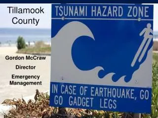
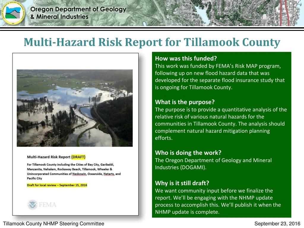
Multi-Hazard Risk Report for Tillamook County • How was this funded? • This work was funded by FEMA’s Risk MAP program, following up on new flood hazard data that was developed for the separate flood insurance study that is ongoing for Tillamook County. • What is the purpose? • The purpose is to provide a quantitative analysis of the relative risk of various natural hazards for the communities in Tillamook County. The analysis should complement natural hazard mitigation planning efforts. • Who is doing the work? • The Oregon Department of Geology and Mineral Industries (DOGAMI). • Why is it still draft? • We want community input before we finalize the report. We’ll be engaging with the NHMP update process to accomplish this. We’ll publish it when the NHMP update is complete. Tillamook County NHMP Steering Committee September 23, 2016
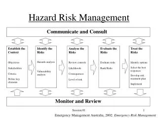
Scope of Multi-Hazard Risk Assessment • What are we analyzing? • Buildings and population. For buildings we relied on assessor data to create a countywide database. For population we used the 2010 Census, and pro-rated population to residential buildings based on square footage. • What natural hazards are we considering? • Cascadia Subduction Zone (CSZ) Earthquake and Related Hazards • Earthquake Hazus-MH loss estimation from a CSZ Magnitude 9.0 event • Tsunami exposure to five potential CSZ scenarios • Flooding • Hazus-MH loss estimation to four recurrence intervals (10%, 2%, 1%, 0.2% annual chance) • Exposure to 1% annual chance recurrence interval • Landslide Susceptibility • Exposure based on Landslide Susceptibility Index (low to very high) • Coastal Erosion • Exposure based on Coastal Erosion Zones (none to very high) • Wildfire • Exposure based on Fire Risk Index (low to high) Example of building database in Tillamook. Tillamook County NHMP Steering Committee September 23, 2016
Scope of Multi-Hazard Risk Assessment Which communities did we focus on? All the cities, the unincorporated county, and three unincorporated communities (Oceanside/Netarts, Pacific City, and Neskowin). Tillamook County NHMP Steering Committee September 23, 2016
Terminology • Defined Terms for Hazus Loss Estimation • Loss estimation: Damage that occurs to a building in an earthquake or flood scenario, as modeled with Hazus-MH. • Loss ratio: Percentage of estimated loss relative to the total replacement cost of a building. • Damage function or curve: A formula that represents the relationship between a given hazard parameter(s) (e.g. depth of flooding) and the estimated loss to a building. • Replacement cost: Monetary amount to restore a building to its pre-loss value. This term is used in the context of Hazus loss estimation. Earthquake Flood Tsunami Flood Coastal Erosion Landslide Wildfire • Defined Terms for Exposure Analysis • Exposure: Determination of whether a building is within or outside of a hazard zone. No loss estimation is modeled. • Building value: Total monetary value of a building. This term is used in the context of exposure. Tillamook County NHMP Steering Committee September 23, 2016
Community Characteristics Draft results – figures may change prior to final publication Tillamook County NHMP Steering Committee September 23, 2016
Community Characteristics Draft results – figures may change prior to final publication Tillamook County NHMP Steering Committee September 23, 2016
Draft results – figures may change prior to final publication Graphs not normalized. They show absolute damage. Note that Neskowin does not have 500-year flood mapped.
Draft results – figures may change prior to final publication Graphs normalized. They show exposure ratio, comparable across communities.
Draft results – figures may change prior to final publication Graphs normalized. They show exposure ratio, comparable across communities.
Draft results – figures may change prior to final publication Graphs normalized. They show exposure ratio, comparable across communities.
Wildfire exposure results are out of date. We just received a new dataset from Oregon Department of Forestry. We will revise results next week. Tillamook County NHMP Steering Committee September 23, 2016
Draft results – figures may change prior to final publication
Draft results – figures may change prior to final publication
Draft results – figures may change prior to final publication Tillamook County NHMP Steering Committee September 23, 2016
Appendices TablesTsunami Draft results – figures may change prior to final publication Tillamook County NHMP Steering Committee September 23, 2016
Jed Roberts Flood Mapping Coordinator Oregon Department of Geology & Mineral Industries (DOGAMI) Portland Office jed.roberts@dogami.state.or.us (971) 673-1546 Tillamook County NHMP Steering Committee September 23, 2016