Download
1 / 16
170 likes | 404 Vues
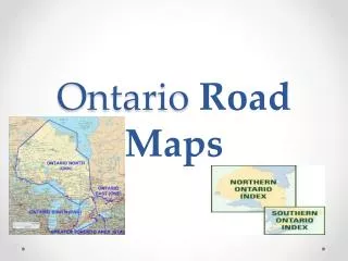
Data Maintenance of the Ontario Road Network (ORN). Overview of the ORN Building the ORN Maintenance of the ORN.

E N D
Data Maintenance of the Ontario Road Network (ORN)
The ORN is a horizontal initiative reducing government duplication, i.e. three levels of government working in the creation, maintenance and sharing of a common and standard road centreline database across Ontario.The ORN is the authoritative source of roads data for the OPS; it is a Government of Ontario Information Technology Standard (GOITS #29). For more information refer to www.itstandards.gov.on.ca
ORN Objectives Establish agreements with road authorities and municipalities in order to capture, integrate and maintain changes to the Ontario Road Network. Build and maintain a province wide common road database that is shareable across all levels of government and easily accessible to the public sector at large. Provincial and federal governments used this data along with other layers to determine infrastructure gaps and analysis, natural resource management (spills, inventories) and municipal funding e.g. gas tax dollars, school boards
What is the ORN? Over 275,000 km of roads Over 198,000 km of named roads Over 151,000 km of addressed roads
Accessing the ORN The ORN is available to registered users through the LIO Warehouse. Registered users are members of LIO’s Data Exchange or have signed an UUL/OGDE Agreement with MNR. Land Information Ontario/MNR has provided updates to road geometry and attributes to the National Road Network (NRN) annually. NRN format is provided to Statistics Canada for the realignment of the RNF to the ORN data.
Unpaved Speed Limit Bridge ORN LRS LIO based upon Geographic Data Files (GDF) - ISO/TC 204, adopted a Linear Referencing System (LRS) data model Allows for attribute expansion and does not require segmenting the geometry for changes in attribute values
Bridge B Street A Street 80 km 50 km 80 km Paved Paved Unpaved Arterial Road 2 Lanes ORN LRS attributes include: • Point Events: Blocked Passage, Toll Points and Junctions • Linear Events: Street Name, Alternate Street Names, Address Ranges, Jurisdiction, Structure, Road Surface, Route Name, Rout Number, Road Class, Number of Lanes, Speed Limit
Road Element Street Name Address Range Directionality Municipality ORN Segment with Address • Derived from LRS, LIO has produced a segmented version of the ORN includes street name, alternate names, range addresses, directionality, and municipality based on road element.
Building the ORN In partnership with the Ontario Road Network (MNR), Natural Resources Canada (NRCan) 60,000 km of geometry and attribute data from 8 municipalities: Peel Region, York Region, Region of Waterloo, City of Toronto, City of Hamilton, City of London, City of Ottawa, County of Oxford built the base of the ORN Completed August 2003, NRCan provided Ontario with 190,000 km of field collected roads with a spatial accuracy of less than 10m Standard Labelled Road Network (SLRN) and National Geographic Database (NGD) attributes twere integrated into the ORN base
Current Maintenance Municipalities provide updates the ORN through an ORN Data Sharing Agreement in order to maintain and collect changes to the road network. They are the authoritative source for the ORN! ORN is currently maintain the ORN based upon data sharing agreements. Where there is not an agreement with a municipality, field collection was completed those areas. Ministry of Natural Resources (MNR) provide updates for resource access roads on Crown Land and Ministry of Transportation (MTO) provide updates to highways across Ontario. Conflicts between the municipal data and MTO/MNR are tracked and forwarded to MTO/MNR for resolution.
Processes Supporting Data Maintenance - Transformation Data is provided is either linear or point data representing roads with attributes that describe characteristics of the roads. A dynamic and flexible translator transforms data from standard GIS file types (e.g. Shape, CAD) to a common schema. The transformation process is able to convert spatial data with attribution from one format into a standard format that can be reused and updated to maintain data.
Processes Supporting Data Maintenance – Change Detection Change detection process compare measurable changes in geometry (length and nodes) as well as attributes. Automated methodologies facilitate change analysis but are not always effective as some data sets or features are not well suited for determining change. Manual methods of determining change which are typically slow, complex and task specific are also used but these methods can accelerate automation over time.
Processes Supporting Data Maintenance - Integration Automated methods are used to integrate data based on change detection process. Linear or location referencing will allow other data, such as speed limit data, to be assigned to specific places along the road segment. Data collection standards of the ORN are adhered to when integrating data, e.g., the update of dual roads using current imagery and verification of data quality based on imagery sources.
Processes Supporting Data Maintenance – Quality Assurance Quality Assurance and Quality Control (QA/QC) enforce data consistency and accuracy within the ORN. • Topological – checks connectivity of the line work at intersections and other features • Data Requirements – ensures minimum required fields are valid and client needs are met • Interdependency – guarantees that assigned attribution makes logical sense (e.g. road class and speed limit match accordingly) • Common Sense – visual review to check that the common-sense approach is adhered to based on conceptualizations and interpretations of geographic space.
Questions? Carol Anne Albertson Project Manager, Land Information OntarioTelephone: 705.755.2175 E-mail: carolanne.albertson@ontario.caOntario Ministry of Natural ResourcesP.O. Box 7000, 300 Water Street, 2nd Floor North TowerPeterborough, ON K9J 8M5http://www.ontario.ca/lio