Download
1 / 37
380 likes | 779 Vues
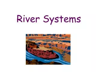
Watersheds and River Systems. Jennifer Naples Environmental Science. River System. A river system is made up of a river an all of it’s tributaries Rain running downslope eventually reaches a permanent body of water Delaware River. Tributary. A stream that runs into a larger stream

E N D
Watersheds and River Systems Jennifer Naples Environmental Science
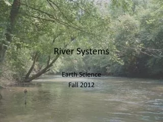
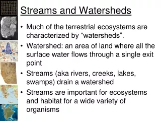
River System • A river system is made up of a river an all of it’s tributaries • Rain running downslope eventually reaches a permanent body of water • Delaware River
Tributary • A stream that runs into a larger stream • Sediments are eroded, carried and deposited • Examples: • Schuykill river runs into the Delaware River • Perkiomen Creek runs into the Schuykill River
Perkiomen Creek • The Perkiomen Creek runs into the Schuykill River in Audobon
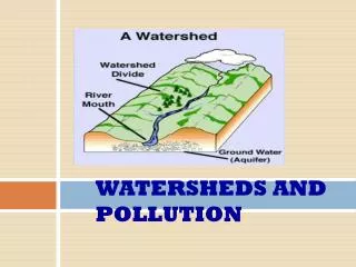
Watershed • A watershed is a drainage basin and includes all the land that drains into a river. • Directly – the river itself • Indirectly – it’s tributaries
Divide • High land that separates one drainage basin from another • The Chesapeake Watershed is separated from the Delaware River Watershed by a divide
Continental Divide • Divide in the middle of the United States • Rain falling east of the continental divide falls into the Atlantic Ocean • Rain falling west of the continental divide falls into the Pacific Ocean
Continental Divide • The continental divide in the United States
Continental Divide • The continental divide runs through Canada, The United States, Mexico and Central America
Mississippi River Drainage Basin • The largest in the United States • Appalacian Mountains to the east • Continental Divide to the west • Covers 4.6 million square kilometers
Check for Understanding • What is a river system? • A river and all of it’s tributaries • What is a tributary? • A stream that runs into a larger stream • Where is the continental divide located? • Canada, The U.S., Mexico and Central America
Drainage Patterns • There are 4 major drainage patterns for rivers • Controlled by the topography(mountains) • Controlled by the rock and bedrock of the earth • Controlled by the geologic structure
Major Drainage Patterns • Dendritic • Radial • Rectangular • Trellis
Major Drainage Patterns • Dendritic • Most of the U.S. • Rocks ar massive, flay lying, sedimentary rock
Major Drainage Patterns • Most streams have this pattern • Resembles a tree trunk • Trunk is the river • Roots are the tributaries • Form where bedrock is flat • Tributaries join at acute angles
Major Drainage Patterns • Radial • When streams flow from a high central area • Also called annular • Patterns resemble the spokes of a bicycle wheel
Major Drainage Patterns • Radial Drainage from a volcano • Mt. Taranaki, NZ
Major Drainage Patterns • Radial Drainage from a dome
Major Drainage Patterns • Rectangular • Occurs when bedrock is faulted or fractured
Major Drainage Patterns • Rectangular • Streams are at right angles • Offset by faulting • Example - California
Major Drainage Patterns • Trellis • Folded sedimentary rocks • Sandstone and limestone • Alternating resistant and non-resistant rocks
Major Drainage Patterns • Trellis
Major Drainage Patterns • Appalachian Mountains
Check for Understanding? • What are the four types of drainage patterns? • Dendritic, radial, rectangular and trellis • Where might a radial drainage pattern occur? • Volcano or salt dome
Pennsylvania Drainage Basins • All flow to the Atlantic Ocean • Susquehanna River • Ohio River • Delaware River • Erie • Genesee River • Patomic River
Ohio River • Starts in Pittsburg • Confluence of the Allegheny and Monongahela Rivers • 471 miles long • Ends at Cairo where it enters the Mississippi River • Provides drinking water for about 13 million people. 3.5 million Pennsylvanians
Ohio River • Ohio River Basin
Potomac River • Does not flow through Pa but drains part of our state • Flows through Washington, DC • Sometimes referred to as “The Nations River”
Genesee River • Headwaters in Potter County • Flows 157 miles north to Rochester, NY • Mouth in Lake Ontario • Part of the Great Lakes Basin
Lake Erie • Part of the Great Lakes Basin
Susquehanna • North Branch headwaters in NY • West branch headwaters in Clearfield, Pa • 444 miles • Mouth in Havre de Grace, Maryland • Drains into the Chesapeake Bay
Susquehanna River • Susquehanna River Basin is the largest basin in Pa • Covers 46% of Pa
Delaware River • Headwaters in Otsego, NY • 360 miles to the Delaware Bay
Check for Understanding • How many major river basins are there in Pa? • 5 • What are they? • Ohio • Potomac • Genesee & Erie (Great Lakes) • Susquehanna • Delaware • What is the biggest river basin in Pa? • Susquehanna