Download
1 / 18
180 likes | 328 Vues
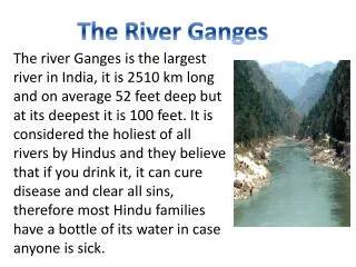
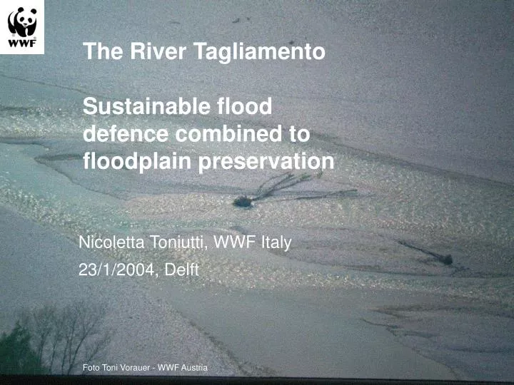
The R iver Tagliamento Sustainable flood defence combined to floodplain preservation. Nicoletta Toniutti, WWF Italy 23/1/2004, Delft. Foto Toni Vorauer - WWF Austria. Fiume Tagliamento. Alps: Near-natural river sections. (Cipra 1992). River length …… 178 km

E N D
The River TagliamentoSustainable flood defence combined to floodplain preservation Nicoletta Toniutti, WWF Italy 23/1/2004, Delft Foto Toni Vorauer - WWF Austria
FiumeTagliamento Alps: Near-naturalriver sections (Cipra 1992)
River length…… 178 km • Catchment area…2871 km2 • Mountainous catchmentarea 2480 km2 • Ave. Elevation 987 m a.s.l. Source Water Authority Venice
Riparian corridor area 150 km² • Active corridor area 61.7 km² • Gravel area 38.7 km² • Island area 10.6 km² • Water area12.4 km² • Number of gravel bars 950 • Number of Islands about 700 • Shoreline length 940 km Photo Toni Vorauer - WWF Austria; Data:Dr. Klement Tockner - EAWAG
M.Spaliviero, Historic Fluvial development of the Alpine-foreland Tagliamento River, Italy and consequences for floodplain management, Geomorphology 1277 ( 2002) 1-17
Natura 2000 Greto del Tagliamento photo A.Mohl - WWF Austria
WWF International Petition ERN European Rivers Network
Foto Toni Vorauer - WWF Austria • Severe reduction of riverbed • consequences on the erosion sedimentation regime • significant reduction of the recharge of the alluvial groundwater aquifer
Three inter-linked retention basins + weir • 6,46 - 10,35 m high, concrete embankments • capacity of 30 million m³ to reduce the peak discharge from 4600 to 4000 m³ at Latisana Photo dr.K.Tockner - EAWAG
0.74 1.02 1.23 1.50 1.65 2.35 Tagliamento: Inundation dynamics Stage From Dr. K. Tockner - EAWAG (CH) (van der Nat et al. 2002)
Current Plan WWF Proposal Municipalities 5 9 Natura 2000 YES NO Dykes (high) 6,46 - 10,35 1,5 - 5 Diaphragms YES NO Groundwater YES NO river continuum interrupted not interrupted Foto Toni Vorauer - WWF Austria
WWF Proposal • Water Retention basins located closer to the area of highest flood risk • Conservation of natural and/or semi-natural floodplains where still existing and maintenance of flow variability • Setting up an effective forecasting and alert system • Mix of measures, in particular the non structural ones • Restoration projects at some critical points/reaches • Public participation process involving all the main stakeholders, including the general public • Constitute a multidisciplinary team involving the scientific community, experts and NGOs Foto Toni Vorauer - WWF Austria
Hot Issues • Accordance with WFD --> protection for remaining wetlands ecosystems. • Coherence at EU policy level • Integrated planning management of land and water resources • Extensive agriculture management as part of flood risk reduction strategy • Open information exchange between governments, experts (university), business enterprises, interest groups and NGOs Foto Nicoletta Toniutti - WWF Italia
“Consideration of how wetlands can be used to manage flood and droughts in a manner compatible with WFD objectives could greatly assist Member States with implementation and in integrating flood management strategies with River Basin Plans. It is highly likely that a mixed range of flood management options will be part of sustainable flood management in the future” • Horizontal Guidance on the Role of Wetlands in the Water Framework Directive Foto Nicoletta Toniutti - WWF Italia