Download
1 / 49
680 likes | 1.19k Vues
------ Using GIS--. Introduction to GIS. Lecture 2: Introduction to the Architecture of ArcGIS By Weiqi Zhou, Austin Troy, Ernie Buford, and Brian Voigt University of Vermont. Introduction to GIS. What is ArcGIS?. ArcGIS is a family of software products from GIS Industry leader.

E N D
------Using GIS-- Introduction to GIS Lecture 2: Introduction to the Architecture of ArcGIS By Weiqi Zhou, Austin Troy, Ernie Buford, and Brian Voigt University of Vermont
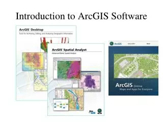
Introduction to GIS What is ArcGIS? • ArcGIS is a family of software products from GIS Industry leader
Introduction to GIS What is ArcGIS? • We will be using ArcGIS Desktop • Three licensing levels: • Basic/ArcView – basic desktop package, $ • Standard/ArcEditor – adds comprehensive editing, $$ • Advanced/ArcInfo – adds advanced spatial analysis and high-end cartography, $$$ • We are using ArcInfo
Introduction to GIS What is ArcGIS? • ArcGIS Desktop application suite: • ArcMap • ArcCatalog • ArcScene • ArcGlobe • Other components include • ArcToolbox and ModelBuilder • ArcGIS Administrator
Introduction to GIS What is ArcGIS? • How do you access these? • From the start menu • >> All Programs • >> ArcGIS
Main menu Standard Toolbar Catalog tree Introduction to GIS ArcCatalog • for organizing and managing spatial and tabular data Catalog display
Introduction to GIS ArcCatalog • This button allows you to connect to a local folder or a network place (make a folder connection) • In this course, all data and work will be stored on your Zoo account for safe-keeping, but during lab it is best to work with a copy of the data on the local drive (C:) • In lab we’ll learn to “map a network” drive to your Zoo account, so it looks no different from saving to your local machine. This will be your Z drive.
Introduction to GIS ArcCatalog • Once a network share is mapped as a drive letter, you can create a connection to it or one of its subfolders
Introduction to GIS ArcCatalog • For instance, here are the contents of the nr143 folder on my Zoo account, which I made a folder connection to:
Introduction to GIS ArcCatalog • There are five types of data shown here Geodatabase Coverage Arc Map Project file Shapefile Tabular data
Introduction to GIS Data types • Shapefile: native file format for ArcView 3.x Windows Explorer (file system) view: One spatial data layer, several files
Introduction to GIS Data types • Coverage: native file format for old ArcInfo 7.x (not a file, but a complex directory structure) Windows Explorer (file system) views: Copy/move/rename the coverage folder in Windows Explorer and you corrupt the whole workspace! (Use ArcCatalog to manage spatial data layers)
Introduction to GIS Data types • Tabular data: data table (often non-spatial) that can be used in a GIS • Spreadsheet • Dbase database file -- .dbf • Map document: a project file—it stores your map layout and preferences in ArcGIS….but not the data!
Introduction to GIS Data types • Geodatabase (GDB): This is ArcGIS’s newest data model for storing geographic information • A geodatabase can contain many layers, known as “feature classes.” Shapefiles have only one layer. • As an example, here is a geodatabase with three feature classes, as seen in Arc Catalog
Introduction to GIS Feature classes • In a geodatabase there are features classes for points, lines and areas (polygons) as well as for rasters (surfaces), annotation (labels), and dimensions Polygon, or area feature class Line, or arc feature class Annotation class: stores info about displaying labels on a map layer; important for roads and utilities
Introduction to GIS Feature dataset • Feature dataset: a thematic grouping of feature classes • Feature classes can be stand alone (do not have to be within a feature dataset) Feature datasets Feature classes
Introduction to GIS Geodatabase • Geodatabases offer numerous advantages: • Multiple spatial layers and non-spatial data sources can be stored in a single file (personal GDB) and organized thematically • Rules can be easily defined that can apply to all classes • These rules can include relationships between layers • Example: one subclass with water lines and one with water valves; you can ensure that if you move a water line, the water valve that connects that line will move as well, or it ensures that, say, if the material attribute for a water line is set to copper, the water valves that connect to it will also be copper
Introduction to GIS Geodatabase • Other advantages: • Spatial layers maintain the same measurement and geographic reference systems, because new layers added to the geodatabase can “inherit” properties of existing ones • Labeling “behavior” can be stored as an annotation feature class, making it easier to keep labels consistent • “Domains” can be established, which specify the valid ranges of values for attributes, which reduces input error.
Introduction to GIS Geodatabase • Types: Personal, File or Enterprise (multi-user) • We will use personal geodatabases. These are actually Microsoft Access files with the .MDB file extension. • We may also use the newer file geodatabases. These are a multi-file-within-folder model similar to a coverage, but easier to manage. The folder has a .GDB extension. • A multi-user (SDE) geodatabase is for organizations that wish to have many people accessing the same database. These are used with enterprise database systems, like Oracle, Informix or SQL Server
Introduction to GIS Personal Geodatabase • View of a geodatabase in MS Access, where you can edit and query attribute tables and manage relationships between feature classes…. • Can only view spatially in ArcGIS (not in Access)
Introduction to GIS ArcCatalog: Data management • Create and modify geodatabases. • You can create new feature classes, tables or relationship classes within a geodatabase
Introduction to GIS ArcCatalog: Data management You can also import existing shapefiles or coverages into a geodatabase or export a feature class to a shapefile
Introduction to GIS ArcCatalog: Data management Through right clicking, you can access the properties of a feature class and make changes … e.g., alter fields for the feature class’ attribute table
Introduction to GIS ArcCatalog: Online data • ArcCatalog also allows you to access data directly from the Internet
Introduction to GIS ArcCatalog: Online data ArcGIS Online (arcgis.com)
Introduction to GIS ArcCatalog: Functionality • ArcCatalog allows you to preview geographic data, including geodatabase feature classes Use these buttons to zoom and pan
Introduction to GIS ArcCatalog: Functionality • You can also preview online data sets
Introduction to GIS ArcCatalog: Functionality • …and you can preview and browse tabular attribute data
Introduction to GIS ArcCatalog: Functionality • Preview, create and modify the “metadata,” or data about the data ArcCatalog standardizes this information and allows you to import and export metadata between layers
Introduction to GIS ArcMap • ArcMap is where you’ll do most of your mapping and visualization of spatial data • This is the default upper tool and menu bar Change map’s display scale (zoom factor) Add new layer Zoom & pan tools Measure Find feature Zoom to full extent Select feature
Display Window TOC Introduction to GIS ArcMap: overlaying data • Using the add data button, you can overlay any number of layers for which geographic reference information exists.
ArcMap: Table of Contents • The window on the left side of ArcMap is the Table of Contents, where project data layers are listed • There are several TOC views, including display and source Draw order Selection Source All lecture materials by Austin Troy except where noted (c) 2010
Introduction to GIS ArcMap: properties • You can access many functions by right clicking on the layer in the TOC. You can access, edit and query attribute tables from a special interface
Introduction to GIS ArcMap: Layer properties • You can access layer properties by double clicking on that layer: much functionality is found there
ArcMap: Data frame • You can access properties for the whole data frame by double clicking on “Layers” at the top of the TOC or by right clicking on the data frame All lecture materials by Austin Troy except where noted (c) 2010
Introduction to GIS ArcMap: Content Pane • ArcMap can view in two modes: Layout view: for laying out data for presentation Data view: for viewing, analyzing and manipulating data
Introduction to GIS ArcMap: Layouts Maps are created in the layout view, where titles, legends, north arrows, scale bars, and other elements can be added and arranged.
ArcMap: Data frame—Units • Two of the most important properties are Map and Display units. Where the Map units are already set (because reference info exists) they will be “grayed out” but display units are still changeable. When the units are unknown to the system (reference info not embedded in the file) you’ll see: This turns into guesswork All lecture materials by Austin Troy except where noted (c) 2010
Introduction to GIS ArcMap: Units • Once you’ve set display units, future geographic measurement functions should be in those units, even if they’re different from the Map units; however, this does not apply to non-spatial attribute values • If you use the ruler tool for instance, measurements will likely be in the selected Display units at the bottom of the page unless you’ve selected different units in the ruler tool interface
Introduction to GIS ArcMap: Scale • Translation factor between one unit on the map and same unit in the real world • map units: ground units (ratio) • 1:10,000 means that 1 inch equals 10,000 inches in real world • Scale is a dimensionless number 1 foot is 1.98 million feet in real world
Introduction to GIS Large vs. Small Scale • Large scale • Lots of detail • Shows small features • Small scale • No much detail • Shows large features
Introduction to GIS Large vs. Small Scale USA Washington State 1:21,197,708 1:3,125,078 Clark County, Washington highway interchange Clark County, Washington 1:30,137 1:5,269
Introduction to GIS ArcGIS: Extensions • Specialized applications • 3D Analyst • Spatial Analyst • Geostatistical Analyst • Tracking Analyst, X Tools… • Others…
Introduction to GIS ArcGIS: Extensions • Activate by going to Customize>>extensions
ArcMap: Toolbars • When you load ArcMap it defaults to a state with a minimum of toolbars. You can add more toolbars and extensions from the Customize menu (Customize >>> Toolbars). All lecture materials by Austin Troy except where noted (c) 2010
Introduction to GIS ArcToolbox • Embedded within both ArcMap & ArcCatalog
Introduction to GIS ArcToolbox • Advanced Analyses • Extract • Overlay • Proximity • Statistics • Data Management • Conversion Tools • Etc.
Introduction to GIS ModelBuilder • An application for building models – workflows that string together sequences of tools
Introduction to GIS ArcScene Primarily for viewing 3D data