Download
1 / 10
140 likes | 447 Vues
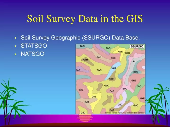
Soil Survey Data in the GIS. Soil Survey Geographic (SSURGO) Data Base. STATSGO NATSGO. SSURGO Data in the GIS. The most detailed of soil survey data. Scales range from 1:12,000 to 1:63,360. Duplicates the original paper surveys. SSURGO Data in the GIS. Digitized in vector format.

E N D
Soil Survey Data in the GIS • Soil Survey Geographic (SSURGO) Data Base. • STATSGO • NATSGO
SSURGO Data in the GIS • The most detailed of soil survey data. • Scales range from 1:12,000 to 1:63,360. • Duplicates the original paper surveys.
SSURGO Data in the GIS • Digitized in vector format. • Archived in 7.5-minute quadrangle units. • Merged to form complete coverage of survey area.
SSURGO Data in the GIS • Map extent is the survey area, e.g., Whitman Co. • SSURGO data set includes: • map data • attribute data • metadata
SSURGO Data in the GIS • SSURGO is linked to a Map Unit Interpretations Record (MUIR) attribute data base. • MUIR gives proportionate extent of component soils for each map unit. • MUIR contains over 25 physical and chemical properties.
SSURGO Data in the GIS • SSURGO data are in DLG-3 or Arc interchange (.e00) file format. • Tabular data are in ASCII or .e00 format. • Metadata are ASCII.
SSURGO Data in the GIS • Distributed in a UTM projection. • Datum is NAD83.
STATSGO Data in the GIS • Generalized from SSURGO data. • Scale is 1:250,000. • Used for broad planning (state, regional, multi-state). • Link to Soil Interpretations Record (SIR).
NATSGO Data in the GIS • NATSGO data base is used primarily for national, regional, and multi-state resource appraisal, planning, and monitoring.
NATSGO Data in the GIS • Boundaries are from the major land resource area (MLRA) and land resource regions. • The MLRA boundaries were generated from state soil maps. The NATSGO maps are digitized at a scale of 1:7,500,000.