Download
1 / 21
220 likes | 352 Vues
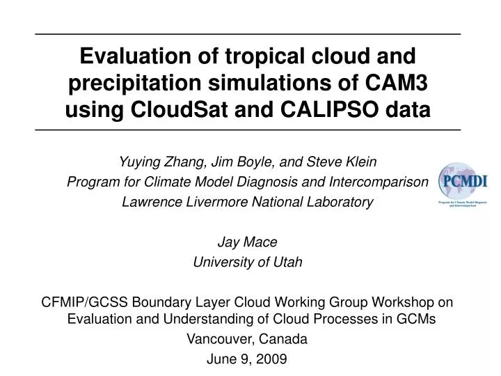
Evaluation of tropical cloud and precipitation simulations of CAM3 using CloudSat and CALIPSO data. Yuying Zhang, Jim Boyle, and Steve Klein Program for Climate Model Diagnosis and Intercomparison Lawrence Livermore National Laboratory Jay Mace University of Utah

E N D
Evaluation of tropical cloud and precipitation simulations of CAM3 using CloudSat and CALIPSO data Yuying Zhang, Jim Boyle, and Steve Klein Program for Climate Model Diagnosis and Intercomparison Lawrence Livermore National Laboratory Jay Mace University of Utah CFMIP/GCSS Boundary Layer Cloud Working Group Workshop on Evaluation and Understanding of Cloud Processes in GCMs Vancouver, Canada June 9, 2009
Outline • Introduction: What is our goal? • Tropical cloud and precipitation “regimes” observed from CloudSat and Calipso • Tropical cloud and precipitation “regimes” from Community Atmosphere Model (CAM) Version 3 • Conclusion: • What’s new here? • What’s not new here? • Ongoing and future work
Introduction: What is our goal? • A number of studies have analyzed passive instruments cloud observations (ISCCP, MODIS) to deduce “cloud regimes” in the tropics and globally (Rossow et al. 2005, Xu et al. 2005) • Cloud regimes decompose observations into a small number of characteristic “cloud types” from which one can analyze the typical cloud properties in a cloud regime as well as the statistical properties related to the occurrence of a cloud regime • These regimes can be used as a basis to assess models (Williams and Tselioudis 2007, Williams and Webb 2009)
Introduction: What is our goal? Cloud regime properties in terms of the joint histogram of highest cloud-top pressure and column cloud optical depth Geographical distribution of the frequency occurrence of each cloud regime Williams and Tselioudis (2007)
Introduction: What is our goal? • Our goal is to deduce tropical cloud regimes from the new active sensors CloudSat and Calipso and then assess CAM3 with this framework • Potential advantages of CloudSat and Calipso include that: • CloudSat and Calipso see the vertical profile of cloud and not just the highest cloud top • CloudSat sees precipitation whereas the infrared and visible passive sensors do not • Calipso sees the very thin clouds which the infrared and visible passive sensors miss
Observed tropical cloud regimes • Cloud & precipitation properties are depicted with the use of the joint histogram of atmospheric pressure and signal strength (dBz for radar + clouds detected by Calipso) • This is like an extended Contoured Frequency by Altitude Diagram (CFAD) CloudSat + Calipso
Observed tropical cloud regimes • Histogram is computed from about 200 1-2 km profiles under the satellite flight track – thus it illustrates the patterns of cloud and precipitation properties at scales less than 200 km • Uses Mace et al. (2009) Vertical Feature Mask that combines CloudSat and Calipso data CloudSat + Calipso
Observed tropical cloud regimes Cloud regime properties Cloud regime frequency of occurrence Low clouds with less precip Low clouds w/ precip Thin cirrus Congestus Anvil clouds Deep conv & heavy precip Cloud regimes from CloudSat/Calipso observations for June – September 2006
Observed tropical cloud regimes Congestus sample • We truly have congestus clouds, note this removes an amibiguity that existed with congestus detection using passive infrared and visible radiances
Model tropical cloud regimes • Model: Community Atmosphere Model Version 3 • We apply the CFMIP Observation Simulator Package (COSP) to model simulations • Model simulations are from day 2 of “weather forecasts” initialized every day in the period June – September 2006 with NCEP analysis data • Model data is extracted only at 1pm & 1am local time • Each model grid-box at each time is assigned to observed cloud regimes based upon the similarity of joint histogram of pressure and signal strength with those observed
Model tropical cloud regimes CloudSat+CALIPSO CAM3.1 The model lacks low and middle level clouds with low dBZ clouds including those that can only be seen by the lidar
Model tropical cloud regimes CloudSat+CALIPSO CAM3.1 Low clouds with less precip Low clouds w/ precip Thin cirrus Congestus Anvil clouds Deep conv & heavy precip Underestimate low-clouds with precipitation and congestus Overestimates cirrus and deep convection with heavy precipitation
Model tropical cloud regimes Deep Convection Sample CAM3.5 CloudSat + Calipso Tropical deep convection often occurs over wide areas whereas the climate model makes heavy precipitation through a convection parameterization that covers a small fraction of the grid box Zhang et al. (2009)
Model tropical cloud regimes • One can stratify the frequency of occurrence of a cloud regime by the monthly mean 500 hPa vertical velocity following Bony et al. (2004) OBS
Model tropical cloud regimes • This approach can be used to examine model changes such as between CAM3.1 and CAM3.5 • The most important difference between these versions is that an entraining plume is used in the deep convection parameterization • This results in more congestus and low-level clouds with precipitation and less deep convection and thin cirrus
Conclusion: What’s new here? • Previous ISCCP cloud-regime analysis has suggested that models systematically underestimate tropical trade-cumulus and congestus. At least for CAM3.5 weather forecasts, we do not find this is case. Furthermore, for climate integrations of CAM3.5, the incidence of congestus is greater than observed. How do we reconcile these results? • These results may be reconciled by recognizing that the identification of congestus in this study is through the precipitation field (dBZ) as opposed to the cloud field (visible and infrared radiances)
Conclusion: What’s new here? • If CAM results are typical, this suggests that if that climate models can produce congestus (and low-clouds with precipitation) with frequencies comparable to observed but that the visible and infrared cloud radiative properties of these regimes are in error. • Also the identification of congestus through CloudSat should be more reliable than the identification through passive satellite data
Conclusion: What’s not new here? • The model underestimate of low- and middle-level clouds with dBZ < -20 is consistent with the result found from ISCCP that models underestimate the amount of low-optical depth clouds (Zhang et al. 2005). This is important because other analyses have suggested that ISCCP underestimates cloud optical depth (see my afternoon talk).
Conclusion: What’s not new here? • The difference in cloud and precipitation properties for the deep convection with heavy precipitation regime between CAM and the observations is consistent with the problem identified from TRMM that climate models strongly underestimate the fraction of tropical precipitation that is stratiform (Dai 2006).
Conclusion: Ongoing & future work • More observations are being composited including: • CERES radiative flux data • MODIS cloud-top pressure and optical thickness • ECMWF thermodynamic profiles • Cloud Regimes in middle-latitudes and polar regimes are being examined • Applying analysis to developmental versions of CAM4