Download

1 / 34
340 likes | 350 Vues
JCOMMOPS is a vital support center that coordinates and monitors the global ocean in-situ observing systems. It collaborates with various implementation bodies to expand and enhance the integration of satellite and in-situ observations. The center is involved with data buoy cooperation panels, ship observations teams, Argo profiling floats, and OceanSITES reference stations. JCOMMOPS offers various services including sponsoring and crowd sourcing, and is continuously developing new operational services.

E N D
JCOMMin-situ Observations ProgrammesSupport Centresupport@jcommops.org Toulouse, Sept. 2012
The JCOMM Observations Programmes Support Centre, JCOMMOPS, is hosted by France (with CLS/CNES and Ifremer support) and monitor on a day to day basis the status of the main elements of the global ocean in-situ observing systems (since 2001). • 4-person operation centre based in Toulouse (sat. link) and funded entirely through extra-budgetary sources, is now an indispensable and highly regarded component of the observing system coordination process, providing a range of metadata, logistics and technical support for the panels as well as for some external bodies. • Efforts are now underway to partner with new implementation bodies (including space agencies) and attract additional funding to allow expansion of the JCOMMOPS functions to cover further components of the in situ observing system, and also enhance integration of satellite and in situ observations. • Synergies and new operational services to be developed with Brest (in-situ link), concentrating many professionals of the ocean JCOMMOPS overall yearly budget: 600k$ Provided by Member States via IOC & WMO and host country (in-kind)JCOMMOPS Services being developed (incomes) Sponsoring, crowd sourcing to be developed
JCOMM Observing Program Support Centre • JCOMMOPS is involved with the implementation of the main global in-situ observing systems, including: • DBCP (data buoy cooperation panel): Drifting and moored buoys in the high seas and tropical moorings, tsunameters and misc. fixed platforms. • SOT (ship observations team) : SOOP (XBTs, TSGs), ASAP atmospheric soundings, VOS meteorological observations (GO-SHIP ?) • Argo: Profiling floats • OceanSITES: Deep ocean time-series reference stations • Next: costal/regional systems (gliders, polar, coastal floats, marine mammals, etc)
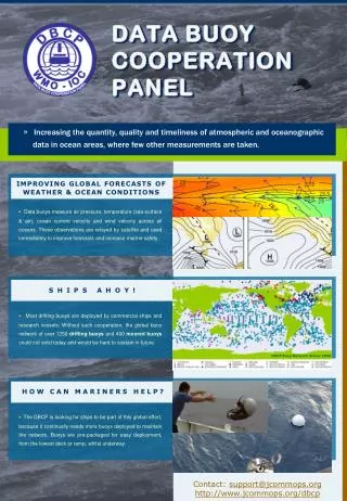
Data Buoy Cooperation Panels: ~1250 surface drifters & ~400 moorings http://dbcp.jcommops.org Surface drifters, tropical/coastal moorings, ice buoys, ...
Data Buoy Cooperation Panels: ~1250 surface drifters & ~400 moorings http://dbcp.jcommops.org
Ship Observation Team (~2000 ships)The work of the SOT consists of several very successful and enduring data collection programmes (over 100 years), involving voluntary observing ships and ships of opportunity operated through the VOS and SOOPIP. A long tradition of voluntary ocean data collection by the world’s seamen gathering essential variables used for research, climate forecasting, numerical weather prediction and maritime safety . Coverage declining (difficulty to recruit new ships in some areas)
SOOP XBT network Needs: •Research-quality deep (2000 m) XBT, •Next generation automatic XBT launcher, •Modernization/standardization of data management system.
~3500 Profiling floats: Argo Programme A revolutionary achievement for subsurface observations An unprecedented cooperative effort in the history of oceanography A crucial mechanism to better understand the warming of the upper ocean Innovative data system
OceanSITES www.oceansites.org A worldwide system of long-term, deepwater reference stations measuring dozens of variables and monitoring the full depth of the ocean from air-sea interactions down to 5,000 meters. Needs: data distribution, standards/QC for bio-geochemical variables.
Many other observing systems are emerging and will complete the GOOS: • Polar systems (Met. / Oceano) • Coastal floats • Marine mammals equipped with sensors • Find holes in ice-covered regions • Multidisciplinary approach • Gliders (regional) • Guided • Multi sensors • expensive Needs: (international) Scientific Steering Team and Data Management Team participating to the international coordination infrastructure And technical coordination within JCOMMOPS
JCOMMOPS comprises Technical Coordinators : • Mathieu BelbeochJCOMMOPS LeadThe Argo Profiling Float programme • Kelly StrokerThe Data Buoy Cooperation PanelThe OceanSITES Program • Recruiting a ShipLogisticsCoordinator(applications closingAug. 31st)SOT program coordinationShips/Cruises metadata championOperations (charters, partnerships, ship time service)Coordination for GO-SHIP (CTDs) TBC • I.T. experts: 1 EFT. to be expanded to 1.5 EFT in 2013 • Students on short/long work experience • Secretarial support by IOC and WMO • Host (CLS/CNES, Ifremer) specific support and facilities (including meetings organizations). • International professional connections and synergies
JCOMMOPS Services = Focal Point + Information System • Manage and control all information except physical (and BGC) data • 50000 platforms, 15000 ships, millions of observations, locations, 2000 contacts points, 400 programs, 50 countries, etc • 4 Servers: DB (Oracle 11x), GIS (ESRI 10.x), Java Web Application • Real-time synchronization with GTS, GDACs, NODCs, Operational centres, … • Websites, Web services • Routine and ad hoc products for the community • Real-time intergovernmental warning system • Products to promote the observing systems to large public (e.g. G-Earth displays) • JCOMMOPS is not a data distribution centre but rather a metadata centre “quality controlling” metadata essential to global programmes coordination
JCOMM Observing Program Support Centre The JCOMMObservations Programme Support Centre, on behalf of GOOS and JCOMM, aims to: • monitorand evaluate the performance of the networks • assist in the planning, implementation and operations of the observing systems • act as a clearing house and focal point on all programme aspects • assist in data distribution on the Internet and GTS • encourage cooperation between communities and member states • relay user feedback on data quality to platform operators • provide technical assistance and user supportworldwide • develop synergies between observing systems (GOOS)
Products & Services: Examples Real-time ...Very early on, JCOMMOPS provided online, interactive GIS–based, real-time tracking tools for ocean platforms and is now working on a partnership with Google to include JCOMM/GOOS observing system status and products within Google OceanInteroperability targeted: Web Map Services, XML metadata exports, etc. Monthly ... JCOMMOPS Status maps are widely recognized as authoritative and giving an up-to-date, verified status of the arrays, encouraging community to share the data and showing how the programmes assess and meet their requirements
Products & Services: Examples (Argo) Planning management...Centralized Planning 6-12 months in advance Official registration/notification Synchronization with all national programmes Crucial for a global array maintenance Plans rated to guide implementation
Float reliability has finally reached manufacturers spec. for most of float models: 150 cycles (almost to 2000m)
G-Earth: Community monitoring toolOutreach http://argo.jcommops.org/argo.kml
Retrieval procedure of beached instruments • Guidance for retrieval, safety information • Regional cooperations developed • Registration/Certification of platforms • Impartial tracking at air-time provider level • Free data access guaranteed • Full transparency on programme implementation
Information on international rules provided to implementers • Notification procedure for Argo: implementation of Res XX-6, Res XLI-4 • RT warning system and reporting to Member States • Reports provided on demand to coastal states • Cooperation encouraged (Donor programmes)
JCOMMOPS Ship Time Service • Recurrent global and regional gaps in the arrays • Global economical context under pressure (ship time decreasing) • Resources available for planning operations under pressure • JCOMMOPS can now provide assistance for deployments, servicing, at a marginal cost • e.g. Lady Amber story, supported by JCOMM, IOC/UNESCO (and IOC Perth) , WMO • Partnerships Sailing community, industry, individuals, explorers, NGOs are being developed After a decade of implementation using mainly research vessels and merchants ships, the global programmes are now investigating green, flexible, free or non-profit based, and dedicated deployment platforms, combining operational efficiency and promotional/educational opportunities
Lady Amber story ~60 floats deployed for CSIRO South African crew.Green, flexible, dedicated, trained crew 30 keuros/month (via CLS/JCOMMOPS) Autonomy: 2 monthsIridium com./email,Argos/GPS tracking Storage capacity (50 units) 100 soon. Crane/CTD to be installed 2011-2012: Indian Ocean 2013: Atlantic ocean Very good communication operation (TV, radios, newspapers websites, …)
Voiles sans Frontières: NGO« Sail without borders … » Unique french NGO recruiting 20 ships every year Development project, solidarity, etc in Senegal 10 floats to be deployed (departure/storage Lorient and Sètes) Flexibility (deploy, load, retrieve, etc) Large spatial coverage !!!! Huge communication potential !!!!
Partnership UNESCO/ MultiOneAttitude “Race for Water” 2 floats deployed between Brest and New York. Presence at the Brest 2012 ship Festival: outreach Huge communication means. Possibility to deploy floats/drifters during sailing races under evaluation
JCOMMOPS: modest but essential oil in the systems of systems • It has proven its efficiency, and inventiveness • assisting as appropriate the varied OOS community • providing an identity to obs. programmes through rigorous monitoring tools • ensuring the transparency of their implementation • Optimizing their efficiency • encouraging international cooperation proactively • developing light operational support means • It needs further means to serve properly each component of the GOOS. • It needs to improve it legal standing with host country, IOC and WMO • Renew MoU with France • Establish a “IOC Programme Office” • Support from host country (France) is critical to its success
JCOMMOPS isrounding a new cape by strengthening its support to the pillars of the GOOS • integrating its core deliverables and services, • developing light operational capacities , and • working with France and Member States , and ocean community (including industry) to increase financial means.
Products and deliverables • DB • (Meta)data downloaders, loaders, checkers • Web based toolbox (e.g. G-Analytics dashboard and tools) • Starting point: • search engine on platforms, observations, ship lines • List entities: edit/inspect, statistics, observations, map • Store query, Comparison with two samples • Mapping module: • Viewer, static maps export, density calculation, 2D (webGIS)/3D (G-earth) • Reporting (pdf export, etc) • Data flow monitoring (observations status) • Monitoring panel • Deployment planning, registration (loader) (write) • Scoring system (GIS?)
Products and deliverables • Instrumentation • Reliability statistics • Management (read/write) of ship, cruises • Maritime Zones monitoring (points vs polygons) • QC feedback relay • Retrieval procedure tracking
Questions • Oracle DB / SDE • Platforms (and metadata) => dedicated flat table (trigger) => SDE layers (launch location, trajectory, latest location) • Impossible to use views ?? Need to reinvent the concept ? • 1 generic layer for N layers (filters on “active”, platform type or any other metadata) or N layers predefined • Trajectory management ? Time management ? • Export (daily) layers for history tracking • Raster/netCDF management (T/S overlays) • Dimensioning (50000 platforms, 15000 ships, millions of observations, locations, 2000 contacts points, 400 programs, 50 countries, etc)
Questions • GIS Processing at DB level • Every location (ptf, obs, ship line) linked to (N-N) polygones • Maritime Zones, Sea Areas • Trigger ?? Script using GIS libs. (Python/Java)? • Processing at application • Density maps on the fly (points / grid) (Python/Java)? • Spatial analyst ??? • Static maps • Java for editing legends, customizing exports (ArcObjects) • On line in Web app ? • ISO/INSPIRE compliant
Questions • Web application development • Java Libraries fro Enterprise Object management To be connected to • GIS libraries • Within same eclipse project • Requirements • Constraints (Ajax libs, dojo, extJS) • => How do we integrate Javascript based (Template ???) viewer with rest of web application. • => How do we integrate analyze tools, scripts with websote
Misc needs and questions: • Set of predefined layers • Dynamic layers according to queries • re-project on demand (choose coord. Sys) • Make analyzes (density maps) • Register deployment plans (pick locations) • Register depl. opportunities (line & polygons) • Recalculate scores/density etc, on the fly • Export maps choosing format/resolution • Use different symbologies (pre defined) • Migration to 10.1
Conclusion • JCOMMOPS & ArxIT partnership follow up ? • Audit deliverable • Hybrid development mode (internal/external) • Prototype development • Widgets • Etc ???