Download
1 / 35
530 likes | 950 Vues
Earthquakes Plate Tectonics. Contents. Earthquake basics Limiting the damage Comparing earthquake impact A case study: The Indian Ocean earthquake Summary activities. The key concepts covered are: Place , Space and Physical and human processes. Earthquake basics. Earthquake basics.

E N D
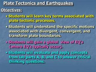
Contents • Earthquake basics • Limiting the damage • Comparing earthquake impact • A case study: The Indian Ocean earthquake • Summary activities The key concepts covered are: Place, Space and Physical and human processes.
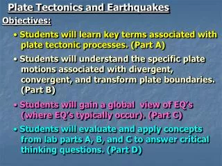
Earthquake basics Earthquake basics By the end of this section, you will: • Be able to describe where earthquakes occur. • Understand the terms focus and epicentre. • Be able to suggest ways to measure earthquakes.
Where do earthquakes occur? Earthquakes are vibrations of the earth’s crust caused by movement at plate boundaries and major fault lines. The red areas on the map are where earthquakes are most common. Eurasian Plate North American Plate Pacific Plate African Plate South American Plate Indo-Australian Plate Nazca Plate Do the location of earthquakes form a pattern?
What are earthquakes? Earthquakes can occur at all four major plate boundaries but the most severe earthquakes usually occur at conservativeand destructiveplateboundaries. Conservative boundary Destructive boundary
How are earthquakes measured? The Richter scale can be used to measure the magnitude (power) of a tremor using an instrument called aseismograph. It is a logarithmic scale which means that a size ‘6’ earthquake on the Richter scale is 10 times larger than a size ‘5’ and 100 times larger than a size ‘4’.
The Mercalli Scale The Mercalli scale rates an earthquake's magnitude based on observations of the damage it causes on a scale of 1 to 12. Items shake from shelves: scale 5 Buildings collapse: scale 10
Limiting the damage Limiting the damage By the end of this section, you will: • Be able to identify the long and short term impacts of earthquakes. • Be able to suggest ways that the impacts of earthquakes can be reduced by humans.
How can we limit earthquake damage? • Plan • emergency services can practise for disaster • stock-pile medicine, food, blankets etc • educate the population in what to do during and after. • Protect • construct buildings and roads that withstand shaking. Predict Predicting earthquakes accurately enough to evacuate people is nearly impossible but: • water levels can change in wells and lakes • foreshocks can be detected by a seismometer and a tilt meter can detect movement within rock • animals can act strangely before an earthquake.
Buildings in earthquake zones What makes a building strong? strong lintels overlapping bricks deep foundations Which shape of building would be most ‘earthquake proof’?
Building in earthquake zones This is San Francisco in the USA. San Francisco is near the San Andreas Fault and therefore the city experiences earthquakes. This skyscraper has been designed and constructed to be ‘earthquake-proof’. Its wide base lowers the structure’s centre of gravity and makes it more stable.
Comparing and contrasting earthquakes Comparing and contrasting earthquakes By the end of this section, you will: • Have compared the impacts of earthquakes on a MEDC and a LEDC. • Have considered development as a key issue in earthquake response.
What factors affect earthquake damage? Different factors affect the damage an earthquake causes: • magnitude of the earthquake • physical landscape • time of day • building design and construction • emergency service response • GDP • education. Which factors do you think are the most important? Which factors are related to the wealth of the country? How can education limit earthquake damage?
What the papers say How different were the immediate effects of these earthquakes? Why might more people have died in Pakistan than in LA?
What’s moving in Pakistan? Pakistan lies on a collision boundary between the Indian plate and the Eurasian plate. The Indian plate is moving into the Eurasian plate at a rate of 67 mm per year. The motion causes the Himalayas to rise, as well as producing earthquakes. Epicentre of the 2005 Pakistan earthquake.
What’s moving in California? The San Andreas fault is a conservative fault that runs along the West of California. Los Angeles lies very close to it. All land west of the fault on the Pacific Plate is moving to the North-west. All land east of the fault on the North American plate is moving to the South-west. The epicentre of the 1994 LA earthquake The rate of slippage across California is 33-37 mm per year.
Devastation and recovery in Pakistan Using these photos as a guide, can you tell a story of the effects the earthquake had and how people responded to it?
Case study: the Indian Ocean earthquake A case study: The Indian Ocean earthquake By the end of this section, you will: • Understand what a tsunami is. • Understand how an earthquake in the Indian Ocean caused a tsunami and be able to state some of its impacts.
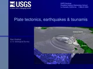
The Indian Ocean tsunami Tsunamis are tidal waves caused by underwater earthquakes. A tsunami travels at speeds between 400 and 600 mph. The tsunami in the Indian Ocean occurred on 26th December 2004. The earthquake measured 9.0 on the Richter Scale and occurred off the northern tip of Sumatra. Over 226,000 people are presumed to have died in the disaster. Earthquake epicentre The tsunami spread across the Indian Ocean affecting coastal areas of 14 countries including Indonesia,Sri Lanka, India, Bangladesh, Myanmar, The Maldives and Malaysia.
Washed away What do you think these satellite images show? Before the tsunami. After the tsunami. 10th January 2003 29th December 2004
Disaster, recovery and aid The tsunami brought devastation to the Indonesian province of Banda Aceh but with aid and community action, people are rebuilding their lives.
Summary activities Summary activities By the end of this section, you will: • Be confident in your knowledge of earthquakes. • Know how to use and spell important terminology relating to earthquakes.