Download
1 / 20
200 likes | 305 Vues
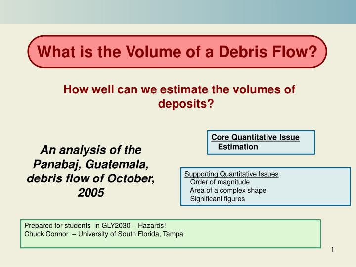
What is the Volume of a Debris Flow?. How well can we estimate the volumes of deposits?. Core Quantitative Issue Estimation. An analysis of the Panabaj, Guatemala, debris flow of October, 2005. Supporting Quantitative Issues Order of magnitude Area of a complex shape

E N D
What is the Volume of a Debris Flow? How well can we estimate the volumes of deposits? Core Quantitative Issue Estimation An analysis of the Panabaj, Guatemala, debris flow of October, 2005 Supporting Quantitative Issues Order of magnitude Area of a complex shape Significant figures Prepared for students in GLY2030 – Hazards! Chuck Connor – University of South Florida, Tampa
Preview This module presents a calculation of the volume of a debris flow that occurred in Panabaj, Guatemala, in October 2005 Slides 3-7 give some background on debris flows and the Panabaj disaster Slide 8 states the problem. What is the volume of the debris flow, given information about the deposit? Slides 9 and 13 analyze the problem and prompt you to design a plan to solve it. The problem breaks down into several parts: estimating the area of the debris flow deposit from a map, estimating the thickness of the deposit, calculating the volume, accounting for the difference in deposit volume and flow volume, and estimating uncertainty in the volume calculation. Slide 14 creates a excel spreadsheet that calculates an answer. Slide 15 discusses the point of the module and provides a broader volcanological context Slide 16 consists of some questions that constitute your homework assignment. Slides 18-20 are endnotes for elaboration and reference.
Background What is a debris flow? debris flow - A mixture of rock debris and water moving rapidly down-slope due to gravity and often with sufficient energy to sweep away buildings and trees, and to erode the channel along the flow-path. On volcanoes, they can form because of mobilization of volcanic material during eruption, mainly due to heavy rainfall during ash-dominated eruptions, or due to the contact of lava with snow, ice or flowing water. They can occur also by mobilization of fragmental material by heavy rain, melting of ice, or seismic activity long after an eruption. This debris flow on Casitas Volcano, Nicaragua, was triggered by heavy rains during hurricane Mitch in 1998. Casitas is a Holocene volcano with no historic eruptions. This volcano does have an active hydrothermal system, that altered lavas, changing permeability and increasing the likelihood of slope failure. For more about debris flows in general: http://volcanoes.usgs.gov/Hazards/What/Lahars/lahars.html
Background How “big” are debris flows? Like many volcanic phenomena, the magnitude of debris flows is most often characterized in terms of volume. Worldwide, the volumes of debris flows vary by many orders of magnitude. Relatively small debris flows are the most frequent to occur, and have volumes of order 103 -105 m3. The largest debris flows are rare, and have volumes exceeding 108 m3. Photo by C. Connor The November, 1985, debris flow at Nevado del Ruiz, Colombia, had a volume of about 4 x 10⁷ m3 in this river valley (the Rio Azufrado). This debris flow killed more than 23,000 people in the city of Armero.
Background Why estimate debris flow volume? In addition to being a simple measure of the magnitude of past debris flows, debris flow volume is useful for bounding future volcanic hazards. Not surprisingly, the volume of debris flows is directly proportional to the planimetric areainundated by debris flows. That is, the volume of debris that flows off a volcano will be an excellent indicator of the area around the base of the volcano that will be covered by debris flow deposits. From a hazard perspective, it is important to estimate the potential volumes of future debris flows, to estimate the areas that might be inundated by these flows. The graph plots data from: Iverson et al., 1998, Objective delineation of lahar-inundation hazards zones, Geological Society of America Bulletin, v. 110, p. 972-984.
Background The Panabaj Debris Flow In October, 2005, tropical storm Stan caused extremely heavy precipitation throughout much of Guatemala. In mountainous terrains, especially on volcanoes in the region, this precipitation resulted in landslides and debris flows. In the community of Panabaj, Santiago Atitlán, a debris flow of pyroclastic material originating high on the slopes of Tolimán volcano buried much of the community, leaving approximately 400 people dead. Photo by C. Connor This photo shows San Pedro volcano on Lago deAtitlán near Panabaj. Lago de Atitlán is a Holocene caldera rimmed by young composite volcanoes. Learn more about the community of Panabaj
Background The Panabaj Debris Flow During tropical storm Stan, mass movement on Tolimán volcano resulted in the generation of a moderate size debris flow that descended the volcano rapidly, bifurcated into two stream valleys high on the flanks of the volcano, and continued to descend both channels until these flows reached the alluvial fan near the shores of Lago de Atitlán. Once reaching the alluvial fan, the flows spread over the relatively flat surface very rapidly, and devastated much of the community of Panabaj. Photos by L. Connor
Problem What is the volume of the western flow? Because the debris flow bifurcated into two different river valleys high on the flanks of the volcano, two separate flows actually inundated Panabaj. These are termed the Western and Eastern debris flows, because of their relative positions where these flows crossed the paved road that runs through the community. Given the map and flow thicknesses measured at several locations, what is the volume of the Western debris flow? Learn more about how this map was made
Designing a Plan, Part 1 Given a map and flow thickness estimates, what is the volume of the western flow? Give answer in cubic meters. Note: The volume of the flow is not the same as the volume of the deposit. This is because a large fraction of the debris flow is water. As the flow comes to rest, the water and fine-grained sediments segregate, forming a hyperconcentrated flow that can continue for great distances. As a result, the debris flow deposit has less volume than the debris flow that inundated the area. So we need additional information to estimate the original flow volume. • You will need to estimate: • the area of the flow • the average flow thickness • The flow volume, based on your estimate of the volume of the deposit
Channel Deposit Deposition starts here Designing a Plan, Part 2 See a larger version of this map You will need to think of ways to: (1) estimate the area of the flow deposit, (2) its thickness, and the (3) volume of the original flow, then (4) estimate the uncertainty. Make your estimate of the area of the western flow. Divide and conquer! Subdivide the map into equal area cells using a grid, estimate the proportion of each cell that is covered by the deposit, and sum. The formula is: Where A is the area of the flow, N is the total number of cells, ac is the area of each cell, and fi is the fraction of cell i covered by the debris flow. The summation sign simply means “add up the areas”. What is the area of each grid cell? The map coordinates are expressed in meters Learn about other ways to estimate area
Designing a Plan, Part 2 (cont.) When you estimate the area, A, of the deposit, it is important to also estimate the uncertainty in this number. Consider two cells, 1 and 2, from the map. The faction of cell 1 covered by debris flow deposit is 1 (the cell is completely filled) and there is no uncertainty in this (assuming that the map is perfectly correct!). The fraction of cell 2 covered by debris flow deposit is estimated to be 0.8. That is, 80 percent of the cell is covered by flow. Cell 1 Cell 2 As the area of an entire cell, ac, is 10,000 m2, the area of the two cells covered by debris flow is: A=ac(f1+f2)=10,000(1 + 0.8) m2 f1= 1 f2= 0.8
Designing a Plan, Part 3 Make your estimate of the thickness of the western flow. The map shows measurements of flow thickness in centimeters. Using these data, estimate an average thickness of the flow Note that the flow thickness varies rapidly and there is not enough information to contour variations in thickness. So, assume a uniform thickness for the deposit. Although this is clearly not completely correct, take your best shot! Note that some measurements are outside of the flow outline. What is going on? These measurements show the thickness of sediments deposited from the hyperconcentrated flow
Designing a Plan, Part 4 Photo by C. Connor How can you estimate the debris flow volume from the deposit volume? The problem is that the flow deposit is “dewatered”! “high-water” line 1.67 m top of deposit In mapping the deposit, volcanologists determined that at most locations the thickness of the high-water mark adds about 40% to the total deposit thickness 1 m So the volume becomes: V = A (1.67Tm) where V is the volume of the debris flow, A is the area of the debris flow deposit, and Tm is the average measured thickness of the deposit. 0m bottom of deposit
Cell with a number in it. Change one of these numbers and other numbers will change. Cell with equation in it. It’s up to you to determine the equation that produces the number that appears in the cell. Carrying Out the Plan, 1: Spreadsheet to Calculate the Volume Recreate this spreadsheet in excel to calculate the volume of the debris flow. Note that you will need more than 9 cell numbers. You will need your spreadsheet to do some of the End of Module Assignments. Note that the final answer has one significant figure! Learn more about significant figures: http://en.wikipedia.org/wiki/Significant_figures
What you have done You have calculated the volume of a deposit and estimated the volume of the debris flow that produced this deposit. Volume estimation is a big part of understanding natural hazards. Volume is one way to understand and categorize the magnitude of many types of natural hazards. As you can see from this module, it is not always an easy task to estimate the volume of hazards like debris flows. Good estimates require good maps, careful interpretations of these maps, and careful calculations, as well as a good understanding of the process itself. In this case, for example, it was important to know that some volume of the deposit (the water) was lost after the flow came to rest. When you make volume estimates, it is essential to understand how well you know the volume, given the compromises in methodology that are always required. When you read a volume estimate, be sure to understand the sources of uncertainty. Not all volume estimates give the correct number of significant figures!
End of Module Assignments • Make sure you turn in a spreadsheet showing your estimate the area and volume of the western flow deposit, and the volume of the western debris flow. Be sure to include your uncertainty estimate! • Describe the major sources of uncertainty in your estimate of the volume of the debris flow deposit. Comment on how you would revise the field investigations to improve your estimate to two significant figures. • Plot the volume and area of the debris flow on the graph (slide #5). Is the area and volume of the Panabaj flow consistent with the other debris flows plotted? Is the Panabaj debris flow relatively large or small in volume compared to these other debris flows shown on the graph (slide #5)? • Describe what steps you might take to work with the community of Panabaj to reduce hazards associated with debris flows. Be sure to consult the web-based material referred to in this module before answering the question.
More about Panabaj and its People The people of Panabaj speak Tzutujil, one of several dialects of the ancient Mayan language. Women of the community are expert weavers: https://mayaworks.org/artisans02.php In Tzutujil, the word Panabaj means “mud and stone”, in reference to the debris flows that have occurred in the area throughout history. Traditionally, no one lived in area affected by the 2005 debris flow. People only recently moved on to this marginal land due to extreme economic and political pressures, particularly during the Guatemalan Civil War. General information about the Lago de Atitlan region in available at: http://en.wikipedia.org/wiki/Lake_Atitlan Return to Slide 6 Photos by L. Connor
How was the Map Made? The deposit was mapped in May, 2006 using a differential global positioning system (GPS). This technique uses GPS satellites to determine geographic position of the surveyor as she walks the perimeter of the debris flow continuously collecting data with a GPS receiver. Simultaneously, a base station GPS, fixed in one location, collects information on its position. The base station position varies with time due to error, which is used to correct geographic locations collected by the roaming surveyor. The map also might have been made using aerial photos or more traditional surveying techniques. Following collection, data are downloaded to a computer and the map prepared using the Generic Mapping Tools (GMT) software. Photo by L. Connor For more about GPS, see: http://www.gpsy.com/gpsinfo/ For more about GMT see: http://gmt.soest.hawaii.edu/ Return to Slide 8
(x1, y1) (x6, y6) (x2, y2) (x5, y5) (x3, y3) (x4, y4) Another Way to Find the Area The GPS points that make the outline of the debris flow deposit are the vertices of a polygon. If these points are sorted in clockwise order, then the area can be calculated using a formula: where N is the number of vertices and the polygon closes (i.e., the first point is also the last point). Of course there are thousands of points, so this requires a computer code. See: http://local.wasp.uwa.edu.au/~pbourke/geometry/polyarea/ Using this approach, the planimetric area inundated by the Western flow is approximately 180,000 m2 and the area inundated by the Eastern debris flow is 77,000 m2. Return to Slide 10
Channel Deposit Deposition starts here Return to Slide 10