Download
1 / 58
610 likes | 729 Vues
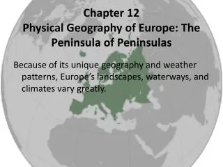
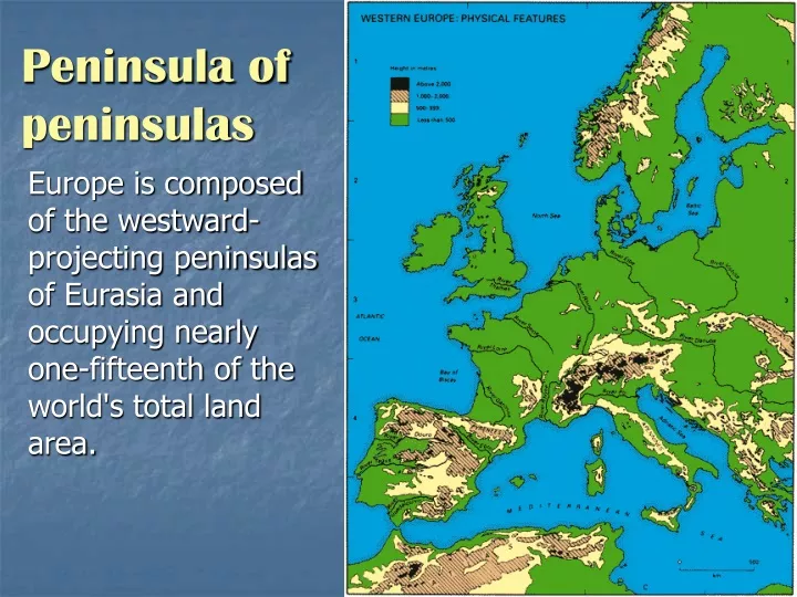
Peninsula of peninsulas. Europe is composed of the westward-projecting peninsulas of Eurasia and occupying nearly one-fifteenth of the world's total land area. European Geography. Geography : the science that deals with the description,

E N D
Peninsula of peninsulas Europe is composed of the westward-projecting peninsulas of Eurasia and occupying nearly one-fifteenth of the world's total land area.
European Geography Geography : the science that deals with the description, distribution, and interaction of the diverse physical, biological, and cultural features of the earth's surface.
Europe is bordered on the north by the Arctic Ocean, on the west by the Atlantic Ocean, and on the south by the Mediterranean Sea, the Black Sea, the Caucasus Mountains, and the Caspian Sea; the eastern boundary runs along the Ural Mts.
Europe is a well-watered continent with many rivers. Most of the continent's drainage finds its way to the Atlantic Ocean via a number of master river systems, whose watersheds interlock in a most complex manner. Europe’s rivers
European Peninsulas Scandinavian Jutland Balkan Italian Iberian
Scandanavian Peninsula In the 17th Century, the Swedish empire consisted of most of Scandanavia. The Swedish Empire in 1658(orange)overlaid by present day Sweden(dark orange).
Fjord -A long, narrow arm of the sea, usually formed by entrance of the sea into a deep glacial trough.
The Ural Mountains The mountain range that runs roughly north and south through western Russia marks the northern part of the (arbitrary) border between the continents of Europe and Asia.
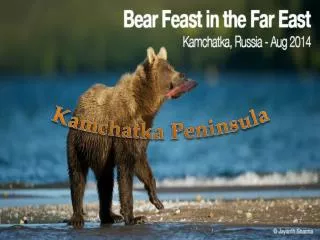
The Balkan Peninsula The Balkans is the historic and geographic name used to describe southeastern Europe.
CarpathianMountains Located in six countries of East and Central Europe: Czech Republic, Hungary, Poland, Romania, Slovak Republic and Ukraine. The Fagaras Massif in central Romania's Transylvanian Alps forms the most spectacular range of the Carpathian Mountains
Carpathians The geologic structure of the inner part of the Western Carpathians is marked by a break running from the east and the south along a line of dislocation in the Earth's crust. (left) Apuseni Mountains in Romania’s part of the Carpathians
Balkan Mts. This is an extension of the Carpathian mountain range, separated from it by the Danube River.
Straits The Bosphorus and the Dardanelles are the straits between the European and Southwest Asian sections of Turkey.
Alps The Alps is the collective name for one of the great mountain range systems of Europe, stretching from Austria in the east, Slovenia, Italy, Switzerland, Liechtenstein and Germany, through to France in the west. The word Alps means mountains.
Italian Boot The Italian peninsula or the Apennine peninsula is one of the greatest peninsulas of Europe, spanning 1000 km from the Alps in the north, to the central Mediterranean Sea in the south.
Romegrew along the banks of the Tiber River into a major city under the rule of the Etruscans in the centuries before Christ.
Vatican City The Vatican City, officially the State of the Vatican City is a landlocked enclave surrounded by the city of Rome in Italy, and the smallest independent state in the world. .
A combination of man’s activities and natural changes threaten the very existence of this historical Italian city. Sinking Venice Raised walkways have been installed in places where the flooding is worst. These people are queueing to enter the Basilica di San Marco
Venice flooding High water regularly floods St. Mark's Square and other parts of Venice, forcing people to tread on raised walkways. The city itself is sinking, the level of the Adriatic is rising and high tides are becoming more frequent.
Venice Lagoon The Venice Lagoon has a surface area of 55,000 sq, meters has and was formed nearly 6,000 years ago. In order to preserve the lagoon and adapt it to existing needs - port, fish farms, land reclamation, transport and industry – for the past 5 centuries man has undertaken increasingly consistent works to achieve hydraulic regulation, mainly by diverting the principal rivers from the Lagoon into the Adriatic Sea, and building numerous reclamation systems on the lower lands to use them for agricultural purposes; in the last 50 years the wetlands have been significantly reduced and the pollution load discharged into the lagoon has been increased. Industrial pollution in the Venice lagoon, 1998
After more than a decade of scrutiny, the colossal $2.6 billion Moses project, a flexible seawall with a series of flap gates that would stretch along the lagoon and block tides from flooding the city, is ready Moses Project
The Strait of Messinais between the island of Sicily and the Italian peninsula . Sicily Italy Strait of Messina Mediterranean Sea
Mt. Etnaon the island of Sicily is one of the world’s most active volcanoes.
Caucasus Mountains The Caucasus Mountains form part of the Euro-Asian border between Russia, Georgia, and Azerbaijan.
Karst Landscapes that show the result of limestone dissolution are called karst. Most limestones are formed by the deposition and consolidation of the skeletons of marine invertebrates .
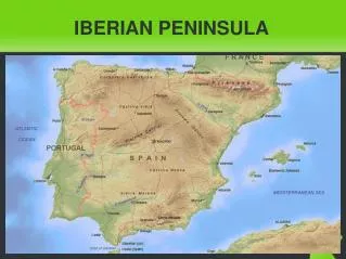
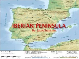
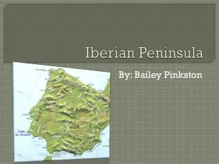
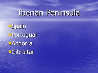
Iberian Peninsula Westernmost European peninsula containing Portugal, Spain, and Andorra. Climatically, the Iberian Peninsula has hot summers, cold winters, and limited precipitation.
Strait of Gibraltar Located at the western entrance to the Mediterranean Sea, this narrow sea- level passage is about 15 kilometers wide and 55 kilometers long.
Meseta The middle of Spain is a high, dry, flat plateau called the Meseta. In the Meseta it can be very hot in the summer and cold in the winter.
The Rock of Gibraltar Strategically important, Gibraltar was ceded to Great Britain by Spain in the 1713 Treaty of Utrecht; the British garrison was formally declared a colony in 1830. In referendums held in 1967 and 2002, Gibraltarians ignored Spanish pressure and voted overwhelmingly to remain a British dependency.
Danube River Danube River
Danube River The second longest river in Europe, it is one of the major methods of transportation. It is the only major European river to flow west to east, going through eight countries and three capitals including: Budapest, Hungary; Vienna, Austria; and Belgrade, Serbia.
Lake Balaton is the largest lake of Central Europe Lake Balaton
Pyrenees Stretching from the Atlantic Ocean in the west to the Mediterranean in the East, a distance of some 250 miles (402.5km), the mountains of the Pyrenees form a natural barrier between Spain and the Iberian Peninsula in the south and France in the north.
The Rock of Gibraltar Strategically important, Gibraltar was ceded to Great Britain by Spain in the 1713 Treaty of Utrecht; the British garrison was formally declared a colony in 1830. In referendums held in 1967 and 2002, Gibraltarians ignored Spanish pressure and voted overwhelmingly to remain a British dependency.
Sirocco This satellite image shows a dust storm over the Mediterranean Sea. The north African winds, known as Sirocco, blow dust north-west out over the Mediterranean Sea from the Libyan desert to the Italian mainland crossing the island of Sicily and part of Sardinia island to the west.
Zuiderzee The Zuiderzee Works is a man-made system of dams, land reclamation and water drainage works, and the largest hydraulic engineering project undertaken by the Netherlands during the twentieth century.
The project involved the damming off of the Zuiderzee, a large, shallow inlet of the North Sea, and the reclamation of land in the newly enclosed water body by means of polders.
Polder Polder:An area of low-lying land, especially in the Netherlands, that has been reclaimed from a body of water and is protected by dikes.
Terpen These high earthen platforms provide safe places during floods and high tides
Zuider Zee ZuiderZee On the left side is the salty North Sea, and on the right side the freshwater lake created by the 'Afsluitdijk‘ dam.
The United Kingdom Strait of Dover France EnglishChannel
Peatis an accumulation of partially decayedvegetationmatter. Soft and easily compressed, water is forced out under pressure. Upon drying, peat can be used as a fuel, and is traditionally used for cooking and domestic heating in many countries including Ireland and Scotland, where trees are often scarce.
Volga River The Volga River in Western Russia, Europe's longest river, with a length of 3,690 km, provides the core of the largest river system in Europe.
Deforestation Most of Europe was once covered by a hardwood forest. Overgrazing, bad soil management, inappropriate land-use, droughts, fires, and political turmoil, caused considerable deforestation, however, most of the forests of Europe and were reduced to charcoal to supply heat for manufacturing processes.
North Atlantic Drift The weather in this otherwise cold climate zone, is moderated by the effects of The North Atlantic Drift which originates from the Gulf Stream along North America and from the northern Sargasso Sea. These waters then slowly flow northward into the Labrador and European Basins eventually becoming the NADC as it enters the Iceland Basin. False-color image of the temperature of the Gulf Stream
Gulf Stream The effect of the Gulf Stream is sufficient to cause certain parts of the west of Britain and Ireland to be an average of several degrees warmer than most other parts of those countries.