Download
1 / 32
320 likes | 399 Vues
Severe Weather: Hurricanes Jim Kossin Cooperative Institute for Meteorological Satellite Studies University of Wisconsin—Madison Madison, WI kossin@ssec.wisc.edu http://www.ssec.wisc.edu/~kossin. National Press Foundation, “Understanding Violent Weather” Program, 12 March 2007.

E N D
Severe Weather: Hurricanes Jim Kossin Cooperative Institute for Meteorological Satellite Studies University of Wisconsin—Madison Madison, WI kossin@ssec.wisc.edu http://www.ssec.wisc.edu/~kossin National Press Foundation, “Understanding Violent Weather” Program, 12 March 2007
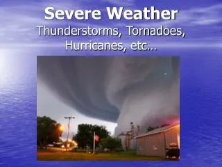
80-90 tropical cyclones (hurricane/typhoon/cyclone) globally each year. • One of the most costly natural hazards in terms of life and property. • North Atlantic, East / West / South Pacific, North / South Indian Oceans. • Less than 15% occur in North Atlantic. • Wind, storm surge, fresh water flooding, (lightning, tornadoes)
Operational hurricane forecasting challenges Primary focus: • Where is it going? (cross-track) • When will it arrive? (along-track) • How strong will it be when it gets there? Other: • Big storm (Katrina) or small storm (Charley)? • How much storm surge? Tides? Coastal topography? • Rain amounts?
Hurricane track forecast errors cut in half in past 15 years Little increase in intensity forecast skill Prediction of large-scale (environment) versus small-scale (hurricane) Figures from Franklin et al. (2005) Present skill (track and intensity)
How does the environment control hurricanes? Genesis: warm SST, low shear, …, an incipient vortex. Intensity change: SST, shear, …, landfall, Saharan dust. Track: larger-scale circulation patterns. Need to predict the environment that the hurricanes are traveling through. (Requires good track prediction) Suppose we could predict the environment and track perfectly. Could we then have perfect intensity predictions?
The challenge: Hurricane-scale processes control / modify intensity • Eye / Eyewall exchanges (meso-vortices) • Spiral-band (rain-band) processes (RAINEX) • Eyewall replacement cycles (concentric eyewall cycles)
Model simulation of eye / eyewall exchange (mixing): Hurricane Alberto (2000) (figure adapted from Kossin and Eastin 2001, Kossin et al. 2002)
Hurricane Isabel Model simulation (figure adapted from Kossin and Schubert 2001, 2004)
Why do we care? Small-scale mixing affects intensity change weakening events mixing events (figure adapted from Kossin et al. 2006)
Primary eyewall Secondary eyewall Eyewall replacement cycles
Cat 3 to Cat 5 in 12 hours Cat 3 Cat 3 Cat 5 Cat 5 Cat 5 Eyewall replacement cycles usually cause rapid intensity swings. Particularly problematic as storms approach land (Hurricane Andrew 1992). (figure adapted from Willoughby et al. 1982)
Longer-term forecasting challenges How are hurricanes affected by climate and climate change? (How is the climate affected by hurricanes?) What changes in the level of hurricane activity can we expect during the next 5, 10, 50, 100 years? Are there cycles and / or trends? Are the cycles / trends natural or man-made?
How do we meaningfully measure the changes? • Frequency (how many?) • Intensity (how strong?) • Duration (how long-lasting?) • Location (where are they? More / less landfall?) Accumulated Cyclone Energy (ACE) Power Dissipation Index (PDI) Number of Cat 4-5 storms Systematic (i.e. not random) track changes
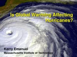
Direct relationship between SST and hurricane intensity The theory of Potential Intensity (PI, MPI) suggests that, all other things being equal, an increase of underlying SST will lead to an increase in the maximum intensity that a hurricane can achieve.
Relationship between SST and hurricane “activity” (figure adapted from Emanuel 2005) Reflects changes in frequency, intensity, and duration
Changes in frequency of the most intense hurricanes (figure from Webster et al. 2005)
Relationship between SST and hurricane location / track (figure from Kossin and Vimont 2007) The relationship with SST is part of a more general relationship with the Atlantic Meridional Mode (AMM). The AMM describes large-scale circulation patterns that go beyond the limitations of Potential Intensity theory.
A Brief History of the Global Hurricane Record Age of the Weather Satellites Post WW-II Aircraft Reconnaissance 1950’s 1970’s Occasional measurements. Serendipitous sources. Maximum intensity rarely measured. Storm counts may be low. Sporadic measurements. Mostly Atlantic. West Pacific until 1987. Maximum intensity rarely measured. Storm counts are better. Hourly measurements. Almost global. The counts are good. The existing record is inconsistent by its nature and its construction.
Data reanalysis Variability and increases in the Atlantic verify well. Global trends may be inflated. (figure adapted from Kossin et al. 2007)
Why are Atlantic hurricanes apparently reacting more markedly to warming SST than storms in other ocean basins? • The answer may lie in the way SST is related to other factors that affect hurricanes: • All climatic factors cooperate in the Atlantic. They are either all favorable or all unfavorable. • This is not true in other basins. One factor might be favorable while another is unfavorable. The factors offset each other. (from Vimont and Kossin 2007)
Changes in the long-term records Human-induced variability and increases, natural cycles, or both?
The Atlantic Multi-decadal Oscillation (AMO) Hypothesis #1: The AMO is a natural cycle related to periodic changes in the thermohaline circulation (a.k.a. the Atlantic conveyor belt). This natural cycle is superimposed on a smaller man-made trend. Under this hypothesis, SST is expected to eventually decrease to a long-term cooler regime. Hypothesis #2: The signal known as the AMO is actually just a superposition of two human-induced signals – anthropogenic greenhouse gas warming and sulphate aerosols. Under this hypothesis, SST is expected to continue its present rate of human-induced increase with no natural cycle to help offset it.
Summary: Hurricane forecasting faces many challenges in both an operational setting and toward long-term risk assessment. Operational intensity forecasts are challenged by the broad spectrum of scales that matter (environment to hurricane scale). Long-term forecasting is challenged by our present lack of understanding of the relationships between hurricanes and climate change. Questions: How will frequency, intensity, and tracks change? Could the effects of increasing SST be offset by more frequent eyewall replacement cycles and/or mixing events? Why is the Atlantic changing so profoundly? Is the present high Atlantic activity just a phase of a cycle or will it continue indefinitely?
Relationship between the AMM and the 3 factors comprising hurricane activity (frequency, duration, intensity) Correlations of raw / low-pass / high-pass time series. Bold significant. Raw time series AMM
Raw time series An explanation for the variability of duration AMM There is a systematic shift of the mean tropical cyclogenesis region to the southeast (northwest) during positive (negative) phases of the AMM. Since storms generally track westward to northwestward, a southeast shift allows storms to last longer before reaching hostile environments (land, cold SST, high shear).