Download
1 / 28
280 likes | 299 Vues
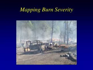
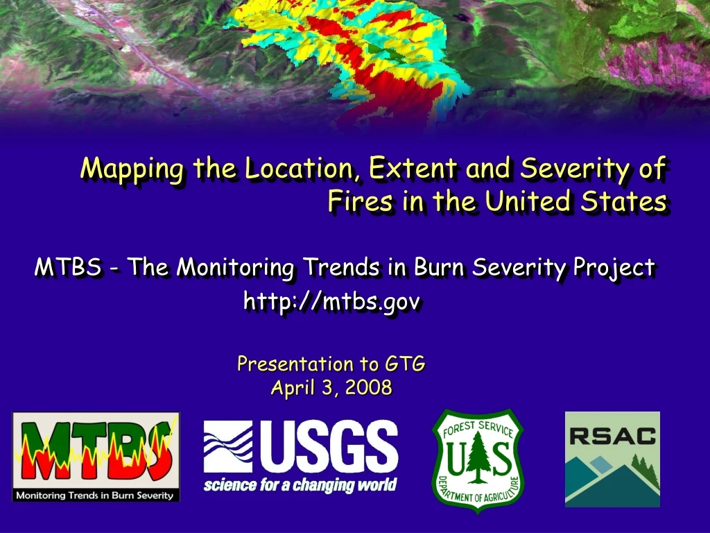
Mapping the Location, Extent and Severity of Fires in the United States. MTBS - The Monitoring Trends in Burn Severity Project http://mtbs.gov. Presentation to GTG April 3, 2008. MTBS Background.

E N D
Mapping the Location, Extent and Severity of Fires in the United States MTBS - The Monitoring Trends in Burn Severity Project http://mtbs.gov Presentation to GTG April 3, 2008
MTBS Background • Consistently map the burn severity and perimeters of largefires on all lands in the United States from 1984 to 2010 • Sponsored by the Wildland Fire Leadership Council (WFLC) • One element of a strategy monitoring the effectiveness of NFP and HFRA • WFLC 2004 Monitoring Proposal, Module 2.1 • Provide an information base to synoptically assess environmental impacts and trends • Required for all lands in conterminous US, AK, and HI • GAO recommendation that land management agencies develop and implement comprehensive burn severity assessments • Jointly implemented by USGS EROS and USFS RSAC
MTBS Objectives • Provide for a national analysis of trends in burn severity for the NFP • Provide information about wildfire effects to land managers and the scientific community • Consistent information across all lands in the U.S. • Consistent information spanning a significant historical period
MTBS Project Definition of Burn Severity • National Wildfire Coordination Group (NWCG) • Burn Severity In the MTBS project, burn severity refers specifically to fire effects on above-ground biomass. The reference definition is drawn from the NWCG Glossary of Wildland Fire Terms based on the term Fire Severity, defined as: “Degree to which a site has been altered or disrupted by fire; loosely, a product of fire intensity and residence time.”
MTBS Project Definition of Burn Severity • Additional Characteristics • Composite of 1st/2nd order fire effects on biomass • Occurs on a gradient or scale (ordinal) • Characterized as a mosaic of effects within a fire perimeter • Occurs within landcover strata • Longer term effects are complicated by multiple variables that MTBS is not characterizing • “Map-able” • Remote sensing provides a measurement framework
MTBS Product Overview • Burn severity data on all fires >1,000 ac in the west and >500 ac in the east • Thematic and continuous 30m raster layers • Subset to map extent of the fire + 3km • Fire perimeters/Fire centroid locations • Shape files w/attributes • Tabular data summarizing burn severity acres by class • Additional stratification by vegetation type, treatment areas, condition classes, etc. • Metadata • Thematic and feature level • Expanded Landsat archive • 7,000+ scenes!!!
MTBS Schedule • Fires processed in two phases • Current fires (2004+) will be processed for the project extent on an annual basis • 2004 fire mapping complete • 2005 fire mapping complete • 2006 fire mapping in progress • Historical fires (1984-2003) will be processed by geographic zone on a biennial schedule • PNW fire mapping complete (WA, OR, ID, western MT) • PSW fire mapping complete (CA) • SW fire mapping in progress (NV, UT, AZ, western CO and western NM)
MTBS Methods Burn severity products are based on the differenced Normalized Burn Ratio (dNBR) approach using Landsat 4/5 TM & Landsat 7 ETM+ data • Mature science established in the literature • Garcia and Caselles, 1991; Brewer et al., 2005; Cocke et al., 2005; others • Operational precedent • Implemented by Key and Benson for development of NPS fire atlases • Landsat data record • Consistent data record spanning ecologically and possibly climatically significant time frame • Resolution synergy • Spatial and spectral resolutions comparable to other national scale data NBR = (NIR – Mid IR) / (NIR + Mid IR) dNBR = Pre NBR – Post NBR
Landsat NBR Burn Severity dNBR Pre-fire Difference Fire Perimeter Post-fire MTBS Methods Outline • Compile a single MTBS fire occurrence database (FOD) from existing data sources • Based on FOD, select pre and post-fire Landsat scenes • Landsat data processed at EROS-terrain correction through NBR calculations • EROS and RSAC analysts perform differencing and threshold dNBR images into burn severity classes • Metadata, map products, burn severity data summary and reporting
MTBS Methods-Fire Occurrence Database (FOD) • Compiled from existing fire occurrence databases • Federal fire history database (NWCG-GTG) • Compiled from ICS209 database • Most state fire databases (occurrence points, perimeters) • Other related databases (NASF, NFPORS, etc) • Standardized to address format and content variability • Core fire data harvested (fire name, fire size, database id, start date, containment date) • Unique MTBS id assigned that links to database of origin • 21,000+ records for years 1984 - 2006 • Numerous duplicates and spatial anomalies • Discovered fires on Landsat imagery are added to database
MTBS Methods – Assessment Strategy • Based on fire type • Extended Assessment (EA) • Severity based on post-fire assessment at peak of green of next growing season • Forests/shrublands • Initial Assessment (IA) • Severity based on immediate post-fire assessment • Grasslands/shrublands • “Single Scene” Assessment • Pre fire imagery not available; use NBR • Conducted on a limited basis (EAs and IAs)
MTBS Methods – Scene Selection • Scene selection based on assessment strategy • Variables: fire location/date, cloud-free availability, and optimal seasonality • USGS Global Visualization Browser (GloVis) • http://glovis.usgs.gov • Review browse images for Landsat data record • MTBS driven enhancements include: • Input and overlay of user supplied shape files • Annual NDVI/land cover summary graphs by path/row
GloVis Scene Selection Process Primary and duplicate Ids identified
MTBS Methods - Data Processing • EROS receives Landsat orders • Data are terrain corrected using National Land Archive Production System (NLAPS) • NLAPS images calibrated to At-Satellite reflectance • NBR images derived from reflectance images • Landsat and NBR images delivered to RSAC and EROS project analysts (GeoTiff format) • Additional pre-processing (dNBR generation, etc) • Fire-level mapping and product development • Metadata, data summary and reporting
MTBS Methods - Perimeter Delineation • MTBS perimeters digitized using dNBR • Incident perimeters do not directly affect delineation • Goal is to utilize a consistent method and data to derive perimeters • Perimeter confidence levels included as feature level metadata
Unburned to Low Low Moderate High Increased Response Non-mapping Area MTBS Methods - Burn Severity Map Development • dNBR images are interpreted to derive 5 severity classes (unburned, low, moderate, high & increased response) • Analysts use existing Composite Burn Index (CBI) thresholds (Key, 2001) and knowledge of site ecology as guidance for choosing severity thresholds • Analysts also have access to advice and feedback from regional experts
MTBS Methods – Metadata • Supplementary metadata is compiled by analysts for each MTBS fire-level dataset suite • XML/Text format • Captures all relevant data elements and processing parameters • Further processed by EROS to generate FGDC compliant metadata
MTBS Methods – Fire Map Products • 8½ x 11 PDF fire maps are generated for each fire • Post-fire reflectance image w/perimeter • Thresholded dNBR image w/perimeter • Statistical summary
MTBS Methods – Data Summary & Reporting • Burn severity data are summarized with key geographic strata • Summary of severity acres by: • NLCD/Landfire land cover classes • Administrative ownership • Watersheds • Geographic Areas • Summary of severity acres by fire, state and national extents • Reporting documents and trend analysis summaries are generated at end of reporting cycles for current year and historical fires • Reporting documents are available at MTBS website • Web-based electronic reporting available • Access through MTBS website • Support standard queries • Includes tables and graphics in printer friendly version
MTBS Data Distribution • Web-based data portal hosted by USGS to distribute fire-level MTBS data • Available via MTBS website • Direct link - http://mtbs.cr.usgs.gov/viewer
MTBS Data Distribution • Alternative download option to support large data volume requests/downloads • Segmented and bundled temporally & spatially • Eastern U.S., Western U.S. and Alaska • Access to data, metadata, MTBS FOD and fire map PDFs
MTBS Project Status • Fire mapping completed • PSW/PNW (1984-2005) • Nationwide (2004-2005) • Southwest (1984-2003) and nationwide (2006) in progress • 4,062 fires mapped (Alaska - 185) • 43.8 million acres (Alaska – 11.6 million)
MTBS Tech Transfer/Training/Feedback • Multi-faceted approach • Documents available on MTBS website • Workshops to enhance understanding of burn severity maps and appropriate applications • Web-based modules to describe data and applications • Findings from analysis of national trends documented and published in peer-reviewed journals • Web and workshop environments in addition to ad hoc opportunities will be used as feedback mechanism to project team
MTBS Project Challenges and Limitations • Continued availability of Landsat data • Investigating alternatives in case of data gap • Ability of dNBR to characterize fire effects across a wide range of ecological conditions • Assessment timing relative to severity characterization and perimeter delineation • FOD completeness • Detection of low intensity/understory fire areas • Large project responsiveness
Uses of MTBS Data • Policy Makers • Resource/land management • Fire suppression • Risk assessment • Wildlife and fisheries • Forest Resources • Research and academia • Change data for targeted updates of similar scale landcover and fuels layers • LANDFIRE • Regional land cover mapping programs
MTBS Website Demos http://mtbs.gov • MTBS electronic reporting summaries • MTBS data access
MTBS Contact Information Project Leads USDA FS – Brian Schwind bschwind@fs.fed.us US Geological Survey – Jeff Eidinshink jeidinshink@usgs.gov Science Leads USDA FS – Ken Brewer kbrewer@fs.fed.us US Geological Survey – Jeff Eidinshink jeidinshink@usgs.gov http://mtbs.gov