Download
1 / 52
520 likes | 631 Vues
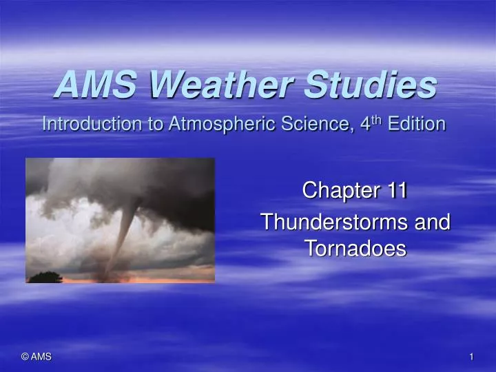
AMS Weather Studies Introduction to Atmospheric Science, 4 th Edition. Chapter 11 Thunderstorms and Tornadoes. Case-In-Point. Major severe weather outbreak of 3 May 1999

E N D
AMS Weather StudiesIntroduction to Atmospheric Science, 4th Edition Chapter 11 Thunderstorms and Tornadoes
Case-In-Point • Major severe weather outbreak of 3 May 1999 • More than 70 tornadoes were reported in Oklahoma, northern Texas, and south central Kansas, and 26 of these occurred in or around Oklahoma City • An F5 tornado took 38 lives in Oklahoma City suburbs • An F4 tornado claimed 6 more lives in Haysville, Kansas • Essential ingredients for this outbreak: • Warm, humid surface air layer was initially capped (capping inversion) with much drier air aloft • Temperature and humidity contrast between low-level and upper-level layers grew throughout the day, increasing the potential for deep convection and severe weather • Sounding indicated strong vertical wind shear • Afternoon arrival of a jet streak lifted the air column and eliminated the capping inversion • Massive supercell thunderstorms developed explosively and spawned violent tornadoes
Driving Question • What conditions in the atmospheric favor development of severe convective weather systems? • Tornadoes are the most intense of weather systems, but less than 1% of all thunderstorms spawn tornadoes • This chapter covers thunderstorms and tornadoes, their characteristics, life cycles, geographical and seasonal distributions and associated hazards
Thunderstorm Life Cycle • A thunderstorm is a meso-scale weather system that is accompanied by lightning and thunder, affects a relatively small area, and is short-lived. It is the product of vigorous convection extending high into the troposphere.
Thunderstorm Life Cycle • Towering Cumulus Stage • Cumulus clouds build vertically and laterally, and surge upward to altitudes of 8,000-10,000 m (26,000-33,000 ft) over a period of 10-15 minutes • Produced by convection within the atmosphere • Free convection – triggered by intense solar heating of Earth’s surface • Generally not powerful enough to produce thunderstorms • Forced convection – orographic uplift or converging winds strengthen convection • This is generally the cause of thunderstorms • Latent heat released during condensation adds to buoyancy • During the cumulus stage, the updraft is strong enough to keep water droplets and ice crystals suspended • As a result, precipitation does not occur in the cumulus stage
Thunderstorm Life Cycle • Mature Stage – maximum intensity • Stage typically lasts about 10-20 minutes • Begins when precipitation reaches Earth’s surface • Features heaviest rain, frequent lightning, strong surface winds, and possible tornadoes • Weight of droplets and ice crystals overcome the updraft • Downdraft created when precipitation descending through the cloud drags the adjacent air downward • Entrained dry air at the edge of the cloud leads to evaporative cooling, which weakens the buoyant uplift and strengthens the downdraft • At the surface, the leading edge of downdraft air resembles a miniature cold front and is called a gust front • Ominous-appearing low clouds associated with a gust front include a roll cloud and a shelf cloud
Thunderstorm Life Cycle Roll cloud Thunderstorms can develop along gust fronts ahead of the main storm Shelf Cloud
Thunderstorm Life Cycle • Dissipating Stage • Precipitation and the downdraft spread throughout the thunderstorm cell, heralding the cell’s demise • Subsiding air replaces the updraft and cuts off the supply of moisture • Adiabatic compression warms the subsiding air and the clouds gradually vaporize
Thunderstorm Classification NOAA classification of thunderstorms, and the likelihood of severe weather.
Thunderstorm Classification • Thunderstorms are meso-scale convective systems (MCS) and are classified based on the number, organization, and intensity of their constituent cells • Single-cell thunderstorms • Usually a relatively a weak system forming along a boundary within an air mass (i.e., gust front) • Typically completes its life cycle in 30 minutes or less • Multicellular thunderstorms • Characterizes most thunderstorms. Each cell may be at a different stage in its life cycle, and a succession of cells is responsible for a prolonged period of thunderstorm weather. • Two types: • Squall line • Mesoscale convective complex • Either can produce severe weather
Thunderstorm Classification A thunderstorm may track at some angle to the path of its constituent cells, complicating the weather system motion. In the above idealized situation, the component cells of a multicellular thunderstorm travel at about 20 degrees to the eastward moving thunderstorm. As they travel toward the northeast, the individual cells progress through their life cycle.
Thunderstorm Classification • Multicellular thunderstorm types • Squall line – elongated cluster of thunderstorm cells that is accompanied by a continuous gust front at the line’s leading edge • Most likely to develop in the warm southeast sector of a mature extra-tropical cyclone, ahead of and parallel to the cold front • Mesocyclone convective complex (MCC) • A nearly circular cluster of many interacting thunderstorm cells with a lifetime of at least 6 hrs, and often 12-24 hrs • Thousands of times larger than a single cell • Primarily warm season phenomena (March – September) • Usually develop at night over the eastern 2/3 of the U.S. • Is not associated with a front • Usually develops during weak synoptic-scale flow, often develops near an upper-level ridge of high pressure, and on the cool side of a stationary front • A low level jet feeds warm humid air into the system • Supercell thunderstorms are long-lived single cell storms • Exceptionally strong updraft, with rotational circulation that may evolve into a tornado
Thunderstorm Classification Infrared satellite image showing a MCC over the south-central U.S. Radar image of a squall line
Where and When • Conditions necessary for thunderstorms to develop include: • Humid air in the low- to mid-troposphere • Often mT air when that air mass is destabilized • Atmospheric instability • mT air becomes unstable when lifted to the convective condensation level • A source of uplift • Along fronts, up mountain slopes, or via horizontal convergence of surface winds • The more humid the air, the less uplift needed to destabilize it
Where and When • Solar heating drives atmospheric convection • Thunderstorms are most frequent when and where solar radiation is most intense • Also storms are most frequent during the warmest part of the day • There are many exceptions • Example - the low-level jet stream up the Missouri/Mississippi River Valleys at night contributes to nocturnal thunderstorm maximum • Thunderstorm frequency is often expressed in thunderstorm days per year • This is merely a count of the number of days in which thunder is heard • This does not account for days with multiple lines of thunderstorms passing over a weather station
Where and When • In the tropics and subtropics, intense solar heating may combine with converging surface winds to trigger thunderstorm development • This combination characterizes the ITCZ • In North America, thunderstorm frequency increases from north to south • Highest frequency over central Florida due to convergence of sea breezes • Second highest frequency over portions of the Rocky Mountain Front Range due to topographically related differences in heating • Thunderstorms are unusual over coastal areas downwind from relatively cold ocean waters (i.e., coastal California) • Infrequent in Hawaii due to trade wind inversion
Severe Thunderstorms • A severe thunderstorm is accompanied by locally damaging surface winds, frequent lightning, or large hail • Surface winds stronger than 50 kts (58 mph) and/or hailstones 0.75 in. (1.9 cm) or larger in diameter • May also produce flash floods or tornadoes • What causes some thunderstorms to be severe? • Key is vertical wind shear, the change in horizontal wind speed and direction with increasing altitude • Weak vertical wind shear favors short-lived updrafts, low cloud tops, and weak thunderstorms • Strong vertical wind shear favors vigorous updrafts, great vertical cloud development, and severe thunderstorms • With increasing vertical wind shear, the inflow of warm humid air is sustained for a longer period because the gust front cannot advance as far from the cell. Also, most precipitation falls alongside the titled updraft, sustaining the updraft.
Severe Thunderstorms A synoptic weather pattern that favors development of severe thunderstorms. A dryline is the western boundary of the mT air mass and brings about uplift in a manner similar to a cold front.
Severe Thunderstorms • The polar front jet stream produces strong vertical wind shear • This maintains a vigorous updraft • This supports great vertical development of thunderstorms • The jet contributes to stratification of air that increases the potential instability of the troposphere • A jet streak induces both horizontal divergence and convergence of air in the upper troposphere • Convergence occurs in the right front quadrant of a jet streak, causing weak subsidence of air • Sinking air is compressionally warmed and forms an inversion (capping inversion) over the mT air mass • The underlying air mass becomes more humid • Contrast between air layers mounts • All that is needed is a lifting mechanism for severe weather to occur
Severe Thunderstorms A temperature sounding that favors the development of severe thunderstorm cells. A capping inversion separates subsiding dry air aloft from warm, humid air near the surface.
Severe Thunderstorms Mammatus clouds occur on the underside of a thunderstorm anvil and sometimes indicate a severe storm system. Their appearance is caused by blobs of cold, cloudy air that descend from the anvil into the clear air beneath the anvil.
Thunderstorm Hazards • Lightning • A brilliant flash of light caused by an electrical discharge within a cumulonimbus cloud or between the cloud and Earth’s surface • Direct hazard to human life • Ignites forest and brush fires • Very costly to electrical utilities • Lightning detection network provides real-time information
Thunderstorm Hazards • Lightning • What causes lightning? • Large differences in electrical charge develop within a cloud, between clouds, or between a cloud and the ground • Upper portion and much smaller region of the cumulonimbus cloud become positively charged, with a disk-shaped zone of negative charge in between. A positive charge is induced on the ground directly under the cloud • Lightning may forge a path between oppositely charged regions • Charge separation within a cloud may be due to collisions between descending graupel striking smaller ice crystals in their path. At temperatures < -15 °C (5 °F) graupel become negatively charged while ice crystals become positively charged. Vigorous updrafts carry ice crystals to upper portions of the cloud. • Positive charge near cloud base also due to graupel-ice crystal collision, but temps > -15 °C (5 °F) induce positive charge to graupel and negative charge to ice crystals
Thunderstorm Hazards • Lightning • A cloud-to-ground lightning flash involves a regular sequence of events • Stepped ladders: streams of electrons surge from the cloud base to the ground in discrete steps • Return stroke: forms as an ascending electric current when the positive and negative charges recombine; often emanates from tall, pointed structures • Dart leaders, subsequent surges of electrons from the cloud, follow the same conducting path • Sequence takes place in < two-tenths of a second • Lightning causes intense heating of air so rapidly that air density cannot initially respond • Shock wave is generated and propagates outward, producing sound waves heard as thunder • Flash-to-bang method: Thunder takes about 3 seconds to travel 1 km (or 5 seconds to travel 1 mi) • If you must wait 9 seconds between lightning flash and thunderclap, the lightning is about 3 km (1.8 mi) away
Thunderstorm Hazards - Lightning Steps in a cloud-to-ground lightning discharge
Thunderstorm Hazards • Downbursts • Exceptionally strong downdrafts that occur with or without rain • Starburst pattern causes ground destruction • Also very dangerous to aircraft because they trigger wind shear • Aircraft have warning systems that use the same principle as Doppler radar • A macroburst cuts a swath of destruction > 4 km (2.5 mi) wide with surface winds that may top 210 km per hr (130 mph) • A microburst is smaller and shorter lived • Derecho: a family of straight-line downburst winds that may be hundreds of kilometers long; sustained winds in excess of 94 km per hr (58 mph)
Thunderstorm Hazards • Flash Floods • Short-term, localized, often unexpected rise in stream level usually in response to torrential rain falling over a relatively small geographical area • Caused by excessive rainfall in slow moving or stationary thunderstorm cells • Atmospheric conditions that favor flash floods: • More common at night and form in an atmosphere with weak vertical wind shear and abundant moisture through great depths • Precipitation efficient atmosphere has high values of precipitable water and relative humidity and a thunderstorm cloud base with temperatures above freezing
Thunderstorm Hazards A hydrograph showing changes in gauge level and discharge in response to a heavy rain event. On the top graph, precipitation and runoff are shown in 6-hr intervals.
Flash Floods Especially hazardous in mountainous terrain Big Thompson Canyon, CO flood on 31 July 1976 Fort Collins, CO flood on 28 July 1997 Urban areas are prone to flash floods during intense downpours Concrete and asphalt city surfaces impervious to water and elaborate storm sewer systems may be unable to handle excess runoff Flash floods can also be caused by breaching of a dam or levee, or by the sudden release of water during breakup of a river ice jam Thunderstorm Hazards
Thunderstorm Hazards • Hail • Frozen precipitation in the form of balls or lumps of ice > 5 mm (0.2 in.) in diameter, called hailstones • Almost always falls from cumulonimbus clouds that are characterized by a strong updraft, great vertical development, and an abundance of supercooled water • Develops when an ice pellet is transported vertically through portions of the cloud containing varying concentrations of supercooled water droplets • Composed of alternating layers of glaze and rime • Grows by accretion (addition) of freezing water droplets and falls out of cloud base when it becomes to large and heavy to be supported by updrafts
Thunderstorm Hazards • Hail • May accumulate on the ground in a long, narrow strip known as a hailstreak; typically 2 km (1.2 mi) wide and 10 km (6.2 mi) long • The figure below is a model of hailstreak development
Hail In the U.S. each year, hail causes an average $1 billion in damage, mostly to crops, livestock, and roofs Farmers cope with hazard by purchasing insurance The figure below shows that the annual number of severe hail reports has increased exponentially due to greater public awareness, easier report filing, and other factors In the U.S., severe hail is most likely in tornado alley Thunderstorm Hazards
Tornadoes • About 10% of the annual 10,000 U.S. severe thunderstorms produce tornadoes • A tornado is a violently rotating column of air in contact with the ground • Most are small and short-lived and often strike sparsely-populated regions • The most prolific tornado outbreak on record occurred over the Great Plains and Midwest on 29-30 May 2004 • 170 tornadoes were reported
Tornado Characteristics • The most striking characteristic is the funnel-shaped cloud composed of tiny water droplets • If the vortex remains aloft, it is called a funnel cloud • If the cloud extends to the ground, it is called a tornado • The funnel cloud forms in response to the steep pressure gradient directed from the tornado’s outer edge towards its center • A weak tornado’s path is typically < 1.6 km (1 mi) long and 100 m (330 ft) wide with a lifetime of a few minutes • A violent tornado can have a path > 160 km (100 mi) long and 1.0 km (3000 ft) wide with a lifetime of 10 min to > 2 hrs • Wind speeds may be up to 500 km per hr (300 mph) • Most are spawned by and travel with severe thunderstorms • Usually track from SW to NE, but may go any direction • Average forward speed is 48 km per hr (30 mph) • An exceptionally great horizontal air pressure gradient is responsible for a tornado’s vigorous circulation
Where and When • Tornadoes have occurred in all 50 states, but most occur in tornado alley, a N-S corridor stretching from eastern Texas and the Texas Panhandle northward to southeastern South Dakota • Weak tornadoes are more likely over flat than rough terrain, but strong to violent tornadoes are largely unaffected by terrain • U.S. typically has 1300 tornadoes/yr • Peak activity in May and June due to in part to: • Relative instability of the lower atmosphere • Favorable synoptic weather conditions: well-defined polar front and intense cyclones • Center of maximum tornado frequency follows the sun
Where and When Average number of tornadoes per 10,000 square miles by state, 1999-2008
Tornado Hazards and the EF-Scale • Tornadoes are a threat to people and property because of • Extremely high winds • Blow down structures • Flying debris main cause of death and injury • Multi-vortex tornadoes are most destructive • It is no longer recommended that windows be opened; most buildings have sufficient air leaks so that a potentially explosive pressure differential never develops • A strong updraft • Subsidiary vortices • An abrupt drop in air pressure • Some tornadoes consist of two or more subsidiary vortices that orbit each other or a common center • These multi-vortex tornadoes are the most destructive
Tornado Hazards and the EF-Scale • The F-scale was revised in 2007 as the EF-scale (Enhanced F-Scale) • The EF-scale is based on rotational wind speeds estimated from property damage • Ranges from EF0 to EF5 • EF5 tornadoes are rare • About 77% of tornadoes in the U.S. are considered weak (EF0 to EF1) and 95% are below EF3
Tornado Hazards and the EF-Scale Path of the Wichita-Andover, Kansas tornado of 26 April 1991. Numbers along the path indicate rating on the F-scale.
The Tornado-Thunderstorm Connection • Most violent tornadoes come from supercells • Very energetic with updraft speeds sometimes in excess of 240 km per hr (150 mph); they can last for several hours and produce more than one tornado • Supercell formation and characteristics • Horizontal wind exhibits strong speed and directional shear, which causes air to rotate about a horizontal axis. The updraft tilts tube of rotating air to vertical and a mesocyclone is formed. • A roughly circular lowered portion of the rain-free base of a thunderstorm, called a wall cloud, often accompanies a mesocyclone • Most wall clouds do not produce tornadoes • Tornadic wall clouds have strong and persistent rotation before the appearance of a tornado
The Tornado-Thunderstorm Connection • Supercell formation and characteristics, cont. • A mesocyclone circulation is most intense at 6100 m (20,000 ft); in a tornadic supercell it narrows and builds downward towards the ground • As the spinning column of air narrows its circulation increases, similar to an ice skater spinning faster as she pulls in her arms • A tornado typically appears near the updraft and toward the rear of a supercell • As the tornadic circulation descends to the surface, a downdraft develops near the rear edge of the supercell. Eventually the downdraft surrounds the tornado and the tornado dissipates • Potentially destructive tornadoes can also develop in multi-cellular thunderstorm clusters and hurricanes
The Tornado-Thunderstorm Connection Plan view of a tornadic supercell thunderstorm Schematic view of a tornadic supercell thunderstorm
The Tornado-Thunderstorm Connection A thunderstorm wall cloud may accompany a mesocyclone, but most do not produce a tornado
Monitoring Tornadic Thunderstorms • Direct monitoring is generally not feasible • Instead, storm chasers rely on photography, balloon-borne instruments that monitor surrounding atmospheric conditions, and portable Doppler radar to detect circulation within supercells • Doppler radar • In the reflectivity mode, can show a hook echo when the parent mesocyclone is present • In the velocity mode it monitors circulation; a tornado circulation may show up as a tornado vortex signature (TVS), a small region of rapidly changing winds within a mesocyclone • Storm spotters and visual surveillance of thunderstorms are still essential