Download
1 / 28
300 likes | 981 Vues
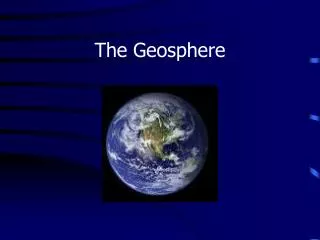
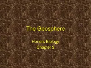
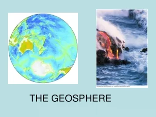
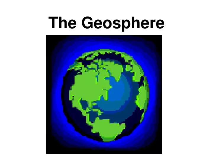
The Geosphere. The Earth as a System. The Earth is a system of 4 interacting components. Consists of: - Geosphere - Hydrosphere - Atmosphere - Biosphere. The Geosphere Composition. The solid part of the Earth (rocks, minerals, soil, etc.) Most of the geosphere is below the surface.

E N D
The Earth as a System The Earth is a system of 4 interacting components. Consists of: - Geosphere - Hydrosphere - Atmosphere - Biosphere
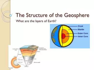
The GeosphereComposition • The solid part of the Earth (rocks, minerals, soil, etc.) • Most of the geosphere is below the surface
Look at the world map. Does anything look like it could fit together like a puzzle?
The GeospherePlate Tectonics Pangaea – Wegener’s idea that all of Earth’s continents were joined into one giant landmass 200 million years ago.
The GeospherePlate Tectonics • The tectonic plates ride atop the asthenosphere, moving in different directions
Convergent Plate Boundaries Continental-continental Oceanic-continental Oceanic- oceanic
The GeospherePlate Tectonics • The tectonic plates ride atop the asthenosphere, moving in different directions
Divergent Plate Boundaries Mid-ocean ridge Rift Valley
The GeospherePlate Tectonics • The tectonic plates ride atop the asthenosphere, moving in different directions
The GeospherePlate Tectonics Global Earthquake Distribution Global Volcano Distribution
The Geosphere Which of these geologic hazards poses the greatest threat to the environment? Why?
The GeosphereErosion • Rocks on the surface are changed by wind, running water, and weather. • Erosion is the removal and transport of weathered surface materials. • Over long periods of time, erosion can wear away entire mountains and produce spectacular landforms.
The Land How is the land in this picture being used?
How We Use Land Urban land = land covered mostly with buildings & roads and containing 2500 or more people. Rural land = land containing few people & large areas of open space.
Think-Pair-Share How are each type of land cover important to people?
The Urban-Rural Connection Think About It… Are people dependent on the resources produced in rural areas? Ecosystem services – resources produced by natural & artificial ecosystems
Urban Land Use • Urbanization = the movement of people from rural areas to cities. • People move to the cities for jobs.
Urbanization Pros Cons
Urban Crisis When urban areas grow too quickly, a crisis can occur. • Overwhelmed infrastructure (roads, sewers, railroads, bridges, firefighters/police, schools, libraries, hospitals, water mains, & power lines) • Traffic jams • Substandard housing • Polluted air & water
Urban Sprawl • Urban sprawl = rapid expansion of a city into the countryside around the city. • Results from suburban building • housing & commercial Suburban development around Maui, HI
Development of Marginal Lands • Some suburbs have been built on land that is not well suited to support buildings. • This land is prone to landslides because it is unstable • Ex: Los Angeles, Mexico City
Urban Environmental Condition Heat Islands – increased temperature in a city Why? - roads & buildings absorb more heat than vegetation Effects? – local weather patterns change, more rainfall in cities Pollution of air, water, & land
Urban Planning • Land-use planning is essential for pleasant urban living experiences. • Ex: • Transportation in cities involves mass transit systems (buses, trains) • Mass transit saves energy, reduces traffic, lowers air pollution, & limits the loss of land to roads & parking lots • Open space is set aside in urban areas for recreational enjoyment (parks, gardens, bike paths, hiking trails) • Open spaces absorb CO2, produce oxygen, filter pollutants, lower temperatures, absorb rainwater
Designing A Community • You are a land-use planner. Design a model community that is to be home for 1000 people. Name your community & tell us where in the world you are located. • Sketch your plans for the following: • Housing • Commercial • Transportation routes • Open spaces • Community services (electricity, water, trash collection, police & fire protection, schools, hospitals, etc.) • Where will resources come from?