Download
1 / 43
620 likes | 2.34k Vues
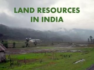
Many ecosystem services provided by rural lands enable the majority of humans to live in urban environments.

E N D
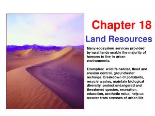
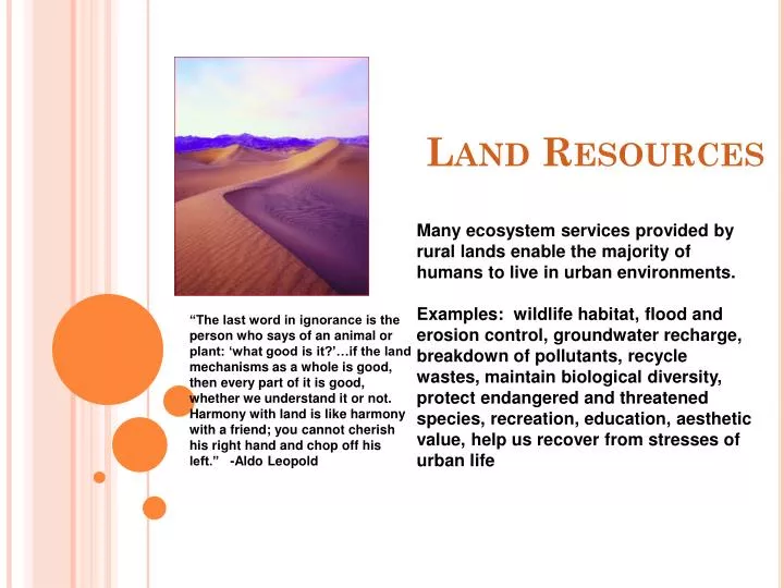
Many ecosystem services provided by rural lands enable the majority of humans to live in urban environments. Examples: wildlife habitat, flood and erosion control, groundwater recharge, breakdown of pollutants, recycle wastes, maintain biological diversity, protect endangered and threatened species, recreation, education, aesthetic value, help us recover from stresses of urban life Land Resources “The last word in ignorance is the person who says of an animal or plant: ‘what good is it?’…if the land mechanisms as a whole is good, then every part of it is good, whether we understand it or not. Harmony with land is like harmony with a friend; you cannot cherish his right hand and chop off his left.” -Aldo Leopold
Land UseManaging Public and Private Land Management of Federal Lands Wise-Use Movement vs. Environmental Movement Wise-Use: The government has too many regulations protecting the environment and property owners should have more flexibility to use natural resources Environmental: Views federal lands as a legacy of U.S. citizens
Wilderness, Parks, and Wildlife Refuges National Parks Most popular http://travel.nationalgeographic.com/travel/national-parks/most-visited-parks-photos/
Wilderness, Parks, and Wildlife Refuges During peak season use, the same problems plaguing urban areas are found in popular national parks: crime, vandalism, litter, traffic jams, pollution of soil, water and air -imbalance of wildlife populations ( elk in Yellowstone) -pollution from out of park boundaries -ecologists have found that when environmental stressors occur, several small “island” populations are more likely to become threatened than single large population in a sizable range National Parks Threats to US Parks
Forests • Tree plantations: (aka Tree Farms) • Large tracts of land where trees are grown for the purpose of harvesting later for profit. • Trees are all about the same age. • Monocultures – only one type of tree is grown. • Pro: Easy to harvest • Con: susceptible to disease / pests. Pesticide Use. • Examples: orchards, pine forests • Silviculture – the management of forest plantations for the purpose of harvesting for a profit.
Old Growth Forest • Virgin forests – have not been cut down & replanted; have not been seriously disturbed in hundreds of years. • The US has the same amount of forest now as 100 years ago, however, only 5% are original forest. • Large amounts of biodiversity • largest in the US is in the Pacific Northwest • logging companies wanted to cut down part of the forest in the 1980s but were halted because of Northern Spotted Owls. • Controversy – protected by federal laws, preventing loggers from coming in. • Forests provide ecosystem services • Remove C from the atmosphere • Provide O2 • Provide food products for human consumption • Animal habitat • Wood • Fuel (from wood) • Recreation • Remove pollution; increase quality of soil & water
Forest Management-Forest Fires • Necessary for the survival of the forest. • Fires help some trees (like pines) to reseed. • Destroys the underbrush that competes with larger trees for nutrients. • Large, healthy trees are not very affected by small fires • Destroys leaf litter = which is a fuel for a bigger / unplanned fire • Too many large trees = competition for resources.
Fires • Controlled burns: performed by the National Forest Services – create fire lines and burn the area in between • Must have certain conditions: • Done every 5 or so years, depending on growth of underbrush • Too much underbrush = too much “fuel” & fire can get out of control • Can’t be done when the area is particularly dry • Dry biomass = faster burn; hard to control • Can’t be done during windy times • if it’s windy fire can jump across the fire lines.
Types of Forest Fires • Crown fires (occur in forests that haven’t had recent fires – lots of energy) • Ground Fires: occur underground & burn partially decayed leaves – common in bogs. • Surface fires: burns undergrowth & leaf litter. Kills seedlings & smaller trees. Controlled burns help prevent crown burns. • Controlling fires: Prevention = burning permits, closing forests when fire danger is high; Prescribed burns = purposely setting controlled fires. • Grasslands & Chaparrals are also maintained by fires
Forest Management • Agroforestry: trees & crops are planted in the same area. • Mutualistic relationship that helps to control pests. • Harvest Strategies: • Clear-cutting: cutting down all trees in an area • Pro: typically done in areas with fast growing trees; efficient • Con: loss of biodiversity; disrupts ecosystem services (above) • Selective cutting: removal of select trees in an area. • Shelter-wood cutting: mature trees are cut over time, but some are left behind to seed the area. • Uneven-aged management: more common in areas where trees that take longer to grow.
Natural Burns vs. Unplanned Burns • Burns occur naturally because of lightning strikes • Controlled burns are done so the fire will not be out of control if there is a natural fire • What Smokey the Bear warned us about! • Under the wrong conditions the fire gets out of control • May not be prepared to protect nearby infrastructure • Out of control burns put fire fighters, residents, and animals in danger
Clearcutting Forests Forest Management Harvesting Trees
Shelterwood cutting Selective cutting Forests Forest Management Harvesting Trees
Forests Forest Management Harvesting Trees http://video.msn.com/?mkt=en-us&vid=b3d1d631-bfd0-4efc-9d50-23b48c15ae59&playlist=videoByUuids:uuids:7d2f0eea-f512-4946-a97b-9b2619e99d7a%2C9c061c0e-efad-41fb-833c-a977fe370893%2C5ebdf576-b611-4764-874f-1d85d10fc1b6&from=MSNHP&tab=m1189615355928>1=42006 Seed tree cutting
Deforestation Deforestation • World forests shrinking by 22 million acres each year • Many causes (drought, agricultural expansion, construction, tree harvest, etc.) • Results in soil infertility, warmer climates, disrupted hydrologic cycle
Deforestation • Removal of trees for agricultural purposes (pastures & farms), home building (MDCs) or purposes of exportation (LDCs) • MDCs have a larger demand for wood but less deforestation b/c of importation from LDCs • Problem w/ reforestation: takes decades for trees to grow enough to be used; no substitute for large trees like the Giant Redwoods / Sequoias. • Land is often cleared to make room for pastures, mining sites, petroleum sites, etc. • Reduction of ecological services (i.e. O2 production, habitat, nutrient cycles, food chains, etc) • n tropical rainforests: • iTypically done to create crop land, but the soil is nutrient poor so crops can’t be supported for long. • ii. Abandoned cropland becomes pasture, which further depletes the soil. • iii. Loss of biodiversity • iv. Hard to selectively cut valuable trees (i.e. teak & mahogany); many other trees are harmed as a result.
Forests Forest Trends in the US US National Forests • Managed for multiple uses (hunting, mining, recreation, timber harvesting, etc.) • Federal Government owns about 35% of land in US.
Forests Why Are Tropical Forests Disappearing? • Subsistence Agriculture • Commercial Logging • Cattle Ranching and Agriculture for Export
Forests Why Are Tropical Dry Forests Disappearing?
Forests Boreal Forests and Deforestation
Rangelands and Agricultural Lands Rangelands
Rangelands and Agricultural Lands Rangeland Degradation and Desertification • Many rangelands consistently overgrazed • Overgrazing coupled with extended droughts = desertification • Too many grazing animals=compact soil; loss of ground cover; nutrient depletion of soil • Compact soil does not allow water to penetrate=less evaporation=less rainfall. • Less ground cover=fewer nutrients in soil and increased erosion. • Worldwide desertification rate = 1,374 mi2 per year
Rangelands and Agricultural Lands Rangeland Trends in the US Rangelands comprise 30% of land in US 1/3rd public, 2/3rd private Issues Involving Public Rangelands Grazing permit fees Wild horses and burros
Rangelands and Agricultural Lands Agricultural Lands US has 300 million acres of prime farmland Main problem: suburban spread onto agricultural land
Wetlands and Coastal Areas Wetlands
Wetlands and Coastal Areas Human activities that threaten wetlands: • Draining for agriculture or mosquito control • Dredging for navigation • Channelization • Construction of dams, sea walls, dykes • Filling in for solid waste disposal, roads, residential / industrial development • Conversion to aquaculture
Wetlands and Coastal Areas US legislation has attempted to maintain a “no net loss” of wetlands Reconstructed wetland in San Diego
Wetlands and Coastal Areas Coastlines Severely degraded or destroyed in US by filling and draining Residential and industrial development common Resulting problems:
Wetlands and Coastal Areas Coastlines Coastal Demographics • In US, 19 of 20 most densely populated areas along coast. • Worldwide, coastal management plans rarely integrate land and offshore water concerns • Results in overdevelopment and pollution
Wetlands and Coastal Areas Coastlines National Marine Sanctuaries • US has 12 • Managed for multiple uses, including conservation, recreation, education, etc. • Commercial fishing permitted, though there are “no take” zones
Conservation of Land Resources Most endangered ecosystems in the US
Urban land development • Planned development; Urban Lands (humans use land for cities) • zoning regulations – control how land is used (some areas of city are only for houses, some only for business, etc.) • Environmental impact Statements – Research must be done to a plot of land before building infrastructure. • Performed by local agencies • All must include • How the infrastructure will affect the environment (short term) – are any organisms affected, erosion, etc. • How the infrastructure may affect the environment in the future • What will be the cost of remediation if there is environmental damage
Cities • Urban area = over 2500 people; growing rapidly since industrial revolution • Poverty increasingly prevalent in urban areas as poor migrate to cities looking for work = huge shantytowns around developing country cities (see Mexico City p.723)
Green Building • Energy conservation – government & private industry rebates as incentives for using solar energy, reducing energy through window placement, motion sensors, etc. • Resource-effective building techniques & materials (renewable resources) • Indoor air quality filters (may include greenhouses on roofs) • Green roof systems: help keep the building cool • Water conservation: xeroscaping; reusing gray water; low flush toilets • Minimize waste in the construction process. • Place buildings near public transportation (light rail, subways, etc) • Pedestrian friendly areas; greenbelts; close shopping areas • Preserve historical & cultural sites
Suburban Sprawl • People move away from the center of the city to neighborhoods further away. • Urban Growth in US • 1800 = 5% urbanized (4 major shifts since then) • 1st shift: Migration to cities (75% urban today) • 2nd shift: Cities to Suburbs (41% in city/59% suburbs) • 3rd shift: Migration to South & West (since 1980 80% population growth in US has occurred here)
Urbanization • Areas (ie cities) with a high population density • Many schools, infrastructure, hospitals, houses, shopping centers, etc. • Making Urban Areas Sustainable • preserve open spaces for trees & common use parks • have a “green belt” around downtown, then allow suburban development outside belt (link suburbs with mass transit). No building can be done in them; increases the quality of life of the residents. • have “cluster housing developments” = pack houses tightly & leave 30% open for parks, etc. • create rail systems / bus systems that encourage carpooling.
Transportation infrastructure • Federal highway system; • Interstate highways paid by federal funding & comply with federal standards. • Pro: less pollution b/c of reduced stop-and-go driving; reduces greenhouse gases; increases fuel economy (& reduces dependence on foreign oil), improves economy; improves quality of life (less time on the road) • Cons: encourages urbansprawl • Taxes on gasoline help pay for roads (higher gas prices = better roads) • Canals and channels • body of water that connects two larger bodies of water • Pros: less time / fuel to transport goods • Cons: have to be dredged regularly to avoid siltation. • may be natural or manmade • Largest canals in the world • Panama Canal (48 miles) – connects Pacific to Atlantic oceans. • Suez Canal (163 miles) – connects the Red Sea with the Mediterranean sea • Maintained by the US Dept of Interior
Transportation infrastructure Cont. • Roadless areas • logging & other development cannot occur. • Provides habitat for organisms. • Includes National wilderness areas • RoadlessArea Conservation Rule: places about 1/3 of national forest system’s total acreage off limits to roads; allows for recreation.
How transportation affects development • Because so little land is available in Japan & Europe: • more vertical growth of cities (in NYC people are required to purchase “air space” when building up.) • In US, Australia, Canada: Urban Sprawl or outward growth because there is more land • cheap gas + vast highways + sprawl =Automobile use dependent • sprawl makes infrastructure more expensive (got to stretch to suburbs)
Current Transportation Problems & Solutions • Individual Transport (cars & trucks) • in US, twice as many commuters from suburb to suburb than suburb to downtown = makes mass transit difficult • Better emissions laws offset by more cars • in US, more land dedicated to roads than houses • autos produce at least 50% of air pollution in US
Solution to Auto Problems • Solutions to Auto Problems • Motor Scooters: heavy use in developing countries (can’t afford cars) = more polluting than autos • Solution: replace gas burners with electric scooters • Bicycles & Walking: no pollution, heavy use in China (50%), Japan (15%), Western Europe (Denmark 30%), but US only 1% (too much sprawl) • Solution: buses & trains equipped w/ bike racks, design cities so workers close to jobs • Mass Transit (3% of population use this in US, 15% Germany, 47% Japan)
Solution to Auto Problems • Rail Systems • rapid rail (subway) - more efficient, less pollution must live near tracks, expensive • light rail (trolley) – cheaper for tracks than roads; need huge ridership to make $ (i.e. need 150,000 cars off the road in Charlotte to pay for the light rail that we have now). • taxes must pay for new systems • Buses – lower cost than rail, more flexible, problem when caught in traffic, no profit if not full • Ways to control Auto use • User fees, higher parking fees, toll roads to pay for hidden environmental costs
Sustainable land-use strategies • Forests: cut down only what is needed. • Allow controlled burns in grasslands, rangelands, and forests • Use the land, but do so slowly so that it can “fix” itself FIGURE: Major Uses of Land, 2002 Land Use 48 States All States Cropland 23% 20% Grassland, pasture, and range 31% 26% Forest-use land 30% 29% Special uses 8% 13% Miscellaneous land 5% 10% Urban land 3% 3%