Download
1 / 38
380 likes | 577 Vues
Marek MARCISZ PhD , DSc ., Eng ., Assoc . Prof. Silesian University of Technology, Institute of Applied Geology Gliwice, POLAND. THE ESTIMATION OF COAL QUALITY AS ONE OF THE MOST IMPORTANT TASK S OF MINIG GEOLOGIST IN UNDERGROUND COAL MINES OF UPPER SILESIAN COAL BASIN

E N D
Marek MARCISZ PhD, DSc., Eng., Assoc. Prof. Silesian University of Technology, Institute of Applied Geology Gliwice, POLAND THE ESTIMATION OF COAL QUALITY AS ONE OF THE MOST IMPORTANT TASKS OFMINIG GEOLOGIST IN UNDERGROUND COAL MINES OF UPPER SILESIAN COAL BASIN Theapplication of combinationSurfer and AutoCAD software
INTRODUCTION • Thegeologisttaskisgivingtheinformation, whichallowsfor exploitation of depositwiththeguarantee of: • thesafetyof people and machines, • thecleanof depositexploitation, • minimaldevastation of the natural environment(in theconsequence of exploitation).
The informations expected by miner from geologist can be divided in 4 groups: • I group – information about the deposit form – indispensable to open out the deposit, • II group – information about the type and quality of the mineral – indispensable in estimation of the utilization value of mineral and designing of the enrichment type, • III group – information about deposit reserves (about mineral quantity in the deposit and about spacing of the mineral in the deposit) – indispensable in estimation of the economic value of deposit and designing of the exploitation method, • IV group – information about mining-geological conditions of the exploitation.
The geologist tasks include: • the geological charting of the deposit, • the sampling, • reserves esimation.
All results of the geologist tasks are presented on the map. • THE MAP IS ONE OF THE ELEMENTARY SOURCES OF GEOLOGICAL INFORMATION. • THE MAP IS USED FOR: • THE PREPARATION OF THE DRAFT OF MINE, • RUNNING THE EXPLOITATION, • ESTIMATION OF THE ECONOMIC VALUE OF DEPOSIT.
OBJECT AND RANGE OF THE • AutoCAD AND SURFER COMBINATION • Thedigitalization of maps hasbecamemore popular recently, howevermajorityof mining maps isstillkeptinoriginal (analog) form. • Thedigitaldrawingupthe maps isusefulbecause of: • theeasiness of storing, • theeasieraccessibility to the data, • theeasinessinmodification and completing.
The GIS (GeographicalInformation Systems)software isveryexpensive so thecombination of theSurfer and AutoCAD software can be an alternative. • Thismethodtakesintoconsiderationthespecificity of themine maps. • Thismethodallowsto combine: • differentmethods of thecontour maps drawing (fromtheSurfer), with • thescaling of maps (optionalchoice of maps format) and adequateselection of themining-geologicaldetails (fromtheAutoCAD).
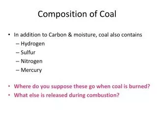
Moreover, this software werechosen, because of thefactthatboth, Surfer and AutoCADusetheCAD’s format of data transfer.dxf. • Thismethodisused for the construction of maps of thechemical-technical and petrographicalparameters of coal. • Coalqualityparameters, for whichthe maps wereconstructed, arebased on national (PolishStandards) and international standards(ECE Geneva).
These standards are based on the: • parameters of technical analysis like: • moisture content Wa [%], • ash content Aa [%], Ad [%], • volatile matter content Vdaf [%], • gross calorific value GCVdaf [MJ/kg], • calorific value CVdaf [MJ/kg], • parameters of elementary analysis like: • sulphur content Sta [%], Std [%],
coking parameters like: • contraction a [%], • dilatation b [%], • Roga Index RI [-], • Swelling Index SI [-], • physicalparameterslike: • vitrinite reflectancein oil immersion R [%], • petrographic composition: • content of vitrinite group macerals Vtmmf [%], • content of liptinite group macerals Lmmf [%], • content of inertinite group macerals Immf [%],
Data includingvalues of theseparameterscomefromthedrill-holescards and cards of theresults of the channel samples’ analysis.
The maps of selectedcoalqualityparameters (cokingparameters: Roga Index and SwellingIndex) fromthe 2 coalseams (403 and 406) from one of Polishmine will presentthismethod.
parameters and their values
2.2. CONSTRUCTION OF THE CONTOUR MAPS OF THE COAL QUALITY PARAMETERS The map of the Roga Index for the coal seam 403 The map of the Roga Index for the coal seam 406
The map of the Swelling Index for the coal seam 403 The map of the Swelling Index for the coal seam 406
These maps areconstructed by Surferusing one of thecontouringmethod: • Inverse Distance to a Power, • Kriging, • Minimum Curvature, • Modified Shepard's Method, • Natural Neighbor, • Nearest Neighbor, • Polynomial Regression, • Radial Basis Function, • Triangulation with Linear Interpolation, • Moving Average, • Data Metrics, • Local Polynomial.
Thekrigingisthemost usefulmethod for thepreciseestimationchanges of thequalityparametersvalues. • The maps constructed by thismethodshould be savedin.dxf format.
2.3. CONSTRUCTION OF THE MAPS OF THE COAL SEAM The map of the coal seam 406 The map of the coal seam 403
Thepicturebelowistheexample of a matrixof thetypicalcoalseam map withthe most fundamentalelementslike: • the coordinate system • the mine field border • the faults • the seam outcrop
Dependingon thedestination, the maps can be completedwithnecessarydetails, like: • the localization of the drill-holes • the sampling points • the underground structure of the mine, mine workings • the details of the underground mine surveying system
Thecontour maps (constructed by Surfer) scaledinthespecialwayarecoated as followedlayers on theseam map (constructed by AutoCAD).
3.1. THE MAPS OF THE ROGA INDEX (RI) The map of the coal seam 403 The map of the coal seam 406
3.2. THE MAPS OF THE SWELLING INDEX (SI) The map of the coal seam 403 The map of the coal seam 406
3.3. THE CONTOUR MAPS SUPERPOSITION VARIANT I: • Itispossible to imposetheisarithms of thedifferentparameters (for instancethe Roga IndexRIandtheSwellingIndexSI) inthe same coalseam (for instancein403seamor406seam).
Variant I:the same coalseam but otherparameters RI + SI RI + SI The map of the coal seam 403 The map of the coal seam 406
VARIANT II: • Itisalsopossible to compilethe maps of the same parameter (for instance Roga IndexRI orSwellingIndexSI) fromdifferentcoalseams(for instance403seamand406seam) and observethechanges of thepararametervaluesinrelation to depth.
II variant: different coal seams but the same parameter RI SI The maps of thecoalseams 403 and 406 The maps of thecoalseams 403 and 406
3.4. THE MAPS OF THE TYPES OF COAL • Thecontour maps of thequalityparametersallow to determinatethepossibilities of thecoalutilization. • According to thePolishStandardsthecoalqualityisdeterminatedonly on thebase of the 5 parameters: • volatilemattercontentVdaf [%], • Roga Index RI [-], • dilatation b [%], • SwellingIndex SI [-], • calorificvalueCVdaf [MJ/kg].
The appropriate ranges of the values of these parameters allow to distinguish types of coal. • On the base of the types of coal it’s possible to determinate very precisely the way of the coal utilization in different branches of industry: • power coals, • coking coals and the others.
Type 34 – the coking coal Type 34 – the coking coal The map of the coal seam 403 The map of the coal seam 406
Itispossible to imposethe maps of thetechnologicaltypes of coal of differentcoalseams. Type 34 – the coking coal The maps of thecoalseams 403 and 406
CONCLUSIONS • Thepossibility of imposingdifferent, selectedlayersallows to presentonlytheessential data. • Thisprocedureallows to reducetheamount of theneedlessdetails on the maps. • Thescaling of maps makespossible to plot wholemaps ortheirfragmentsindifferentformats. • Digital form of the map saving is conducive to easier storing, easier accessibility of the data and easier modification and completing.