Download
1 / 22
220 likes | 347 Vues
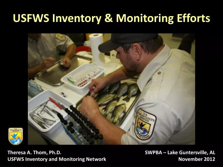
USFWS Inventory & Monitoring Efforts. Theresa A. Thom, Ph.D. USFWS Inventory and Monitoring Network. SWPBA – Lake Guntersville, AL November 2012. Southeast Region – Refuge System. National Wildlife Refuge System (NWRS) in the Southeast Region. 129 Refuges 4 million+ acres.

E N D
USFWS Inventory & Monitoring Efforts Theresa A. Thom, Ph.D. USFWS Inventory and Monitoring Network SWPBA – Lake Guntersville, AL November 2012
Southeast Region – Refuge System • National Wildlife Refuge System (NWRS) in the Southeast Region 129 Refuges 4 million+ acres
National Wildlife Refuge System Improvement Act (NWRSIA) of 1997 Provide for the conservation of fish, wildlife, plants and their habitats; Ensure the biological integrity, diversity, and environmental health; Plan for the continued growth of the System; Assist in the maintenance of adequate water quantity and quality; Acquire water rights; Monitor the status and trends of fish, wildlife, and plants in EACH refuge U.S. Fish & Wildlife Service The Genesis
What is the I&M Network? • A nationally coordinated program of inventory and monitoring on the NWRS to generate information critical to ensuring the System’s ongoing contributions to the conservation of the nation’s fish, wildlife and plant resources in the face of climate change and other environmental stressors • The I&M program will document the status, assess the condition of, and detect changes in the Refuge’s System’s diverse fish, wildlife and plant communities, physical resources including water air and soils, and ecological processes in order to support scientific-based conservation planning and management at multiple spatial scales Plan & evaluate the effectiveness of conservation strategies in close cooperation with Landscape Conservation Cooperatives (LCCs) Integration of I&M data to advance conservation at multiple landscape scales Collaboration with other Service programs, state, federal and conservation partners
What is the I&M Network? Goal: Provide field stations with the foundational ecological information on which to base planning and management decisions. Goal: Provide innovative, relevant, and timely water resources information, assessments, and guidance to refuge staff, regional and national management, and partners to inform refuge management decisions and help meet refuge legal requirements. Goal: Design, develop and maintain and integrated data management system that supports I&M efforts and promotes data sharing and collaboration with internal and external partners. Goal: Ensure that I&M database modules are efficiently utilized by all stations and they contain accurate, relevant, complete and current data that are accessible to others and inform NWRS management decisions. Goal: Establish and implement a coordinated field based assessment with standard metrics of invasive plant infestations across the Refuge System that incorporates early detection, identification and treatment of high-threat species, and local adaptive management monitoring for established invasive species.
What is the I&M Network Zone structure – Atlantic & Gulf South Atlantic LCC Regional coordinator and data manager co-located with NPS 4 ecologist positions co-located on refuges Gulf Coastal Plains and Ozarks LCC Deputy chief and assistant data manager co-located w/refuges/LCC offices 4 biologist/ecologist positions
What We Are Currently Doing • Inventory and monitor fish communities including aquatic invasive species using tools like eDNA on Savannah and Loxahatchee NWRs • Identifying priority water needs: Water Resource Inventory and Assessments on NWRS and Hatcheries • Evaluate vulnerability of refuge lands to drought-related issues
Fish Community Assessment OBJECTIVES: • Survey and Population Assessment • Monitoring using eDNA OVERALL PROJECT GOAL: • Develop standard data collection techniques to inventory & monitor aquatic invasive species within National Wildlife Refuge (NWR) waters • Coordination of effort • Standardization of data
Initial Sampling Sites/Effort • Stratified random design • Seasonal (Aug., Nov., Feb., May) • Multiple habitats • August 2012 • 11 km Little Back River • 3 km Union Creek • 3 km Pool 12/13 • 4 km diversion canal
Aquatic Invasive Species • Red-bellied pacu • Lionfish • Nile tilapia • Mozambique tilapia • Blue tilapia • Asian carp • Invertebrates • parasites
Multiple Agency Benefit • Gulf and South Atlantic Regional Panel on Aquatic Invasive Species • National Aquatic Species Task Force • Region 4 AIS Program • Savannah NWR • Southeast Aquatic Resource Partnership • South Atlantic LCC
Partnerships • Savannah NWR / Coastal Refuge Complex • Warm Springs Fish Technology Center • Welaka NFH • Regional Aquatic Invasive Species Program • Inventory & Monitoring • Regional Office – Fisheries & Refuges
What We Are Currently Doing Water Resource Inventory & Assessments • Cape Romain NWR, SC • Cahaba River NWR, AL • Cache River NWR, AR • Okefenokee NWR, GA • Lower Suwannee NWR, FL • Erwin National Fish Hatchery, TN • White River NWR, AR Transparent Prioritization Process
Specific Needs for Partnering Shared Data Standardized Protocols Transparent Prioritization Process Creative Ways to Work Together PLEASE CONTACT ME! Theresa Thom (843) 784-6262 (office) (706) 201-1846 (cell) theresa_thom@fws.gov
What is the I&M Network? Goal: Provide information on the status and monitoring of species classified under the Endangered Species Act (ESA) in the Refuge System. Goal: Provide summaries of vegetation resources on Refuge lands and ensure each refuge has the capacity to efficiently acquire vegetative covers datasets that meet their specific needs. Goal: Ensure each refuge has the capacity to utilize core abiotic base data layers in order to inform management decisions on Refuge lands. Goal: Ensure bird inventory and monitoring surveys on refuge lands are scientifically credible, evaluate refuge contributions to local, regional, landscape, flyway,and continental scale bird population objectives, and are coordinated across the landscape with other Service programs and our partners. The data will be used to assess the size, distribution, and status of bird populations and to gauge the success of management and conservation efforts.
What is the I&M Network? Goal: Where needed, to conduct baseline inventories of vertebrates, vascular plants, and a subset of invertebrates on all refuge lands. Goal: Ensure that phenological monitoring conducted on refuge land is scientifically credible and will be used to inform climate related management questions at multiple spatial and temporal scales. Goal: To support the implementation of adaptive management at multiple spatial scales. Goal: To assess the baseline quality of wilderness character on all designated wilderness within the Refuge System and then monitor trends in wilderness character over time using a nationally consistent approach. Goal: Ensure that surrogate species monitoring surveys on refuge lands are scientifically credible, evaluate refuge contributions to local, regional, and landscape scale population and habitat objectives, and are coordinated across the landscape with other Service programs and our partners. The data will be used to assess the size, distribution, and status of the selected populations and to gauge the success of management and conservation efforts.
What is the I&M Network? Goal: Generate fire history atlases for high priority refuges and ensure fire effects monitoring data can be utilized to assess the success of refuge management objectives. Goal: To provide coastal refuges with the information necessary to evaluate potential impacts of sea level rise to coastal habitats and wildlife. Goal: To summarize in one place key materials (documents, permits, reviews, plans, etc.) useful for refuge planning and vulnerability assessments. Examples include abiotic resources such as topographic maps, aerial photography, water resources inventories and assessments, HGM reports, as well as biotic resources such as a catalogue of inventories, veg maps, vulnerability assessments, banding, salvage, and endangered species permits, and hunting, fishing, trapping plans, CCPs, HMPs, IMPs, Wilderness Character Measures, and reports from Wildlife and Habitat Reviews.
What is the I&M Network? Goal: Provide baseline inventory data needed to assist with the assessment of the effects of unforeseen disasters and integrate refuge monitoring data with existing marine networks. Goal: That all field station periodically generate a standardized refuge condition assessment report that aligns with other land management status updates. Goal: Develop a nationally coordinated monitoring effort that incorporates wildlife health surveillance, includes training Refuge employees how minimize the potential for disease transmission to other sites, and prevent the transmission of zoonotic agents; identification (or development) of a baseline database used to detect changes in disease expression; and identifying high risk areas likely to experience changes in pathogen and/or vector populations.
What is the I&M Network? Goal: Implement a coordinated air quality biomonitoring (AQB) effort on refuge lands to provide assistance in prioritizing management of limited Service resources; enhance legal and policy-making decisions in light of climate change issues; and complement existing monitoring efforts underway by Branch of Air Quality (BAQ). Goal: Develop a nationally coordinated monitoring effort that incorporates wildlife health surveillance, includes training Refuge employees how minimize the potential for disease transmission to other sites, and prevent the transmission of zoonotic agents; identification (or development) of a baseline database used to detect changes in disease expression; and identifying high risk areas likely to experience changes in pathogen and/or vector populations.
What We Are Currently Doing • Monitoring marsh elevation and relative sea-level rise • Currently, 20 sites with three RSET stations installed on 18 coastal refuges Working with partners to ensure monitoring compatibility and data integration – NPS, USGS, TNC, NOAA, Refuges, South Atlantic LCC Refuge managers can use data locally to answer critical questions and adjust management; SALCC will use data to run and validate landscape scale models