Download
1 / 21
220 likes | 238 Vues
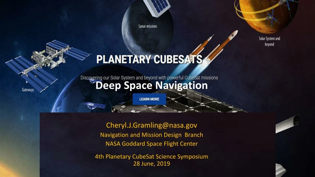
Deep Space Navigation Cheryl.J.Gramling@nasa.gov Navigation and Mission Design Branch NASA Goddard Space Flight Center 4th Planetary CubeSat Science Symposium 28 June, 2019. Agenda. Navigation Regimes Data Types and Systems Capabilities and SWaP.

E N D
Deep Space Navigation Cheryl.J.Gramling@nasa.gov Navigation and Mission Design Branch NASA Goddard Space Flight Center 4th Planetary CubeSat Science Symposium 28 June, 2019
Agenda • Navigation Regimes • Data Types and Systems • Capabilities and SWaP 4th Planetary CubeSat Science Symposium, NASA GSFC, June 27-28, 2019 3rd Planetary CubeSat Science Symposium, NASA GSFC, August 16-18, 2018
Defining Navigation Regimes • Near Earth – central body is Earth or within 2e6 km of earth • Planetary – Moon, Planets and their moons, Asteroid, • Heliocentric – Non-Planetary designs, Drift away • Navigation refers to: • Knowledge of the mission orbit wrt the central body (absolute) or wrt another object (relative) • Knowledge of where the object resided or currently resides in the orbit (definitive) or will reside in the future (predictive), • The trajectory design associated with achieving the mission, • How to modify the object’s orbit to follow that trajectory, • And the time associated with each of these. 4th Planetary CubeSat Science Symposium, NASA GSFC, June 27-28, 2019
Navigation Regimes Near Earth DSN GEO Planetary TDRSS Possible ~15+ RE Libration, L1 GPS ~7RE L1 ~50 RE L2 ~70 RE ... MMS Phase 2 25 RE LEO ~4RE Potential Lunar Nav GPS Weak-signal Possible 4th Planetary CubeSat Science Symposium, NASA GSFC, June 27-28, 2019
Forms of Direct Measurements • Time Delay Range (Distance) • Differential Delay Angle • Frequency shift (Doppler) or Carrier Phase Line of Sight Velocity • Frequency Change Rate Line of Sight Acceleration • Angular Change, Orientation Bearing, Range One common element among each of these is: TIME 4th Planetary CubeSat Science Symposium, NASA GSFC, June 27-28, 2019
Time is Fundamental Flight Units TCXO OCXO Cs Rb Space Qualified: 1 sec/31,688 years 4th Planetary CubeSat Science Symposium, NASA GSFC, June 27-28, 2019
TIME is the Facilitator • Ground element timing establishes boundary condition for end-user performance • Applicable to communications, radiometrics, and science • Sources clock and frequency • Delay accountability • Phase noise & jitter • Coherency • Automatic exchange of timing state during a communication session enables: • Synchronization across long distances • Time-based communication schemes • Universal and onboard timing sources needed as orbit moves away from Earth • Round trip light time (RTLT) challenges our ability to perform navigation operations in real time • Overcome by moving navigation onboard the spacecraft to provide in-situ real-time operations 4th Planetary CubeSat Science Symposium, NASA GSFC, June 27-28, 2019
Data Types & Systems Range & Doppler can be either 1-way or 2-way; Both improved by differencing. 4th Planetary CubeSat Science Symposium, NASA GSFC, June 27-28, 2019
Planetary Navigation • Planetary Navigation options include traditional ground based, or can be facilitated by onboard systems Traditional ground-based option includes • Use of the NEN and/or DSN • DSN compatible transponder, e.g. IRIS-V2, or DST • Requiring multiple station contacts • Higher precision or faster plane-of-sky knowledge requires two ground stations simultaneously for DDOR Onboard options include • Doppler or pseudorange measured onboard from received communication signal using the receiver • Optical Navigation using a camera • Accelerometer/IMU • X-ray Pulsar Detector • All use Flight Software – • unifies the system, runs under cFS • Processes measurements • Provides onboard knowledge of orbit and attitude • Plans maneuvers • Executes & controls maneuvers through closed-loop feedback • Improved accuracy and convergence using onboard system, especially for frequent maneuvers for formation control, momentum uploads, near-body targeting Delta f Delta T = R/C 4th Planetary CubeSat Science Symposium, NASA GSFC, June 27-28, 2019
Optical Comm: Optimetrics at the Moon • 1-way forward laser signal to vehicle from Earth stations. • Observations taken and processed onboard in real time. • Can be complemented with other data types (GPS, TRN) Gateway (NRHO) MC Max RSS position error: 1.5 m apolune, 17.6 m perilune Lander During Descent (with maneuvers) RSS position error: 1-5m, 157m @ touchdown 4th Planetary CubeSat Science Symposium, NASA GSFC, June 27-28, 2019
Optical Navigation, 1 Optical Navigation (OpNav) is a technique by which digital imagescan be used to determine the relative position andorientationof a camera with respect to something observed in the image There are 3 primary types of OpNav:star-based, celestial, and relative. Star based OpNav generates inertial pointing measurements CelNav produces bearing measurements to a number of objects Relative OpNav (RelNav) generates bearing/position estimates to an observed object Venus Mars Jupiter Star based CelNav RelNav 4th Planetary CubeSat Science Symposium, NASA GSFC, June 27-28, 2019
Optical Navigation, 2 The type of CelNav/RelNav used depends on the apparent size of the body in the image. X Star based CelNav RelNav Extended Body Unresolved Body Model Fitting Center Finding Terrain Relative Navigation (TRN) Surface Feature Navigation (SFN) LROC image, April 2019 4th Planetary CubeSat Science Symposium, NASA GSFC, June 27-28, 2019
Pulsar Navigation – X-Nav • Couples precision timing of distant pulsars with geometric diversity to determine orbital state and time • Provides plane of sky information • Universally available • Advancements expected to achieve CubeSat SWaP
Autonomous Navigation, Guidance, Control • Onboard navigation operational since 1999 in LEO, 2015 in HEO (formation) • Follow-on to onboard orbit estimation is onboard orbit control: autonomous maneuver planning, execution, and calibration • AutoControl demonstrated on EO-1 in 2000; Established for single mission • Reduces ground ops required for maneuver planning and execution and associated risks • Requires telemetry feed from the maneuver, similar to ground planning/execution/calibration process • Algorithms for maneuver planning and formation missions being implemented in FSW via IRAD 4th Planetary CubeSat Science Symposium, NASA GSFC, June 27-28, 2019
Simplified Measurement Capability • Broad summary of measurement capability • Not intended to indicate one size fits all • Some measurements not available in real-time • Snowflake-like possible combinations for performance & robustness 4th Planetary CubeSat Science Symposium, NASA GSFC, June 27-28, 2019
Estimated SWaP-C • Assumptions • Every element not applicable to all orbit regimes • Comm Receiver outputs pseudorange and Doppler (established techniques exist for both; soft/firmware); not included in table • Camera has integrated electronics with a head for far-field (attitude estimation) & at least one head for near-field imaging for OpNav/TRN; • C&DH exists on bus capable of running GEONS/AutoNGC • SWaP-C are per unit 4th Planetary CubeSat Science Symposium, NASA GSFC, June 27-28, 2019
Planetary Navigation Summary • Navigation in the near-earth regime, 2e6 km, can be performed by an array of systems to provide robust solutions with seamless transitions between orbit regimes • Navigation in the planetary regime has fewer options available, with traditional ground support using radiometric (or optimetric) tracking and onboard systems that rely on sensors and/or comm systems • Flight components are developed to meet the CubeSate size, weight, and power constraints • Components within a communications system influence the resultant radio/optimetric tracking data quality • GSFC Navigation offers relevant pre- and post-launch services to the planetary user and networks communities • Navigation needs to be an enabler for the science NASA hopes to achieve in the future – technology investments are key. 4th Planetary CubeSat Science Symposium, NASA GSFC, June 27-28, 2019
BACKUP 4th Planetary CubeSat Science Symposium, NASA GSFC, June 27-28, 2019
Simplified Navigation:Science Categories • Broad summary of navigation categories • Not intended to indicate one size fits all • More snowflakes • Mission unique elements • Combination of many known components 4th Planetary CubeSat Science Symposium, NASA GSFC, June 27-28, 2019
Sensors • GPS/GNSS Receiver • GSFC developed weak-signal GPS; licensed to companies (BRE) • Assists in coverage in higher altitudes outto lunar distances • Crosslink • Developed as element integrated with weak-signal GPS receiver to TRL 5 for MMS • 1-way range & Doppler measurement for relative navigation • Low-rate data on signal (exchange science alerts, Health & Safety, nav) • Autonomous Rendezvous and Docking Sensor • XNav sensor (pulsar detector); translates pulsar timing to pseudo-range observation • Star Camera • Accelerometer • Integrate navigation sensor with communications receiver 4th Planetary CubeSat Science Symposium, NASA GSFC, June 27-28, 2019
Systems • Fusion of multiple data types from independent systems • Robust to outages or shortcomings of any one system • High accuracy • Seamless transitions across orbit regimes • GEONS flight software processes forward Doppler from ground stations and TDRSS, attitude sensor data for celestial nav, GPS, crosslink & broadcast service pseudo-range, Xnav, OpNav/TRN • Solves for absolute and relative navigation • Works under core Flight System • Test Facility: Formation Flying Test Bed • Provides Test As You Fly simulation capability • GPS simulator, Path Emulator for RF Signals, User Dynamics Environment Simulator • From the spacecraft side, as comm subsystem is developed, nav and comm engineers need to work together to define requirements 4th Planetary CubeSat Science Symposium, NASA GSFC, June 27-28, 2019