Download
1 / 31
310 likes | 438 Vues
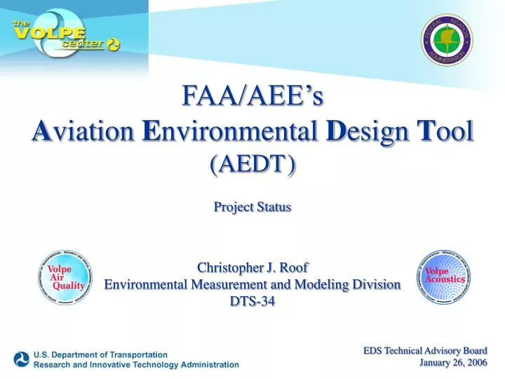
FAA/AEE’s A viation E nvironmental D esign T ool (AEDT ) Project Status Christopher J. Roof Environmental Measurement and Modeling Division DTS-34. EDS Technical Advisory Board January 26, 2006. Presentation Outline. Overview of FAA/AEE Tool Suite Need for AEDT Project Team

E N D
FAA/AEE’sAviation Environmental Design Tool(AEDT)Project StatusChristopher J. RoofEnvironmental Measurement and Modeling DivisionDTS-34 EDS Technical Advisory Board January 26, 2006
Presentation Outline • Overview of FAA/AEE Tool Suite • Need for AEDT • Project Team • Project Status • - Database Harmonization • - Prototypes • Schedule • Closing Remarks
New Toolset Definitions Environmental Design Space (EDS)An aircraft systems model that integrates engine and aircraft design with aircraft operations to examine environmental performance and technology development providing a single source of aircraft data to AEDT. Aviation Environmental Design Tool (AEDT)Merging of existing tools and new modules into both a publicly available, regulatory/planning component (Local) and the policy component of AEDT (Global). Aviation Environmental Portfolio Management Tool (APMT)The economic analysis capability to be integrated with AEDT and EDS.
Overview of AEE Tool Suite Vehicle Noise Design Tools EDS What are the environmental implications of this design? Technology Impact Forecasting Vehicle Emissions Design Tools Design Tools Interface Vehicle Cost Assessment
Overview of AEE Tool Suite AEDT EDS Vehicle Noise Design Tools Airport-level Noise Tools Airport-level Emissions Tools Technology Impact Forecasting Vehicle Emissions Design Tools Vehicle Noise/Emissions /Performance Characteristics Design Tools Interface Global Emissions Inventories Global Noise Assessment Vehicle Cost Assessment What are the costs associated with this design? and What are the benefits in implementing this design?
Overview of AEE Tool Suite AEDT Vehicle Noise Design Tools EDS Airport-level Noise Tools Airport-level Emissions Tools Technology Impact Forecasting Vehicle Emissions Design Tools Vehicle Noise/Emissions /Performance Characteristics Design Tools Interface Global Emissions Inventories Global Noise Assessment Vehicle Cost Assessment APMT Environmental Exposure Characteristics Microeconomic Assessment Tools Macroeconomic Assessment Tools Vehicle Cost Characteristics Cost/Benefits of Options
The Need for AEDT • DOT 2004 R&D Annual Review • FAA 2005-2009 Flight Plan(http://www1.faa.gov/aboutfaa/flightplan.cfm) • Joint Planning and Development Office • Next Generation Air Transportation System “Ensure aviation remains a good neighbor.” “Develop better technologies and analytical tools to evaluate aircraft noise and emissions.” “Create new analytical tools to understand better the relationship between noise and emissions, the different types of emissions, and the costs and benefits of different policies and actions.”
The Need for AEDT • FAA’s lead role in ICAO CAEP (e.g., noise and NOx stringency) • FAA’s regulatory obligations for legacy tools: • - EDMS (CAEP, NEPA, SIPs, etc.) • - INM (CAEP, Part 150, NEPA, Air Tour Management Act of 2000, etc.) • - MAGENTA (CAEP, DOT Noise Performance Goal, etc.) • - SAGE (CAEP, FAA Flight Plan Goal, UN Framework Convention on Climate Change, etc.) • Tradeoffs and interdependencies (e.g., A380/Trent) • Society of Automotive Engineers Aircraft Noise Committee (A-21) • (expanding role to include emissions and interdependencies) • Better use of R&D funds • Assessing environmental effects of air traffic initiatives, e.g., CDA, RVSM, etc.
Project Team • FAA Office of Environment and Energy (AEE) • Volpe Center (Lead Systems Integrator) • ATAC Corp. • CSSI, Inc. • Wyle Laboratories • Georgia Tech • MIT • (NASA / Industry) AEDT EDS/APMT
Project Status - Database • Three Primary Global Databases - Fleet Database - Movements Database - Airports Database • Redesigned database structure to support all legacy tools (i.e., INM, EDMS, MAGENTA, SAGE) • Data harmonized across legacy tools • Harmonized with available international sources
Airports Database Main Airports Database Runways Tracks / Track Segments Helipads Operations Entry Fix Points Capacities Navaids Detailed Layouts Weather • “Specialized”-Data that needs to be acquired on an airport-by-airport basis. Usually compiled for local models. Some examples are trajectories, area population, and airport boundaries. “General”- Data already existing in global airport databases. Some examples are airport reference point (ARP) positions, runways, and navaids.
Airports Database • Main Airports Database • Sources • Legacy (EDMS, INM, MAGENTA, SAGE) – Current State • DAFIF (Digital Aeronautical Flight Information File) - Enhancement • NASR (National Airspace System File) - Enhancement • Size • ~4 MB • ~35,000 Records
Airports Database • Main Airports Database
Airports Database • Main Airports Database
Airports Database • Runways Database • Sources • DAFIF (Digital Aeronautical Flight Information File) - Enhancement • NASR (National Airspace System File) - Enhancement • Size • ~2 MB • Runways for ~20,000 Airports • ~25,000 Runways Total
Airports Database • Runways Database
Airfield Layouts Database (GIS) • Potential Sources (Enhancements): • Satellite imagery • Space Imaging LLC • Jeppesen • Size: TBD • Proposed Content: • Gates and apron markings (points) • Buildings (polygons) • Taxiways (lines) • Roadways (lines) • Parking Lots/Structures (polygons) • Helipad markings/touchdown points
Airports Boundary Database (GIS) • Potential Sources (Enhancements): • US: • Census TIGER/Line Files • Geographic Data Technology (GDT) Database • 2000 Census • Non-US: • Digitize Paper Maps • Satellite Imagery (Space Imaging LLC) • Airport provided (few) • Approximation • Size: • Current: Shell 1 US (~100 airports) and Shell 2 US (~280 airports) • Needed: • non-US Shell 1 non-airport-provided (~90 Airports) • Shell 2 (~1200 non-US)? • Proposed Content: • Boundary (polygon)
Population Database (GIS) • Sources (Enhancements): • US: 2000 Census • Non-US: • Joint Resources Assessment Database System (JRADS), • Gridded Populations of the World (GPW) • Global Rural Urban Mapping Project (GRUMP), • Landscan • Airport-provided or National Census data (expensive) • MapInfo European population databases • Size: Large • Shells 1 and 2 currently • Content: • Polygons: JRADS • Raster: GPW, GRUMP, and Landscan
Project Status - Prototypes • Two Prototypes Currently Underway - NOx Prototype - Continuous Descent Profile (CDA) Prototype • Redesigned computational modules, e.g., aircraft performance, emissions, fuel burn • Harmonized common modules across legacy tools • Integrated common modules across legacy tools
CDA Prototype • Objective: Develop a modeling capability to quantify the environmental benefits of CDA • Develop generic methodology for modeling baseline (existing) approach profiles • Develop generic methodology for modeling CDA approach profiles • Conduct comparative assessment of baseline/CDA approaches – quantify benefits (i.e., noise, emissions, fuel burn)
CDA Prototype - Baseline DRAFT
CDA Prototype - Baseline DRAFT
CDA Prototype - Baseline DRAFT
CDA Prototype - Baseline DRAFT
CDA Prototype - Baseline DRAFT
CDA Prototype - Summary • Developed baseline approach modeling methodology using LAX as a test-bed • Expand analysis beyond LAX to help quantify necessary scope • Initiated validation and verification (V&V) activity to assess new standalone aircraft performance modules ability to accurately model approach (e.g., level flight): • - Over 1,000 flight operations quality assurance (FOQA) operations from a major European carrier • - Several hundred (FOQA) operations from various U.S. sources, include airlines and NASA test aircraft • CDA implementation to focus on nighttime operations at low volume airports – at least initially
Closing Remarks • Continued global leadership in environmentally responsible aviation • Ability to optimize environmental benefits and tradeoffs of proposed actions and investment • More effective R&D portfolio management • Ability to analyze multi-dimensional environmental constraints to capacity growth • Quantify uncertainty associated with complex environmental policy decisions (i.e., validation) • Improved/harmonized data and analysis on airport/airspace capacity projects • Increased capability to address noise and emissions interdependencies in the resolution of community concerns • Cost savings for the environmental user community, as well as for others (e.g., streamlined noise/emissions analyses with common inputs)
Questions or comments? Christopher J. RoofUS DOT Volpe CenterEnvironmental Measurement and Modeling Division(617)494-6344roof@volpe.dot.gov
Definitions/Acronyms • CAEP – Committee for Aviation Environmental Protection • DOT – Department of Transportation • EDMS – Emissions and Dispersion Modeling System • FAA – Federal Aviation Administration • ICAO – International Civil Aviation Organization • INM – Integrated Noise Model • MAGENTA - Model for Assessing Global Exposure form Noise of Transport Airplanes • NEPA – National Environmental Policy Act of • RVSM – Reduced Vertical Separation Minimum • SAGE – System for assessing Aviation’s Global Emissions • SIP – State Implementation Plans