Download

1 / 23
230 likes | 371 Vues
Choose to view chapter section with a click on the section heading. The History of Oceanography – Why Study It? Ancient Uses and Explorations (5000 B.C. - 800 A.D.) The Middle Ages (800 A.D. - 1400) European Voyages of Discovery (1400 - 1700) The Birth of Marine Science (1700 – 1900)

E N D
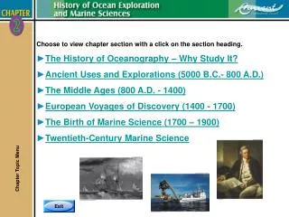
Choose to view chapter section with a click on the section heading. • The History of Oceanography – Why Study It? • Ancient Uses and Explorations (5000 B.C. - 800 A.D.) • The Middle Ages (800 A.D. - 1400) • European Voyages of Discovery (1400 - 1700) • The Birth of Marine Science (1700 – 1900) • Twentieth-Century Marine Science Chapter Topic Menu
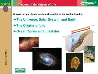
Why Study It? • Three very good reasons to learn the historyof oceanography: • 1. The history of oceanography is connected to the world’soverall history. • 2. Oceanography’s past helps us understand why and howpeople apply marine sciences today. • 3. It is interesting. • The history of oceanography can be dividedinto four stages: • 1. Ancient Uses and Explorations (5000 B.C. - 800 A.D.) • 2. The Middle Ages (800 - 1400) • 3. European Voyages of Discovery (1400 - 1700) • 4. The Birth and Growth of ModernMarine Science (1700 - present) The History of Oceanography – Why Study It? Chapter 2 Pages 2-2 & 2-3
Prehistory and the Rise of Seafaring • Three primary reasons for early civilization to interact with the ocean: • 1. To obtain food. • 2. To discover new lands. • 3. As a means of trade. • The earliest recorded sea voyage appears to be 3200 B.C. under the auspices of Egyptian Pharaoh Snefru. Ancient Phoenician Explorations and Discoveries • The Phoenicians contributed to ocean exploration by establishing the first trade routes throughout the Mediterranean, even as far north as Great Britain. Ancient Uses and Explorations (5000 B.C. – 800 A.D.) Chapter 2 Pages 2-4 to 2-6
Ancient Polynesian Explorations and Discoveries • The significance of Polynesian seafaring is that it is the earliest known regular, long-distance, open-ocean sailing beyond sight of land. • Spreading eastward from Fiji, Tonga, and Samoa, Polynesianssettled islands in an area of about 26 million square kilometers (10 million square miles). Ancient Uses and Explorations (5000 B.C. – 800 A.D.) Chapter 2 Pages 2-7 & 2-8
Ancient Greek Explorations and Discoveries • The Greeks used references on shore to navigate. This is called piloting. • As seafaring advanced they learned to use the sun, constellations, the North Star and sea conditions to navigate in the open ocean. • The Greeks knew the Earth was a sphere, not flat. • Pytheas (314 B.C.) noted that he could predict tides in the Atlantic based on the phases of the moon. • He could determine how far North or South one was from the North Star by measuring the angle between the horizon and the North Star. This was a significant improvement in navigation. • Eratosthenes (264-194 B.C.) is credited with two contributions: • 1. He calculated the Earth’s circumference. • 2. He invented the first latitude/longitude system. Ancient Uses and Explorations (5000 B.C. – 800 A.D.) Chapter 2 Pages 2-8 & 2-9
The Greeks Excelled at Mapmaking • In 127 B.C., Hipparchus improved Eratosthenes’ mapsby inventing the regular grid system. • In 450 B.C., Herodotus published a detailed history ofGreece’s struggles with the Persian Empire. This workwas significant because it was one of the earliest publishedmaps of the world the Greeks knew. • In 63 B.C.-24 A.D., Strabo published a 17-book workcalled Geographic that contained a map expandingknowledge/accuracy about the world. • Inc. 100-168 A.D., Ptolemy developed the first knownmap to show a portion of the Earth as a sphere onflat paper. • It showed latitude/longitude by dividing the grid intodegrees, minutes, and seconds of the arc. Ancient Uses and Explorations (5000 B.C. – 800 A.D.) Chapter 2 Pages 2-9 & 2-10
Latitude/Longitude System • The purpose of the latitude and longitude mapping systemis to identify specific locations on the Earth’s surface. • Latitude Lines • Also called parallels • Run east-west • 0º parallel is also called the equator • Longitude Lines • Also called meridians • Run north-south • Prime Meridian is located on the longitude ofthe Royal Naval Observatory in Greenwich, England. • Further Accuracy • Degrees are subdivided into 60 minutes, minutes aresubdivided into 60 seconds. Ancient Uses and Explorations (5000 B.C. – 800 A.D.) Chapter 2 Pages 2-12 & 2-13
The European Middle Ages • Also known as the Dark Agesbecause during this time further advancements in the knowledge of geography and science were suppressed in Europe. • Little ocean exploration by Europeans was made, only trade continued. Viking Explorations and Discoveries • The Vikings were the only people with significant exploration taking place in Europe during the Dark Ages: • They established trade routes throughout Britain, Ireland, Southern Europe, North Africa, and Central Asia. • In the 9th century there was a global warming that freed the North Atlantic of ice allowing the Vikings to explore westward discovering Iceland, Greenland, and North America. The Middle Ages (800 A.D. – 1400) Chapter 2 Pages 2-16 & 2-17
Chinese Explorations and Discoveries • The Chinese were very active explorers during the Middle Ages and were responsible for many important contributions. • Probably the most important of their discoveries was the magnetic compass dating about 1000 A.D. and in widespread use about 1125. • Europe’s first reference to the compass was in 1190 in a poem, but was not widely used until the 1400s. • By the mid 1400s in China shipbuildingwas well established. • Chinese ships from that period had central rudders and watertight compartments – these are part of today’s modern ships. The Middle Ages (800 A.D. – 1400) Chapter 2 Pages 2-18
The End of the Middle Ages and a Route Around Africa • The period of 1400-1700 is called the Renaissance. A new interest in long ocean expeditions and travel in the 15th century was motivated by economics, politics and religion. • Three explorers tried to establish a route to the East around Africa: • The first of these was Prince Henrythe Navigator of Portugal in the early 1400s. He went down the west coast of Africa, but did not find a route around the Cape of Good Hope. • The second was Bartholomeu Dias who completed a voyage around the Cape of Good Hope in 1487, but did not make it all the way to India. • The third was Vasco da Gamma. In 1497 he led the first expedition around the Cape of Good Hope all the way to India. European Voyages (1400-1700) Chapter 2 Pages 2-19 & 2-20
Exploration of the New World • Christopher Columbus took the first of his four voyages to find aroute to Asia in 1492. He believed he’d found Asia when he landed on aCaribbean island. • Between 1454-1512, Amerigo Vespucci voyaged to South America. He explored much of the east coast, the mouth of the Amazon River, and is credited as the first European to recognize that South America was a new continent. The Americas are named in honor of Vespucci. • In the early 1500s, Vasco Nuñez de Balboa led an expedition that crossed the Isthmus of Panama and discovered the Pacific Ocean. Balboa was the first European to sail in the Pacific. • News that the Pacific lay beyond the Americas renewed the hope that one could sail around the world west-to-east. European Voyages (1400-1700) Chapter 2 Pages 2-20 & 2-21
Exploration of the New World (continued) • In 1519, Portuguese explorer Ferdinand Magellan led the first expedition to circumnavigate the world. He had five ships and about 260 men. • Magellan died in the Philippines in a fight with islanders. • One ship and 18 men completed the journey in 1522. Three year journey !! • The second successful circum-navigation of the world was made in 1577 by Francis Drake. • He left England for the New World with the purpose of raiding Spanish ships and settlements for treasure. • Drake returned to England in 1580 where he was knighted for his exploits as well as for bringing back treasure and spices worth a fortune. European Voyages (1400-1700) Chapter 2 Pages 2-21 & 2-22
Cook’s Expeditions • The voyages of Captain James Cook receive credit asthe first sea expeditions devoted to methodical,scientific oceanography. • His reports changed the western view of the world. • He discovered Australia, New Zealand,many islands in the South Pacific, the Hawaiian Islands, the West Coast of the US and Canada, the Bering Strait andthe Antarctic Circle. • A major contribution to Cook’s voyageswas the invention of the chronometer. • In 1735, John Harrison invented a clockthat runs accurately at sea. This made itpossible to determine longitude accurately. The Birth of Marine Science (1700-1900) Chapter 2 Pages 2-23 to 2-26
The United States Exploring Expedition • Under command of Lt. Charles Wilkes, it was one of the first significant scientific expeditions launched by the US. • The objective was to explore the southern Atlantic and Pacific Oceans, to collect specimens, and to map, illustrate and provide text to document their discoveries. • The most outstanding achievement of the US Exploring Expedition was proving the existence of Antarctica. The Father of Physical Oceanography Matthew Maury • Between 1842-1855, Matthew Maury published many detailed works on sea navigation. He earned global acclaim for his work and his data was adopted worldwide. • In 1855, he published The Physical Geography of the Sea, which is now considered the first textbook on modern oceanography and he is remembered today as thefather of physical oceanography. The Birth of Marine Science (1700-1900) Chapter 2 Pages 2-27 & 2-28
Darwin and the H.M.S. Beagle • The Beagle began it’s five-year voyage with Charles Darwin as the ship’s naturalist in 1831. The H.M.S. Beagle ultimately circled the Earth. • Darwin noted that coral grows in relatively shallow, warm, upper depths. • But, coral reefs extend deeper thancoral grows. Darwin observed themassive reefs must form when thesea floor slowly sinks and coral grows upward from its base to remain in shallow water. • Darwin is renowned for his theories on natural selection and the evolution of species. • In 1859, he published The Origin of Species. The Birth of Marine Science (1700-1900) Chapter 2 Pages 2-28 & 2-29
The Challenger Expedition • The Challenger expedition (1872-1876), is known and recognized as the first devoted entirely to marine science. • The two men responsible for the mission were Scottish professor Sir Charles Wyville Thomson and British naturalist Sir John Murray. • Among its accomplishments and discoveries, the expedition: • Took the first soundings deeper than 4,000 meters (13,123 feet) – 8,200 meters (26,900 feet) in the Marianas Trench. • Captured biological samples in midwater and along the bottom with a towed device. • Discovered marine organisms in the deepest parts of the ocean, contrary to popular belief at the time. • Sampled and illustrated plankton in various habitats and depths not previously studied. • Cataloged and identified 715 new genera and 4,717 new species. The Birth of Marine Science (1700-1900) Chapter 2 Pages 2-30 & 2-31
The Oceanography Explosion • The Industrial Revolution spearheaded the growth and expansion of marine sciences. This included: • Better ships made of iron with steam engines. • Improvements in the design and building of research equipment. • The advent of the submarine. • Global conflict helping to accelerate research in science and technology. Three Expeditions • The German MeteorExpedition (1925) • Crossed the Atlantic 14 times in two years. • Data collected established patterns for oceanwater circulation, nutrient dispersal, andplankton growth. • Primary accomplishment was mapping the Atlantic seafloor withecho-sounding technology. Twentieth-Century Marine Science Chapter 2 Pages 2-33 & 2-34
Three Expeditions (continued) • The United States Atlantis Expedition – 1931 • The first ship specifically designed and built for ocean studies. • Atlantis added to the work of the Meteor as well as confirmed the existence of theMid-Atlantic Ridge and mapped it. • The H.M.S. Challenger II Expedition – 1951 • Mission to measure the depths of the Atlantic,Pacific, and Indian oceans. • Used eco-sounding technology for mapping. • Challenger II’s most noted discovery wasfinding the deepest known part of the ocean. At 10,838 meters (35,558 feet) deep,this is still the deepest known place in the world. • This spot, located in the Marianas Trench, wasnamed Challenger Deep in honor of thefirst Challenger expedition. Twentieth-Century Marine Science Chapter 2 Page 2-35
Submersibles and Self-Contained Diving • How the oceans were studied was changed forever by the submersibles and self-contained diving. • Instead of grabbing samples blindly, a scientist couldpick specific ones. • Scientists could take delicate samples without damagingthem and living organisms without killing them. • Scientists can directly observe the geology, life, andother phenomena without taking any samples. Submersibles • Three types of submersibles used for underwater research: • Bathysphere - operated only vertically. • Bathyscaphe - operated much like a blimp air ship by releasing ballast and had a small electric motor to give it limited horizontal mobility. • Deep-diving submersibles - state of the art today, far less fragile than bathyscaphes, easier to launch and use in rough seas. This makes them suitable for more varied types of research. Some even have robotic arms. Twentieth-Century Marine Science Chapter 2 Pages 2-36 & 2-37
Self-Contained Diving • In 1840, Augustus Siebe introduced the first practical diveequipment; hard-hat diving that supplied air from the surfacethrough a hose. • Used mainly for underwater construction, salvage, and shipmaintenance. Limited because it is heavy and requires asupport team and vessel. • In 1878, Englishman Henry Fleuss introduced the first workableself-contained underwater breathing apparatus, called scuba today. • In 1943, Jacques Cousteau introduced the first practical scuba. Twentieth-Century Marine Science Chapter 2 Pages 2-38 to 2-42
ROVs, AUVs, Electronic Navigation, and Satellites • Technology such as electronics and space travel have providedfour important contributions to oceanography: • 1. Remotely Operated Vehicles (ROVs) became common in thelate 1970s. • A ROV is a small, unmanned submarine with propellers, video camera,and an umbilical to the surface. • ROVs are an economical way to match the capability of a submersibleand the dexterity of a scuba diver. • 2. Autonomous Underwater Vehicles (AUVs) • AUVs are untethered robotic devices propelled through the water by self-contained power systems. • Piloted by an onboard computer, AUVs are launched from the surfaceand are maneuvered in three dimensions. • AUVs sample the ocean along precise preprogrammed underwater paths. • 3. The first electronic navigation came into use in the late 1960s. • LORAN (LOng RAnge Navigation), later called Loran-C, used land basedradio transmitters along the coasts. However, accuracy varied with distancefrom the transmitters. The farther from a transmitter the less accurateis the position. Twentieth-Century Marine Science Chapter 2 Pages 2-43 to 2-45
ROVs, AUVs, Electronic Navigation, and Satellites (continued) • 4. Satellites – sea surface observations. • Satellites orbit the Earth and assist oceanographerswith global observations of the oceans. • Satellites assist oceanographers in understanding theinfluence and effect of the oceans on the globalclimate systems. • Information gathered from satellites helps to validatecomputer models that numerically simulate climatic events. • 5. In the 1990s, GPS (Global Positioning System) replaced the Loran. • GPS is based on signals from orbiting satellites and works everywhereon Earth, all the time, in all weather and is more accurate – to within1-2 meters (3-6 feet). • Electronic navigation has been very important for oceanographers: • Scientists know where they are when they take samples or conduct research. • They can provide this information to other scientists who need to conduct research in the same location. • Makes navigation significantly more accurate and easy. Twentieth-Century Marine Science Chapter 2 Page 2-45
ROVs, AUVs, Electronic Navigation, and Satellites(continued) • How GPS works. • GPS uses triangulation to accurately determine a positionon Earth. Satellite 1 transmits its location and time. Thisprocess is repeated for 2 and 3. Where the three signalsmeet at the GPS is its location expressed in specific coordinates. • Satellite 4’s signal is required to obtain the elevation of theGPS unit. In the 1990s, GPS replaced Loran. • GPS is based on signals from orbiting satellites and workseverywhere on Earth, all the time, in all weather and is accurate– to within 1-2 meters (3-6 feet). • Three types of sea surface observations made by satellites to benefit oceanographers: • 1. Provide long-time continuous measurements of variables such as sea-surface height, shape, temperature, and color over the entire planet. • 2. Can detect algae blooms and river plumbs, monitor pollution, and assist oceanographers in understanding the influence and effect of the oceans on the global climate system. • 3. Can look at very large areas of the world in a very short period of time. Twentieth-Century Marine Science Chapter 2 Page 2-46