Download

1 / 33
330 likes | 333 Vues
CapStat is a project developing an interoperable architecture and web services for regional data exchange. It aims to establish a secure network for applications to work together, publish seamless GIS maps, and share situation notifications in real time.

E N D
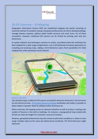
CapStat GIS Overview September 22, 2005
Agenda • CapStat Project Introduction • Technology Overview • GIS Issues • GIS Committee relationships • Demonstration • Discussion
What is CapStat? • A project to develop an interoperable infrastructure for data exchange • A concept for the interoperable architecture & suite of web services • Technology to implement the architecture & web services (ESB, GIS, Fast Data Search) • Joint effort among DC & NCR jurisdictions • Funded by a DHS grant of $976K • Completed by March 2006
Project Scope • Establish secure network that enables applications to work together and exchange information on regional basis – regional Enterprise Service Bus (ESB) • Connect the District and selected NCR partners using this regional network • Publish seamless GIS situation map of NCR with coordinated content from CapStat partners • Post relevant E-911 incident calls to shared NCR GIS situation map on real-time basis • Publish situation notification: news and weather alerts with content collected from databases, web sites (e.g. NOAA) and syndicated news wires
DHS/Emergency Issues & Requirements • Security • Authentication • Real time data management • Managed routing • Guaranteed delivery • Penetrate firewalls • Emergency data exchange vs public web service
Interface Web Services Messaging XML Schema Delivery Network Governance, Semantics Service Oriented Architecture ESRI ArcIMSWeb Feature Service SonicEnterpriseService Bus GML, NIEM, NCR &Jurisdiction Schemas
Business Value of SOA • Broaden business integration – partners • Deepen business integration – outsourcing • Reduce data communication cost • Faster process change • Reduce cost of change • Accommodate uneven rates of change • Speed!
What are Web Services? • Application component interfaces that: • Communicate via open protocols (HTTP, SMTP, etc) • Process XML messages framed using SOAP • Describe its message using XML schema • Provide an endpoint description using WSDL • Can be discovered using UDDI • Standalone service
XML • eXtensible Markup Language • Provides a universal data format that lets data be easily adapted or transformed • Example: • <?xml version="1.0" encoding="UTF-8"?> • <addr1 version=“1.0"> • <request type="validate"> • <ADDRESS> • <BLDGNUM>1350</BLDGNUM> • <STREETNAME>Pennsylvania Ave</STREETNAME> • <QUAD>NW</QUAD> • </ADDRESS> • </request> • </addr1>
GML • XML based language for exchange of geographic data • Uses XML schemas to define the geometry elements needed to encode geographic elements • Supports spatial & non-spatial properties • Works on browser • Custom map styling • Editable maps • Sophisticated linking capabilities
What is an Enterprise Service Bus (ESB)? • Standards-based integration platform that enables applications to reliably work together and exchange information • Support for legacy applications • Sonic ESB services • Message quality of service • Intelligent routing • Data transformation
ESB Functional View J2EE Applications .NET Applications Packaged Applications GIS DHSSchemas XSD Jurisdiction Message Schema ESB Process Flow Security Publish/Subscribe NCRSchemas XSD Transform Validate Exception Handling Jurisdiction Message Standards Load Balance Routing Federated Management SOAPMessage Web Services Relational Databases Message Bus
New Bus Architecture SCM SQL Access Oracle DB Query Web Server Proxy Data Tier Address Verifier Business Logic Tier
NCR Situation Map Regional Enterprise Service Bus CapStat Web Services Fairfax County District of Columbia GIS CAD CapStat CapStat GIS EDW BI WebEOC ESB SRC CAD ESB WebEOC Fast Search Montgomery County GIS WebEOC ESB CAD CapStat Situation Notification/Alert Internet Monitoring Additional CapStat Partners
Example Regional Services • Enterprise Search Engine • Web sites, Media feeds (RSS), District databases • Alert generation: triggers, actionable information • EPA Hazmat data • Weather observations • District 311/911 data • District address validation • Spatial services: radius search, nearest neighbor
SOA Benefits to Regional Interoperability • Publish services • Publish data “as is”, transforming • Content meaning • Versions • Owner controls access, distribution • Security, authentication, encryption • Guaranteed message delivery • Traverse firewalls
How Fast Can Government Respond? • How fast can government… • Move resources where needed? • Make a decision when asked? • Engage teamwork when needed? • Change course when needed?
Emergency GIS Operations • “Normal” pre-event data exchange (MEDS) • Periodic exchanges • Ad-hoc requests • Emergency event operations: • Updates to pre-event data • Real time event data • Real time additional data acquisition
General GIS Use Cases • Publish GIS data for external use • Download/access data form other jurisdiction • Push update data to another jurisdiction • Request data from another jurisdiction • Exchange event report/situation data • Exchange data for real time collaboration • Monitor location of event data to recognize alert condition
GIS Issues • ESRI software relationships • Map/image service, feature/vector service • OGC-GML (2, 3.0/1), catalog standards • NIEM standards • MEDS determination • Real time emergency event data • Compose map from multiple GMLs • Consume external jurisdiction data
Related Projects & Systems • National Capital Region Interoperability Program-overall interoperability throughout the region • WebEOC system-widely used incident management system with GIS interface • Maryland EMMA/MEGIN capabilities-ESB handle actual data movement
GIS Committee Roles • Determine MEDS content • Determine GIS exchange processes, rules, policies • Agree upon standards • Establish web service development methods • Share development responsibilities • Participate in ESB & web service training
Jurisdiction Roles • Determine web services to be provided to NCR • Develop jurisdiction web services • Publish jurisdiction GIS data • Consume external data in jurisdiction applications • Determine ESB administration parameters
Demonstration Scenario • Introduce & show Mobile View application • Describe Mobile View-ESB relationship & highlights • Examples of diagrams & code of ESB operation
About MobileView • Objective: Provide mobile workers in the District access to strategic DCStat data and services • Integrates databases from multiple agencies : • Property owners, tax and vacant housing • Housing complaints • Citations for housing violations • Resident requests for city services • Crime incidents • Search and GIS spatial analysis functions • Optimized for Microsoft PocketPC PDA over wireless connection
Bus Process Orchestration • Application services • Message channels (queues & endpoints) • Intelligent routing rules • Message transformations
Intelligent Routing • Eliminates need to return to broker between process steps • Route messages through applications based on message body content • Transform Message • Reshape message content between MobileView XML document message and signatures expected by web services • Filtering, security • Demo example includes both .NET and Java web services
Transformation • Mobile View employs Mini-MAR address validation service and database • DC has a new MAR V1 validation service and database now available • Without changing the Mobile View application the EBS can transform the validation request from the Mini-MAR to MAR • Example address not present in Mini-MAR database now available in MAR