Download
1 / 22
220 likes | 224 Vues
This study examines the relationship between fire and climate in the Western Sierra Nevada region. It analyzes fire history data, vegetation composition, and species diversity to understand the impact of fire regimes on forest stands. The study also compares pre-settlement composition estimates with current stand composition and explores variability in forest composition between plots. Additionally, the study extends the fire record in the Circle Meadow area back to approximately 600BC.

E N D
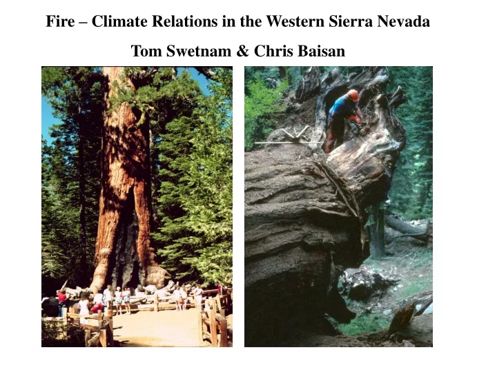
Fire – Climate Relations in the Western Sierra Nevada Tom Swetnam & Chris Baisan
Colony Mill, Giant Forest Open pine stand Tree sampled for fire history in 1992
Vegetation, species composition plot data: • Compare pre-settlement composition • estimates with current stand composition. • Relate pre (and post) settlement composition • with fire regime characteristics among and between • plots, sites, and transects. Giant sequoia fire record in the Circle Meadow area now extended back prior to ~600BC with some replication. High variability in forest composition between plots Estimates of b.a. increase from pre-settlement condition varied from 0 to 100%. Average increase ~50%.
Helispot fire history site Elevation 1350m MFI ~6yrs Plot species composition
Four Fire-Scar Networks in Western U.S 1. East Cascades, 2 watersheds, 723 trees, Everett et al. 1999, For. Ecol. & Manage., In press. 2. Blue Mountains, 4 watersheds, 628 trees, Heyerdahl 1998 PhD diss., Univ. Wash. 3. West Slope Sierra Nevada, 4 elevational transects, 49 sites, 446 trees, Swetnam & Baisan, In Press. 4. Southwestern US, 63 sites, 1,215 trees, Swetnam and Baisan 1996, USFS RM-GTR-286:11-32. 2
A. L. Westerling, T. J. Brown, A. Gershunov, D. R. Cayan, and M. D. Dettinger. Long lead statistical forecasts of area burned in western U.S. wildfires by ecosystem province. International Journal of Wildland Fire 11:257-266. 2002
Composite fire scar chronologies from 10 forest stands In the Jemez Mountains, New Mexico
Fire-scar chronology from Gila Wilderness, in Southwestern New Mexico. Swetnam and Baisan. In press. Fire and climate history in the Sierra Nevada, California and Southwestern US, Veblen et al., Fire and Climate in the Western Americas, Springer-Verlag, Ecol. Studies Series.
Fire-scar chronology from Sierra San Pedro Martir from Stephens, Skinner and Gill, in review.
Dead and dying trees from a combination of drought stress and bark beetle attack. Area affected is now > 500,000 acres. This may become one the largest bark beetle outbreaks in recorded history in North America. Data from USDA FS Forest Health Protection, Arizona Zone, Entomology & Pathology group.