Download
1 / 32
320 likes | 404 Vues
Landforms and Resources. China covers about 80 percent of East Asia’s land area and has the world’s largest population . The rest of East Asia is shared by Japan, Taiwan, North and South Korea, and Mongolia.

E N D
China covers about 80 percent of East Asia’s land area and has the world’s largest population. The rest of East Asia is shared by Japan, Taiwan, North and South Korea, and Mongolia.
Along the coast of East Asia, many peninsulas and islands dot the westernmost Pacific Ocean. Shandong, Leizhou, and Macao Peninsulas are found off the east coast of China. Because of the peninsulas China has a very long coast line and many wealth port cities, like Shanghai. To the east of China is the Korean Peninsula, which contains North and South Korea. The South China Sea carries one-third of the world’s shipping traffic.
A continental shelf off the coast of China is the reason for the islands located there. The isolation of these islands has permitted them to develop in greater security. Hainan and Hong Kong belong to China, While Japan and Taiwan are separate nations. The Island of Hong Kong was originally part of China but controlled by Great Britain until 1997. Taiwan once belonged to China, and even though it is recognized as a separate nation China still claims it.
The islands of Japan and Taiwan are part of the Pacific Ring of Fire, a circle of volcanoes bordering the Pacific Ocean. Plate movements there cause frequent, violent earthquakes and volcanic eruptions.Japan has more than a thousand minor earthquakes every year.
High mountains limit contact between China and the rest of Asia. Kunlun Mountains are the source of China’s two greatest rivers the Huange He (Yellow) and the Chang Jiang (Yangtze). The Quinling and Shandi Mountains divide the northern part of China from the south. The landscape of the western region causes the region to be under populated.
Japan and Taiwan have mountainous interiors surrounded by coastal plains.Mount Fuji is a dramatic peak rising above the central plains of Honshu, Japan’s biggest island.
The Plateau of Tibet in southwest China is East Asia’s highest plateau region with an elevation of about 15,000 feet. The Mongolian Plateau consists mainly of grassy pastures ideal for grazing.
The largest desert in East Asia is the Gobi Desert, it spans from northwest China into Mongolia. It is a prime region for finding dinosaur fossils, since thousands of these animals roamed through the region millions of years ago.
China’s major rivers originate high in the Plateau of Tibet and flow eastward to the Pacific Ocean.China has three great rivers, which have been critical to the development of China’s civilizations. They feed hundreds of millions of people because of the fields and crops they irrigate. Huang He or Yellow River of northern China is 3,000 miles long and empties in the Yellow Sea. The sea and river get their name from the yellow silt they carry. Carried eastward and deposited by the river, this rich soil makes the North China Plain an agriculturally productive area. A nickname for the river is “China’s Sorrow” because of the floods it has caused.
The Chang Jiang or Yangtze River (which means “long river”) is the longest river in Asia at 3,900 miles long. It flows through gorges and plains and empties into the ocean at Shanghai. Xi Jiang or West River runs through southern China and joins up with the Pearl River. It flows into the South China Sea, where it has created a huge, fertile delta. The Grand Canal– the world’s longest artificial waterway–connects Hangzhou in the south to Beijing in the north.
Japan and Korea have short, swiftly flowing rivers with spectacular waterfalls. These rivers provide hydroelectric power.
The Chinese concept of feng shui guides architects, contractors, and decorators to design and build structures that harmonize with surrounding landforms.
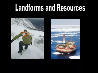
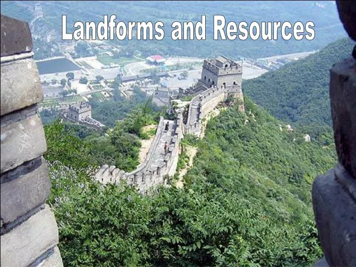
Natural resources are distributed unevenly throughout East Asia. Some countries are rich in resources like China and North Korea, other lack resources like Japan, South Korea and Taiwan. China’s population is centered in the East near river basins and good farmable land. Here they grow rice among other crops. Timber is another resource found in most of the countries of East Asia. Japan has been able to keep most of their forest in reserve by buying timber and other forest products from other places. China has large energy reserves of petroleum, coal, and natural gas. China’s resources has enabled it to be self sufficient. Japan’s shortage of resources has forced it to trade for what it needs.
The rivers provide crop irrigation, hydroelectric power, and transportation. People in East Asia look to the sea for food. Japan has one of the world’s largest fishing industries.
Climate and Vegetation
High Latitude Climate Zones Subarctic climates are found along Mongolia’s and China’s border with Russia. Highland climates are found mostly in Western China. Mid-latitude Zones Humid Continental can be found in Northeastern China, North Korea, northern South Korea, and northern Japan. Humid Subtropical can be found in Northeastern China, southern South Korea, southern Japan, and northern Taiwan.
Typhoon- a tropical storm that occurs in the western pacific.
Dry Zones Semiarid found in parts of the Mongolian Plateau. Most deserts are found in the west central area. Taklimakan Desert is located in western China. Gobi Desert is located in northern China and southeast Mongolia. Tropical Zones Tropical Wet – found along China’s southeast coast .
In the eastern half of the region, forests consist of evergreen and deciduous trees. Bamboo grows abundantly in warmer areas and is the only food source for rare mammals, such as giant and red pandas. People in the region use bamboo in numerous ways, from medicines to material for bridges. The Chinese have cultivated rice and soybeans for seven thousand years. These are two of their staple foods. Tea and mulberry leaves also play a major role in the culture and economy of East Asia. Summer monsoons blow from southeast to northwest, causing soaking rains Farmers depend on the summer monsoon rains for their crops.
Human-Environment Interaction
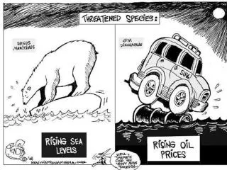
Rising standards of living and growing economies have resulted in greatly increased demands for electric power in East Asia. Most of East Asia’s power comes from the burning of fossil fuels. China, North Korea, and Mongolia are able to rely on their coal reserves for power. Japan, South Korea, and Taiwan are all heavily industrialized but have few coal or oil deposits. To keep their economy booming they must adapt and import fossil fuels.
Aware of the damage that fossil fuels inflict on the environment, East Asians have begun to search for cleaner sources of power. Japan, South Korea, and Taiwan rely on nuclear energy for 30 to 40 percent of their electrical power. China’s Three Gorges Dam project on the Yangtze River aims to supply a huge amount of hydroelectric power to China’s interior.
The dam will, in part, help to control flooding along the great river, the third longest behind the Nile and the Amazon. The dam itself is China’s largest construction project and will be the world’s biggest dam when completed. It will be 600 feet high and more than a mile wide. It will create a reservoir nearly 400 miles long. At least 1,000 towns and villages will disappear under the waters of the reservoir when the dam is completed.
The dam will help control frequent flooding, which results in large losses in life. The dam will generate huge amounts of electrical power. The dam will, also, make it easier for ships to reach China’s interior. A series of locks will raise ocean-going ships up from the river to the reservoir
The cost of the dam will be enormous (estimates range between 11-75 billion dollars). Between 1-2 million people will have to be moved. Hundreds of historical and scenic spots will be submerged. The habitable land of animals will be reduced. Submerged factories could leak contaminating chemicals into the reservoir. Climate changes may result and certain species may not survive. Because of this some investors have pulled out and environmental agencies have slowed the process, possibly delay the projected 2009 completion date.
East Asians largely ignored environmental problems during the region’s period of industrial and economic growth. Only now are the countries of East Asia beginning to deal with these challenges.
Nine of the 10 most-polluted cities in the world are located in China. One major cause is China’s heavy reliance on coal, which causes smog and acid rain. In northern industrial areas, windblown dust adds to the air pollution, causing lung disease among many people living there. Neighboring countries, such as Japan, also are affected by China’s acid rain. Eighty percent of China’s cities have no sewage treatment facilities. Sewage, as well as industrial waste from factories, poses health risks to urban populations.
Japan ignored the effects of its industrial growth on the environment for a long time. Since the 1970s, however, Japan has developed some of the world’s strictest environmental laws. Japan has developed a program to help stop global warming and has offered financial help and “clean technology” to other East Asian countries. In 1990 Japan mandated the use of less-polluting vehicles and overall waste reduction.
Geographic challenges facing Japan are different than those facing China. Japan is made up of a series of mountainous islands. Most of the cities are on coast and can not expand into these mountainous regions to satisfy growing populations.
Japan has 127 million people and Tokyo has 25 million citizens. More than 60% of the people live on 3% of the land. 80% of the people live in cities. Some Japanese cities have had problems with pollution. Like mercury and PCB poisoning. Both build up in animal tissue and can cause disease and birth defects.
The Japanese have shown great ingenuity in adapting to limited spaces. Homes and rooms are small, furniture is multipurpose. One of the solutions to the shortage of space are landfills. Landfillis a method of solid waste disposal in which refuse is buried between layers of dirt to fill in or reclaim low lying ground.