Download
1 / 1
20 likes | 140 Vues
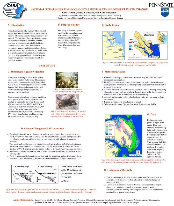
OPTIMAL STRATEGIES FOR ECOLOGICAL RESTORATION UNDER CLIMATE CHANGE Koel Ghosh, James S. Shortle, and Carl Hershner * Agricultural Economics and Rural Sociology, Pennsylvania State University * Center for Coastal Resources Management, Virginia Institute of Marine Science. B Purpose of Study

E N D
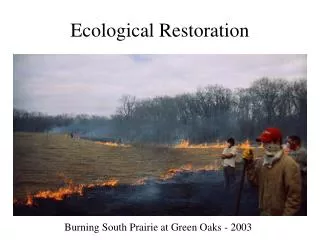
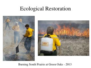
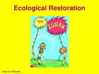
OPTIMAL STRATEGIES FOR ECOLOGICAL RESTORATION UNDER CLIMATE CHANGE Koel Ghosh, James S. Shortle, and Carl Hershner* Agricultural Economics and Rural Sociology, Pennsylvania State University * Center for Coastal Resources Management, Virginia Institute of Marine Science B Purpose of Study The study determines optimal strategies for natural resource adaptation under climate change using the Submerged Aquatic Vegetation (SAV) Restoration Program in the lower Chesapeake Bay as a case study. A Introduction Natural ecosystems like forest, wilderness, and wetlands provide valuable habitat and ecological services intimately linked with sustenance of life on earth. The survival of species depends on the availability of migration corridors and the existence or emergence of suitable habitats. Climate change will affect fundamental ecological processes and the spatial distribution of terrestrial and aquatic species. A crucial issue in facilitating ecosystem adaptation to climate change is managing land use and landscapes to preserve migration corridors and potentially emergent habitats. E Study Region Fig. 5: The study region is Hampton Roads in southeast Virginia. The right-hand map divides the region into segments for the study. CASE STUDY C Submerged Aquatic Vegetation The diverse assembly of underwater grasses found in the shallow water of the Chesapeake bay are called Submerged Aquatic Vegetation (SAV). SAV provides important habitat for the fish and shellfish population of the bay and contributes to improving water quality by removing excess nutrients. The increased nutrient and sediment input from development in the surrounding watershed resulted in a dramatic bay wide decline in all SAV species in the late 1960’s and 1970’s. Compared to historical estimates of 200,000 acres, a 1984 aerial survey of the bay documented only 38,000 acres—prompting a SAV restoration plan that would ensure the future of SAV in the Chesapeake Bay. • F Methodology Steps • Understand the impact of sea-level rise on existing SAV and future SAV restoration opportunities. • Identify adaptation strategies for SAV restoration under climate change--strategies are a portfolio of choices regarding extent of restoration at current sites and future sites. • Account for uncertainty in future sea-level rise. This is done by considering alternative scenarios of sea-level rise that can occur in the future. Associated with each state is the likelihood of that state occurring. • Account for the social cost of other land and water uses excluded by SAV restoration. • Bring it all together in a mathematical model. • Solve the model using Discrete Stochastic Programming (DSP). Fig. 1: Eelgrass (Zostera marina) dominates the lower Chesapeake Bay. Fig. 2: The blue crab, symbolic of the life and culture in the Chesapeake Bay region, uses the bay grass beds as nursery area. G Data Bathymetry maps points of equal water depth. Data was obtained by combining bathymetry information (from the Chesapeake Bay Program) with GIS data coverage of current and historic SAV, suitable shellfish aquaculture area, and tidal marsh inventory data (from Virginia Institute of Marine Science) in GIS software ArcInfo. • D Climate Change and SAV restoration • The distribution of SAV is influenced by salinity, temperature, light penetration, water depth, water wave and current actions, and bottom sediment. Climate change can affect any of these conditions, either by itself or by interacting with other environmental stressors. • This study looks at the impact of climate-induced sea-level rise on SAV distribution and restoration opportunities. Sea level rise will alter the water depth at current SAV sites. Existing SAV will migrate from the deeper waters to the shallower waters near the shore. • As the sea moves inland, current tidal marshes on the coast may become suitable as SAV growing sites. • There is incomplete information regarding both the magnitude and the likelihood of sea-level rise. These uncertainties must be reflected in the methodological framework. Fig. 4: The bathymetry bands and coverage area of existing SAV, historic SAV, tidal marshlands, and aquaculture suitable areas are shown for segment 6. MHW:Mean High Water MTL: Mean Tide Level MLW: Mean Low Water T: Low Tide L: Light • H Usefulness of the study • This methodological framework also can be used for research on the economics of planned ecosystem adaptation to climate change (in addition to SAV). • The study is of practical value as it will aid Chesapeake Bay region planners in evaluating ecological restoration strategies and developing forward-looking land-use plans that enhance autonomous adaptability of marine ecosystems. Fig.3: The suitable water depth for SAV is below the low tide line (T) to about 2 meters in depth (L). The SAV fringe (arrow) decreases as the tidal range increases with sea-level rise. Source: Chesapeake Bay Program Acknowledgements:1. Support is provided by the Global Change Research Program, Office of Research and Development, U.S. Environmental Protection Agency (Cooperative Agreement R-83053301). 2. Tamia Rudnicky at Virginia Institute of Marine Science helped organize the GIS data for the analysis.