Download
1 / 14
140 likes | 215 Vues
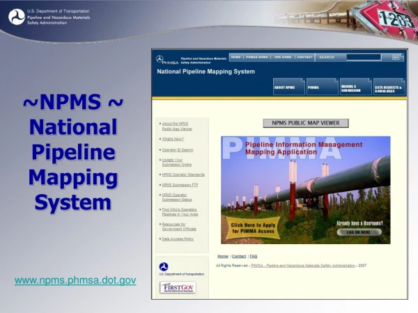
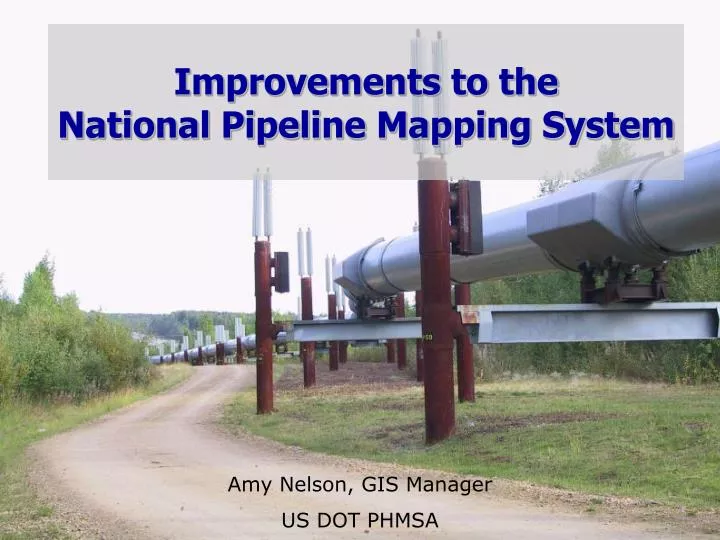
Improvements to the National Pipeline Mapping System. Amy Nelson, GIS Manager US DOT PHMSA. Introduction: 1998. What hasn’t changed since 1998?. The data the NPMS collects. 1998: NPMS data standards were written.

E N D
Improvements to the National Pipeline Mapping System Amy Nelson, GIS Manager US DOT PHMSA
What hasn’t changed since 1998? The data the NPMS collects.
1998: NPMS data standards were written • The NPMS (National Pipeline Mapping System) is PHMSA’s program of collecting geospatial data from pipeline operators, analyzing the data, and disseminating it • 1998 Standards reflected the state of GIS and GPS at the time • Optional submissions began in 2000/2001; attributes collected were minimal, to encourage operators to submit • Only 6 months for operators to submit after PSIA 2002; PHMSA opted not to change data standards • As years go by and technology advances, the deficiencies in PHMSA’s dataset become more apparent
Reauthorization Mandates PHMSA’s reauthorization stated: • PHMSA must promote greater awareness of the NPMS • The Secretary may collect additional geospatial data Result: PHMSA is drafting an Information Collection to obtain the data it needs to perform its mission • Will aid mission goals of safety, environmental stewardship, reliability, and assisting emergency responders and government officials
IC Overview The upcoming Information Collection will expand the data that operators submit to the NPMS and will modify some existing submission elements • Positional accuracy will be tightened • Additional pipeline attributes will be collected • Pipeline-related facility data will be collected • LNG plant submissions will have additional attributes • Breakout tank submissions will be mandatory
IC Timeline • Federal Register notice will be published in fall 2013 • 60 day comment period will follow • Final notice expected in 2014 • Operator submissions of the new data will begin in 2015 at the earliest • Security implications of new data will be discussed with TSA; it’s unlikely most new data will appear on public portion of NPMS website
Meeting mission goals • The Information Collection will strengthen PHMSA’s ability to accurately identify, regulate, and respond to emergencies for pipelines, LNG plants, and breakout tanks • PHMSA’s ability to evaluate risk for a pipeline will be improved by obtaining basic information about that pipe, such as coating, SMYS, and MAOP • Improved positional accuracy will assist emergency responders as well as PHMSA staff and stakeholders in accurately locating the pipe, especially in densely pipelined areas • Key PHMSA datasets refer to features not in the GIS; they cannot be analyzed geospatially
Current 500 foot positional accuracy Dozens of lines are in the 500 foot radius!
Referencing data the NPMS does not have From PHMSA’s Pipeline Datamart Pump/Compressor stations Diameter
Process of defining data needs • Gathered requirements from all levels of PHMSA to understand organizational/mission needs • Reviewed currently collected data and identified deficiencies • Interviewed five operators about their GIS data; thanks are due to • Nisource • Marathon • National Grid • Colonial • Access Midstream • Spoke with current and former industry employees
Simplifying Annual Reports • Over the past 10 years, PHMSA has made several attempts to replace AR data with NPMS submissions • PHMSA does not want to collect duplicate data • Our goal: data in the NPMS will replace data currently collected through Annual Reports • Should streamline operator’s annual report preparation and result in time savings after the initial submission • Easier and faster reporting for operators. Better quality and more precise data for all.
How PHMSA will use the new data • Aid government and industry in promoting public awareness of hazardous liquid and gas pipelines and improving emergency responder outreach. • Permit more powerful and accurate tabular and geospatial analysis which will strengthen PHMSA’s decision support, regulations, and program evaluation. • Strengthen the effectiveness of PHMSA’s pipeline risk assessment models. • Allow for more effective assistance to emergency responders by providing them with a more reliable, complete dataset of pipelines and associated data. • Provide better support to PHMSA’s inspectors by providing more accurate pipeline locations and additional pipeline-related geospatial data which can be linked to tabular data in PHMSA’s inspection database.
Questions? Amy.Nelson@dot.gov 202-493-0591