Download
1 / 44
440 likes | 445 Vues
This presentation discusses the importance of monitoring, analyzing, and predicting weather on the mesoscale level. It explores the Advanced Regional Prediction System (ARPS) and its applications in the real world. It also highlights the decision tools available for operational forecasters and emergency managers. The presentation concludes with a vision for the future of meteorology and the various institutions involved in weather analysis and prediction.

E N D
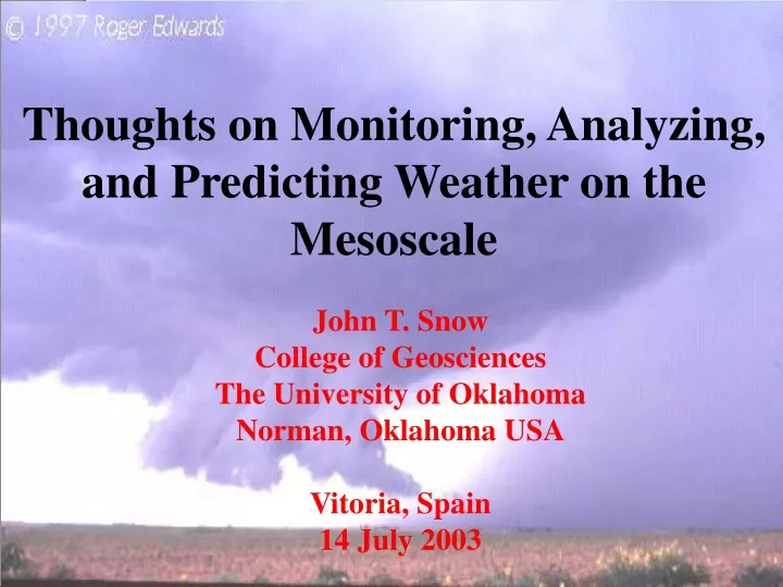
Thoughts on Monitoring, Analyzing,and Predicting Weather on the Mesoscale John T. SnowCollege of GeosciencesThe University of OklahomaNorman, Oklahoma USAVitoria, Spain14 July 2003
Outline • Who I Represent – the Oklahoma Weather Center • Background – Two-Fold Motivation • Overview of the Advanced Regional Prediction System (ARPS) – with two digressions • ARPS Applications In The Real World • Decision Tools for Operational Forecasters and Emergency Managers • One Vision for the Future
School of Meteorology (SoM) • Department of Geography (GEOG) • Center for Analysis and Prediction of Storms (CAPS) • Oklahoma Climatological Survey (OCS) • Cooperate Institute for Mesoscale Meteorological Studies (CIMMS) • Environmental Verification and Analysis Center (EVAC) • International Center for Natural Hazard and Disaster Research (ICNHDR) • Center for Spatial Analysis (CSA) • National Severe Storms Laboratory (NSSL) • Storm Prediction Center (SPC) • National Weather Service Forecast Office • Radar Operations Center (ROC) • Warning Decisions Training Branch (WDTB)
Why Society Supports A Meteorological Community • Reduce “Nature’s toll” – provide advance warning of severe and hazardous weather to protect lives, mitigate property losses • Increase economic returns – provide information to decision makers to reduce losses, improve economic efficiencies, and enhance economic competitiveness
Reducing Nature’s Toll • Severe weather watches and warnings: • Watch:Forecasted conditions are such that severe weather is expected to occur at a future time over a region • Warning:Observed conditions indicate that severe weather is occurring or is imminent • Public response training on meaning of watch/warning and proper response to each hazard is an essential and never-ending task • Requires collaboration of emergencies services, law enforcement, the media, and schools • Annual events to educate, reinforce, and update • Immediate: Seek shelter (tornado) • Long term: Wise choices (hail-resistant roofs)
Example: Evolution of Tornado Warnings Over Time NEXRAD Source: NWS Office of Science and Technology
Weather/Climate and the U.S. Economy • Over 30% of the $10 trillion US economy is negatively impacted each year • Thunderstorms, blizzards, heat waves, cold periods, and hurricanes cause economic losses in the US that average $300 M per week;Agriculture losses exceed $10 B/year;Commercial aviation loses $1-2 B per year due to diversions, delays, and cancellations (one diverted flight costs $150K) • The cumulative effects of “typical” events exceed those of infrequent but “major” events • About 50% of losses are preventable with better forecasts! • “typical events” may not impact general populace, but have serious effects on business • On plus side, weather-based scheduling, managed energy purchases, use of weather-related financial tools, marketing, etc… all add positively to the “bottom line” POINT: Weather forecasts on right scale, at right time, with stated uncertainties, are of great value to many business sectors and enterprises!
3. Overview of the Advanced Regional Prediction System (ARPS)With two digressions
Mission in the area of Severe Weather SCIENCE: To demonstrate the capability of using computer models to predict high-impact spring and winter weather, especially individual thunderstorms TECHNOLOGY: To develop, test, and help implement a complete analysis and forecast system appropriate operational, commercial, and research applications
Advanced Regional PredictionSystem
ARPS was specifically developed for use on the storm-scale (e.g. 3-km and finer resolution) ARPS was developed entirely at the University of Oklahoma prizing-winning well-documented code ARPS is available for use for free within the academic research community and is currently used by researchers around the world ARPS tech support, tailored products, and numerical modeling services for operational applications is provided via Weather Decisions Technologies, Inc. Advanced Regional PredictionSystem
The Key To ARPS’ Success:ARPS Data Assimilation System (ADAS) • Surface networks • Profilers • Radars • ACARS • Satellites ADAS assimilates environmental data from all available sources to develop the best possible 3-D view of the atmosphere at the initial time
The First Digression:State-wide SurfaceEnvironmental Observing Network
Oklahoma Mesonet • 2-way radio communications • Solar-powered • Measurements of pressure, air & soil temperature, relative humidity, wind speed & direction, rainfall, soil moisture, and solar radiation • Automated and manual quality assurance of data
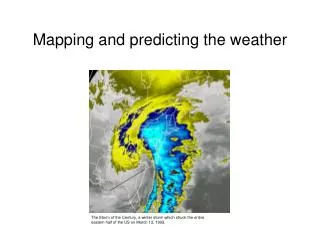
Passage of a Winter Low Pressure System Surface data with overlaid radar mosaic
The need for remotely-sensed observations of the lower boundary layer for the detection and prediction of highly-localized weather (and associated phenomena) has prompted a decades-long effort to develop a new radar technology and telecommunications techniques
Oklahoma is today the leader in weather radar research, development, utilization, and education
The Future: National Weather Radar Test Bed (NWRT) NEXRAD: - Upgrades - Dual Polarization Phased Array Radar (PAR) Shared Mobile Atmospheric Research and Teaching Radar (SMART-R) Collaborative Radar Acquisition Field Test (CRAFT) Center for Adaptive Sensing of the Atmosphere (CASA)
The Collaborative Radar Acquisition Field Test (CRAFT) • A collaborative project to demonstrate the real time compression and Internet-based transmission of WSR-88D (NEXRAD) base data • Philosophy: Leverage existing infrastructures (Internet), public-domain software (Unidata LDM), and secure, low-cost services (56K phone lines) • Long-term goal: formal implementation for operations, research, and private industry Based on the success of CRAFT, the NWS has recently launched an initiative to build a national network for the real-time archive and distribution of NEXRAD wideband radar data for completion in 2004
Unique Capability in ADAS: Assimilation of Radar Data ARPS is recognized internationally for its capability to assimilate radar data into a numerical weather model
WITHOUT WITH Moore, OK Tornadic Storm 2-Hour CAPS Computer Forecast Down to the Scale of Counties NEXRAD Radar Observations ForecastsWithandWithoutRadar Data
Forecasting High-Impact Local Weather NWS Model at 40-km resolution 6-hr precip. forecast valid 1 p.m., 6/25/03
Forecasting High-Impact Local Weather ARPS at 27-km resolution 33-hr precip. forecast
Forecasting High-Impact Local Weather ARPS at 9-km resolution 6-hr storm forecast
Forecasting High-Impact Local Weather ARPS at 3-km resolution 6-hr precip. forecast
4. ARPS Applications in the Real World ARPS is being used operationally in government and several industrial sectors ….
…. in Aviation • 3-year, $ 1 million R&D partnership with American Airlines • Entrée into working with the commercial sector (only 4 years after initial development of the ARPS) • Developed a real-time forecast system to use at AA’s DFW hub airport • AA is in process of moving its weather services division to Norman
…. in Energy • 5-year, $ 10 million R&D partnership with Williams Energy Marketing & Trading for the development of a real-time forecast system to support energy trading • Due to a sharp downturn in the energy market, the contract was rescinded after 1-year • Wind Generation initiatives offer many opportunities for new products in support of operations and trading of “green energy” futures
…. for Commercial Meteorology • Weather Decision Technologies, Inc. (WDT) is a for-profit private company created to commercialize Oklahoma Weather Center technologies • WDT holds an exclusive license to the ARPS for commercial use • Provides mechanism for broad application of the ARPS • Aviation • Surface • Transportation • Energy • Recreation • Broadcast Meteorology
International Applications • Korea Meteorological Administration is using ARPS operationally to generate regional forecast products • ARPS is used by a group from the University of Santiago to generate operational weather products over NW Spain • Plans exist to set up a weather forecast system in Paraguay based on ARPS technology (through WDT)
5. Support for the Operational Forecasters and Emergency Managers
Experimental Visualization Tools Pseudo 3-D Radar Display of one volume scan
Future Paradigm Option #3 (‘private- private enterprise’) SYNOPTIC WMO NMS OBSERVATIONS: • WMO GTS • NWS • FAA; UCG Core Entity is a private, multi-company enterprise • Vaisala/GAI ($) Private MS Measurements NCEP & Forecasting • analyses Enterprise • forecasts • Measurement cos . Note: Numerous sub - options are • Forecasting cos . feedback possible, ranging • Wx derivatives cos .? from one each • Other cos .?? measurement and End forecast companies to multiple Users companies + other value - added entities Courtesy of Walter Dabberdt, 2003
John T. Snow Dean, College of Geosciences The University of Oklahoma Sarkeys Energy Center, Suite 710 100 E. Boyd Street Norman, Oklahoma 73019 Tel: 405-325-3101 FAX: 405-325-3148 E-mail: jsnow@ou.edu Web: http://geosciences.ou.edu http://www.owc.ou.edu