Download
1 / 1
10 likes | 137 Vues
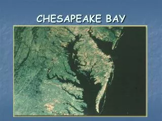
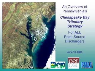
STAR/NCBO Collaboration on Chesapeake Bay Interpretive Buoy System. Education & Outreach Curriculum development. Chesapeake Bay Observing System (IOOS). John Smith Water Trail Public Awareness. Eric Stengel 1 ( Government Principle Investigator ) , Doug Wilson 2

E N D
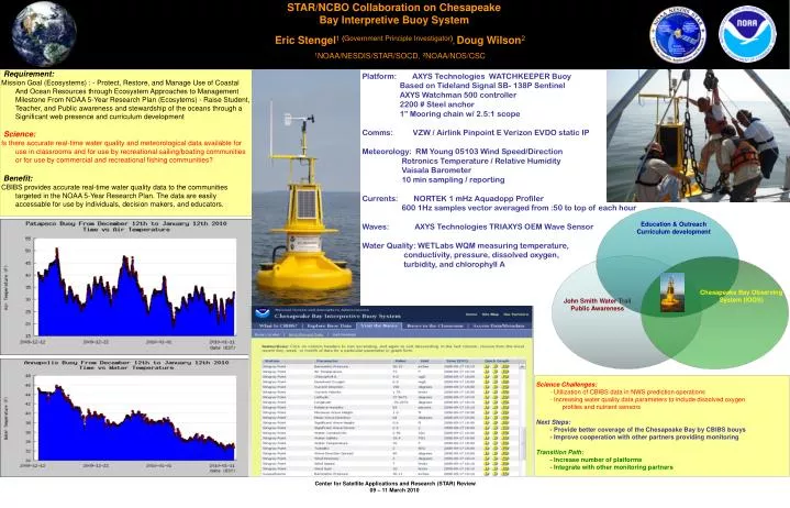
STAR/NCBO Collaboration on Chesapeake Bay Interpretive Buoy System Education & Outreach Curriculum development Chesapeake Bay Observing System (IOOS) John Smith Water Trail Public Awareness Eric Stengel1 (Government Principle Investigator), Doug Wilson2 1NOAA/NESDIS/STAR/SOCD, 2NOAA/NOS/CSC • Requirement: • Mission Goal (Ecosystems) : - Protect, Restore, and Manage Use of Coastal • And Ocean Resources through Ecosystem Approaches to Management • Milestone From NOAA 5-Year Research Plan (Ecosytems) - Raise Student, • Teacher, and Public awareness and stewardship of the oceans through a • Significant web presence and curriculum development • Science: • Is there accurate real-time water quality and meteorological data available for • use in classrooms and for use by recreational sailing/boating communities • or for use by commercial and recreational fishing communities? • Benefit: • CBIBS provides accurate real-time water quality data to the communities • targeted in the NOAA 5-Year Research Plan. The data are easily • accessable for use by individuals, decision makers, and educators. Platform: AXYS Technologies WATCHKEEPER Buoy Based on Tideland Signal SB- 138P Sentinel AXYS Watchman 500 controller 2200 # Steel anchor 1” Mooring chain w/ 2.5:1 scope Comms: VZW / Airlink Pinpoint E Verizon EVDO static IP Meteorology: RM Young 05103 Wind Speed/Direction Rotronics Temperature / Relative Humidity Vaisala Barometer 10 min sampling / reporting Currents: NORTEK 1 mHz Aquadopp Profiler 600 1Hz samples vector averaged from :50 to top of each hour Waves: AXYS Technologies TRIAXYS OEM Wave Sensor Water Quality: WETLabs WQM measuring temperature, conductivity, pressure, dissolved oxygen, turbidity, and chlorophyll A Science Challenges: - Utilization of CBIBS data in NWS prediction operations - Increasing water quality data parameters to include dissolved oxygen profiles and nutrient sensors Next Steps: - Provide better coverage of the Chesapeake Bay by CBIBS bouys - Improve cooperation with other partners providing monitoring Transition Path: - Increase number of platforms - Integrate with other monitoring partners