Download
1 / 31
320 likes | 520 Vues
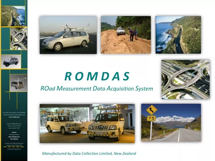
R O M D A S RO ad M easurement D ata A cquisition S ystem. Manufactured by Data Collection Limited, New Zealand. Overview. ROMDAS has been developed by Data Collection Ltd. (DCL) as a low cost modular system designed to collect road and pavement data using any vehicle. ROMDAS…

E N D
R O M D A SROadMeasurement Data Acquisition System Manufactured by Data Collection Limited, New Zealand
Overview ROMDAShas been developed by Data Collection Ltd. (DCL) as a low cost modular system designed to collect road and pavement data using any vehicle. ROMDAS… • Is vehicle mounted equipment, • Is modular, • Offers equipment for collecting a variety of data and a variety accuracy levels, • Cost efficient equipment, • Can be installed on most local vehicles
History • First developed in 1989 by Dr Chris Bennett in response to his work in India and other developing countries where data collection equipment was expensive and impractical. • The first system was developed in New Zealand with assistance from members of the University of Auckland. • During the early years the heart of ROMDAS’ success was due to the Bump Integrator which was popular in developing countries due to its low cost and robust design. • As the years passed and pavement data collection requirements increased new modules (e.g. video, TPL, GPS) were developed and integrated into the central ROMDAS system. • In 2003 DCL was purchased by two employees; Paul Hunter and Raj Mallela. Both owners have kept closely to the philosophies with which the company was founded. • In the last 5 years, DCL has integrated a number of high-end technology modules (e.g. LRMS, Geometry and LCMS) and can now offer customers high accuracy solutions as well as more traditional low cost options.
DCLs Point Of Difference Our success within the Road Maintenance industry can be put down to three main reasons; • Financial – ROMDAS equipment is positioned at the lower end of the cost spectrum in the vehicle mounted pavement analysis market, while at the same time offering data quality equal to competitors. • Service – customer support is a high priority for DCL. We aim at ensuring our customers are trained and supported so that their equipment is functioning at optimal levels. This applies at not only time of purchase but also for post-sale support. • Innovation - ROMDAS equipment is constantly being developed. While entry level systems have mostly standardised designs, more technical systems are customised by DCL’s production team to best suit the specific situations and needs of customers. With many data collection systems in the market offering very similar high-end modules, ROMDAS tries to differentiate itself by offering a variety of low-cost entrance level equipment which can then be upgraded in the future to higher specification modules as the road conditions improve.
The ROMDAS System The ROMDAS system itself comprises of the central components and software licences that allow for data acquisition and analysis. It is the ROMDAS system that the variety of data collection modules and sensors connect to and is therefore a requirement for all new survey vehicles. • Standard equipment included in the ROMDAS system: • ROMDAS Data Collection Software, • Proximity sensor DMI, • Power distribution box and cable, • Vehicle power supply for survey computer • Hardware interface, • Other accessories and basic tools needs for installation and maintenance.
The ROMDAS System ROMDAS and its modules can collect the following information; • Location Referencing Points • Linear Profile/Roughness (IRI) • Transverse Profile and Rut Depths • Right Of Way Road Video Survey • Pavement Video Survey • Road Condition Rating • Inventory & Asset Survey • GPS Centreline • Road Geometry • Laser Surveying • High Accuracy Distance • Automated Crack Detection • 3D Pavement Surface Modelling • Pavement Texture (MPD & SMTD)
LCMS - Measures every mm of pavement across and along the road
ROMDAS System: LCMS • The ROMDAS Laser Crack Measurement System (LCMS) uses 2 high powered scanning lasers to measure a variety of pavement characteristics. E.g.: • Automatic crack and defect detection and analysis (including; crack severity, potholes and ravelling), • Rut Depth, Width & Cross-Sectional Area for each wheelpath, • Macro-Texture (MPD) in 5 longitudinal bands, • This system represents a trend in data collection technology towards multipurpose modules for collecting a wide variety of high accuracy data.
Optional Upgrades to LCMS Scanning Laser • Roughness (IRI) • Raveling/Joint Data • Geometry • FOD Detection (Airports) Recommended ROMDAS Modules for use with LCMS • Right Of Way Video Logging (Asset Inventory) • GPS (Location Referencing) • DataView (Post Processing Software)
The LCMS has a variety of advantages and benefits that far exceed traditional multifunctional data collection devices. The high powered scanning lasers are capable of profiling every millimetre on the road surface and identifying a wide variety of pavement characteristics.
Special Features There are several unique features to this system which significantly enhance the data reliability and accuracy over other traditional multi-laser profilometers. These include: • Scanning Laser; accurately measures the transverse profile across the full lane width. • Macrotexture Measurement; can be measured over whole pavement. • Lane tracking; eliminates data variability and inaccuracies due to vehicle wander ‘year-on-year’. • Roof Mounted Equipment; mounted 2.2 m above pavement surface, at rear of vehicle. • Roughness Inertial Measuring Unit (IMU); instead of traditional accelerometers. • Validation tool; unique tool which quickly calibrates the equipment on a weekly basis. • Laser based pavement imaging; automated defect detection, lane markings, high quality pavement images (with optional defect overlay).
Lane Tracking A key advantage to using the LCMS system is the ability for data sets to be referenced to the lane markings and kerb positions instead of the vehicle transverse position travelled which will vary from year to year. This unique feature can be used when calculating the wheelpath and lane roughness, Macrotexture Measurement and rutting scan width.
Macro Texture The LCMS is unique in that with the very high transversal scan rate of the laser the Macro texture can be calculated for all parts of the complete pavement area. The LCMS reports the Mean Profile depth (MPD) macro texture and / or Road Porosity Index (RPI) in 5 adjustable width longitudinal bands across the whole lane width (the 5 AASHTO bands are: central band, two wheel path bands, and two outside bands).
ROMDAS System: LCMS • Survey Speed 0 – 100km/h. • IP-65 (NEMA 4). • Operates at 5,600 Hz (Profiles per second). • 4 m profile width. • Creates Access (.mdb) files for raw data, as well as JPEG images which show the quantity and severity of defects at 10m intervals. • Laser imagery allows for data collection in day or night conditions.
ROMDAS System: LCMS Standard equipment included with the LCMS module; • 2 x LCMS laser profiler units, • Rack mount LCMS controller, • All necessary cabling, • All external mounting, • Basic tools and accessories for installation and maintenance.
ROMDAS System: LCMS • Benefits • Very high accuracy data making it perfect for analysis of major highways, • High operating speed (up to 100km/h), • Wide variety of data collected, • Identification of lane markings mean the unit can automatically adjust the position of data (like MPD bands and Roughness) to match user-defined locations. In turn giving increased accuracy (i.e. removes the influence of the driver on the collection of data), • Raw data profiles are recorded allowing for re-processing using different parameters. • Real time status provided to operators
ROMDAS Software ROMDAS Data Acquisition & Processing DataView Highway Information Management System (H.I.M.S.)
ROMDAS Data Acquisition & Processing Software Supplied with the purchase of the ROMDAS system, Used for 2 primary functions: • During ROMDAS surveys to display and integrate all modules and interfaces, • Process raw .rbf files into Microsoft Access files (.mdb)
ROMDAS Data Acquisition & Processing Software Key built in features: • Calibration Processes that step the user through how to calibrate specific module, • Powerful Keycode System: a very flexible feature that allows users to define manual ratings and events at the touch of a button, • Location Referencing (LRP) at the touch of a button, • Travel-Time surveys, • View the status and data collection of devices in real-time,
ROMDAS Data Acquisition & Processing Software Microsoft Access (.mdb) files created contain a number of tables that reference all data to Chainage and/or GPS, Access databases are easily exported to most asset management, GIS mapping and highway maintenance planning software,
DataView DataView is used to perform several advanced data processing steps. These include; • Process video images for asset and condition data, • Integrate multiple survey files into a single database, • Present data in customised charts, • QA Data by viewing all datasets link to Video, GIS Map and Charts Simultaneously • Create GIS maps with exportable layers
DataView View a variety of survey data in a linked display, Survey Videos GPS Map Stripmaps LCMS Images
DataView Additional Features and Benefits: • Create GIS Map layers from ROMDAS surveys data • GIS map layers can be quickly created for all data referenced with GPS coordinates. • Utilise survey video to perform condition & inventory rating, reducing pressure on operators on site and increasing accuracy on a variety of information recorded. • Create distinct map layers for roads, video rating keycodes, Survey Events and Location Reference Points. • Create custom graphs, charts and strip maps • Easy QA tools for project managers by viewing all datasets, videos and GIS maps linked in the same window, • Custom templates can be designed to include additional features and further streamline the integration process.
ROMDAS Support Overview: ROMDAS offers a number of post sale support systems, these including: • Annual Maintenance Subscription (AMS) • ROMDAS Remote Support • Training and Installation Services • Newsletter
A N N U A L M A I N T E N A N C E S U B S C R I P T I O N (A. M. S.) The ROMDAS AMS offer customers a range of entitlements to help keep their systems in optimal condition. • Entitlements include: • ► Free Technical Support • ► Discount on Spare/Replacement Parts • ►Discount on any follow up Training & Installation Services • ► Free Software Updates • ► Access to Secure Member's Page • ► Free Annual System Audit
R O M D A S R E M O T E S U P P O R T Technical support in real-time Have a ROMDAS technician remotely connect to the survey computer to; • Check settings, • Diagnose faults, • Assist with installation and setup, • Perform online training, • View the system operating in real-time.
R O M D A S T R A I N I N G A N D I N S T A L L A T I O N The training and installation service involves a ROMDAS engineer travelling to visit you on site. They will assist and train your operators with the installation and use of ROMDAS equipment. Training on survey methodology and practical tests will also be conducted during the visit. The aim is to make your operators comfortable with collecting and processing data (into MS Access databases) as well as using and maintaining the equipment.
R O M D A SROadMeasurement Data Acquisition System Manufactured by Data Collection Limited, New Zealand