Download
1 / 40
400 likes | 734 Vues
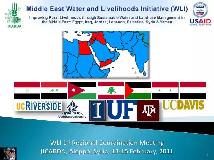
WLI 1 st Regional Coordination Meeting (ICARDA, Aleppo, Syria, 13-15 February, 2011. Orontes River Watershed. Biophysical characterization. Lebanon. Presented by Ihab JOMAA (Head D. Irrigation and Agrometeorology ). Team: Randa MASAAD, Ihab JOMAA, Sleimen SKAFF, Naji ARAJI. LARI.

E N D
WLI 1st Regional Coordination Meeting(ICARDA, Aleppo, Syria, 13-15 February, 2011
Orontes River Watershed Biophysical characterization Lebanon Presented by Ihab JOMAA (Head D. Irrigation and Agrometeorology) Team: Randa MASAAD, Ihab JOMAA, Sleimen SKAFF, Naji ARAJI LARI Orontes Falls at Beit el tachem
1384 km2 Orontes River Watershed Lebanon
Orontes or El Assi River Watershed El Assi River 46 km Syria Lebanon AinEzZarka
Topography of Lebanon Rainfall rate 200 – 800 Rainfall rate 800-1400 Snow covers 2500 km2 III I II Baalbeck Tripoli Zahle Beirut Sour
Orontes River Watershed Topography N Mount Lebanon Northern Bekaa Valley Anti Lebanon
Watershed climatic characteristics • Maximum daily temperatures exceed 35°C in the Bekaa Valley. • The highest temperatures are recorder toward the northern part of the Bekaa. • Bekaa Valley could be divided into three ecoclimatic zones based on the annual rainfall rates (northern, central and southern part). 150 mm, and 550 mm 450 mm 550 mm 150 mm, 450 mm Bekaa Valley
Rainfall evolution in Hermel area between 1930 and 1970 report PNUD- Etude des eaux souterraines 1970
Evapotranspiration rate 50 to 75% may reach 85% to the north of the Bekaa Valley
Schematic cross-section along El-Assi River basin (W-E alignment) Geological characteristics Mount Lebanon Anti Lebanon
Erosion risk map Darwish et al
Monthly mean flow and mean water volume of the Orontes River Reference: Projet d’irrigation a partir de l’Oronte dans les cazas de Baalbeck & Hermel, Ministry of electricity & hydraulics, November 1996).
Mean Annual Flow Rate and mean water volume of the Orontes River
Lebanon Prepared By: National coordinator: Eng.Randa Massaad Bio-physical Team: Dr. Ihab Jomaa Eng. Sleiman Skaff Mr.Naji Araji Socio-economic team: Mr.Fadi Naddaf Eng Hanaa Chehabedine
Part II: Socio-economic Characterization • II.1 Livelihood assessment 1- Population description The total population of the Project Area ( Baalbeck and Hermel ) is 250000 inhabitants. This area is one of the least developed regions of the country, and people often suffer from certain isolation. Agriculture, livestock and fish farming incidentally dominate the economics of the project area. 2- Demographic Characteristics: Poor families are larger than non-poor families with a higher number of family members and more children. The average size of poor families in the area of study is large (5.9 members), and is observed to be higher than the average for the region as a whole (5.2 members) and much higher than that for Lebanon (4.7 members). Poor families have more children, with an average number of children per family amounting to 3.7, as compared to 3.1 for the region as a whole.
Part II: Socio-economic Characterization II.1 Livelihood assessment 3- Poverty Profile Poverty lines have been determined based on the cost of a minimum consumption basket, founded on the food necessary for a recommended calorie intake, and augmented by an allowance for nonfood needs consistent with the spending patterns of the poor themselves • The lower poverty line for the region is equivalent to LBP 500.000 per month (approximately US $332) for an average household with 5.26 members. • The upper poverty line for the region of is equivalent to LBP 1.000.000 per month (around US $652) for an average household with 5.26 members 58% of households (and 65% of the population) relative to the upper poverty line. • The headcount index for the region is equivalent to 25.5% of households relative to the lower poverty line
II.1 Livelihood assessment 3-Poverty Profile The poverty gap for the sample is approximately US$ 1.85 million per year, and US$ 86 million for the region as a whole. The poverty gap index for the region amounts to 30.4%. The inequality in the distribution of income and wealth is exhibited as follows: • around 50% of the population in the region only control around 20% of the total income, • while 10% of the population control more than 30% of the total income. 4-Life Standards The level of dissatisfaction of the residents of Hermel is higher than that in Baalbeck. When asked on their views on the minimum monthly salary sufficient to cover household expenses, the average estimated by the residents were very close to the poverty lines determined in the context of the study.Food constitutes the highest expenditure burden on poor families, followed by education and health expenses.
II.1 Livelihood assessment 5- Family size • Th average number of family members was 5.56 persons. The distribution of the male members by age was as follow: • Childhood < 18 years 37% of the total number. • Youth 19-60 years 60% of the total number. • Elderly 3% (above 60 years) of the total number. The distribution for females according to the same groups is as follows: • Childhood < 18 years was 39% of the total number • Youth 19-60 years 53 % of the total number. • Elderly 8% (above 60 years) of the total number.
II.1 Livelihood assessment 6-Education Level • Poor families have higher illiteracy rates, and amounts to 15%, and is much higher in Hermel (20.5%). • Illiteracy among poor members is higher than the aggregate percentage for the region as a whole (13.6%). and is much higher for females than for males. • Around 35% of the population in Hermel are currently enrolled in some type of education, whereas • 42% were previously enrolled, and 14% have never had any form of previous education. • School enrollment is highest for children aged 5-9 years (95%), and remains high for those aged 10-14 years (94%). Enrollment rates drastically declines after the age of 14 years. • Percentage enrollment in public schools in the region is higher than the national average. • The educational enrollment per type of schooling in the region shows some gender bias, with higher female enrollment in public schooling systems
II.1 Livelihood assessment 7- Main agricultural and non-agricultural activities of the rural communities The total labor force (including those who are employed, unemployed, and first time job seekers) in Hermel is estimated to comprise around 27.6% of the total population in the area. • The highest proportion of workers in the Orontes basin are employed in the agricultural sector (22.1%), • followed by the sector of commerce (18.5%). Gender variations in the distribution of the labor force per economic sector exist. Agriculture and commerce comprise the highest percentage of the male labor force, whereas the highest proportion of female workers are employed either in the educational or in the agricultural sector, together employing more than 60% of the female labor force.
II.1 Livelihood assessment 8-Farm revenue-baseline data / Household Income • The individual income scales in the region are generally low. • Around 67% of workers in the Orontes Basin have a monthly income below LBP 600 thousand, of whom 28% have a monthly income less than the minimum wage rate declared by the Government (LBP 500 thousand). • Gender variations in income levels are evident, where the highest proportion of the female labor force with monthly incomes below LBP 300 thousand (51%). • Lowest income levels are associated with the sector of agriculture, followed by construction (57.2% and 33% of workers in agriculture and construction, respectively, have monthly incomes below LBP 300 thousand).
II.1 Livelihood assessment 9-Farmer's skills, awareness and attitudes When considering the biological and physical factors affecting the agricultural production practices in the study area, the following was observed; • Water resources are scarce. This scarcity represents another important limitation of agricultural production in the area, where the majority of the farmers rely on rain for their water supply and only around 6% of the sample irrigates their land. • They showed awareness to current environmental problems and to problems which may arise with the relatively newly adopted farming system. • Around 90% of the sample noticed severe degradation in the grazing areas and this was attributed to trees replacement, overgrazing, droughts, and floods. Seventy percent of the sample indicated that either there are erosion problems, on their land or neighboring properties, and only 20% practice limited conservation measures
II.1 Livelihood assessment 10- Gender-related data • Ownership of assets is, in the majority of cases, male dominated. • Females have extremely restricted control over physical and financial assets • Around 85% of houses are owned by husbands or sons, • 92% of land ownership is in the hands of male members of the family, and only • 2% of industrial or agricultural equipment is owned by wives or daughters. • The case is worse in poor families Females only constitute around 15% of the total labor force in the area. The female economic activity rate out of the total female population above 15 years of age is estimated at 8% Female members of the family are primarily responsible for reproductive roles, whereas male members are primarily involved in productive employment. The production of handicrafts is female dominated, but males also control the market process. Females in poor families have lower educational status than males. Gender bias in educational status in poor families is not observed in the pre-elementary and elementary levels. Agriculture consumes the highest percentage of the female labor force in poor families, with 36% of the female labor force in poor families work in agriculture (as compared to 26% of the male labor force).
II.1 Livelihood assessment 10- Gender-related data • The share of agriculture of the poor female labor force is also observed to be higher than that for female labor force in the region in general. • Females, the majority of whom are widows (82%), head around 13% of the households in the region. Some 8.5% of female heads of households are single and are responsible for the income of their families. • The production of handicrafts is female dominated, but males also control the market process. Even when female members of the family are involved in productive roles, such as the production and marketing of handicrafts and assistance in agriculture, such chores are not counted formally as female employment.
Part II: Socio-economic Characterization • II.2 Livestock characterization • Aarsal village owns the largest herd of cattle in Lebanon; almost 70000 heads of goats and sheep,(LARI/UNDP Report 2005). The herders move around all year long, from el Qaa in winter, to the mountainous lands of Aarsal in spring, to the weastern chain of mountains in summer and autumn. • In Hermel caza the livestock was 50000 goats, 25000 sheep and 700 head of cattle • The number of livestock in the El Qaa' region owned by surveyed households is 12803 sheep, 476 cows, 1602 hens and 185 rabbits
Part II: Socio-economic Characterization II.2 Livestock characterization Fish farming • Freshwater aquaculture has been carried out in Lebanon since the 1930s (El-Zein, 1997). Semi intensive growing was introduced in 1958. More than 90 percent of aquaculture production in Lebanon is rainbow trout, Onchorhyncus mykiss • The oldest farm was established in 1965 in the Hermel area. However, most of the farms (about 41 percent) were established during the years 1985-1990, mainly in the Anjar and Hermel areas and a few in Zahle. • About 11 percent were established in the period 1991-1994 and 2 percent followed in the period 1995-1997. • After 1997 another 90 farms were established. The industry now accounts for 150 farms distributed mainly in the Bekaa area along the river Assi with some smaller ones along the northern coast.
II.2 Livestock characterization Fish farming • After crop production, aquaculture is the second main economic activity of the Hermel, Yammouneh s and constitutes an income generating activity linked especially with restaurants and tourism in the areas. • Restaurants usually serve trout at the table at a price of USD 10/kg. Trout cooking and meals are considered a specialty for the Hermel and Anjar communities. Most of the Nearly all of the trout farms use a semi intensive system. The farms are mostly artisanal family owned businesses. The production system used is mostly semi-intensive. The average annual production of trout is around 1 100 tonnes . This is produced by 150 farms, 80 percent of which are in Hermel-North Bekaa, at a total value of USD 3.7 million and an estimated average yield of 10-12 tonnes (at approximately 1.5 Kg/litre/minute).
II.2 Livestock characterization Fish farming • Fish farming is developed on the edges of Assi, to the level of Hermel, one counts in fact close to 80 fish farming (exclusively trout) in the town, what represents an annual production of 4000 tons of fish. It is the first source of income of the city, but equally the first sources of provisions in proteins for the population 3- Beekeeping in Orontes Basin • In Orontes basin, the highest number of beekeepers is in Baalbek and Hermel cities while it is lowest in the largest village of the basin, Aarsal • the biggest Beekeeper's property size is shown Bouwayda village (about 60 beehives) and then in Kouakh, charbine and el Kaser at Hermel caza. Percentage of beehives in Orontes basin • Also, the percentage of beehives is the highest in Baalbek and Hermel cities, while it is the lowest in others villages as aarsal.