Download
1 / 36
370 likes | 489 Vues
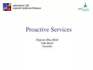
A Web GIS Module for Drupal and Joomla! Content Management Systems - Historical GIS for Hanoi City, Vietnam-. Venkatesh Raghavan, Nguyen Hoa Binh and Sarawut Ninsawat, Osaka City University, Japan Thanks to Gérald Fenoy, GEOLABS, France. PRESENT STATUS.

E N D
A Web GIS Module for Drupal and Joomla! Content Management Systems - Historical GIS for Hanoi City, Vietnam- Venkatesh Raghavan, Nguyen Hoa Binh and Sarawut Ninsawat, Osaka City University, Japan Thanks to Gérald Fenoy, GEOLABS, France
PRESENT STATUS • FOSS Portal & CMS like Joomla!, Drupal provide an environment for collaborative content development. • Available Web-GIS clients like Gmap,OpenLayers KaMap etc. are meeting the needs for Web-Mapping. • However, there is currently few Web-GIS+CMS integrated solutions are available.
PROBLEMS • Stand-alone Web-GIS clients lack of information exchange functions and poor in conventional content management. • Portal & CMS systems are powerful, functions-rich, modular designed; but lack of support for spatial information. • Spatial data needs to be supported for community-oriented services in Web2.0 applications.
BOOK BORROW ANDDELIVERY SYSTEM • A typical example of “loose Integration” model for 3 independent applications. • Users browse books from OPAC application. • Enter books’ information into Borrow cart application. • Select a nearest convenient store on the map to have books delivered using Web-GIS application. • Integration done in term of look-n’-feel only.
Application 2 Application 1 Application 3
RESEARCH OBJECTIVES • To enhance Geospatial support in existing CMS by integrating GIS content and functionalities: • GIS technology becomes more popular and available to general users community. • CMS also become more powerful and functionality rich. • To develop integrated Web-GIS clients as functional module for CMS: • Spatial content and GIS functions are supported by Portal. • Portal’s content can be linked with map’s objects. • To develop routing functionalities for Location-Based Services (LBS) in the spatially enabled Portals.
Portal & CMS ??? Web-GIS Clients
MAIN TASKS • Developed Web-GIS functions, including: • Enhance functionality for Gmap (DM Solutions) Web-GIS client. • Incorporate query function to link spatial and non-spatial contents. • Developed WMS-support capability to enable distributed spatial data-sources: • A WMS server is created as a data source for satellite images. • WMS layers are embedded into the map file. • Integrated Shortest path and Traveling Salesman Problem (TSP) functions using PgRouting engine. • Implementd spatially enabled Historical Portal for Hanoi City
N HANOI (1) • One of the oldest capital cities in South East Asia • Thang Long: “Ascending Dragon” City, given by Ly dynasty in 1010 • City of Peace: given by UNESCO in 1999 • A multi-cultural city (Vietnamese, Chinese, French) with many heritages: places, life-style culture • There are 2000 historical places: architectures, scenes, archeological sites Hanoi City Urban zone
HANOI (2) • Rapid urban development is a threat to historical and archeological heritages • Housing development are trespassing cultural sites • Proposed new parliament house leads to discovery of priceless “Thang Long old citadel” archeological site • Great Hanoi 1000 years celebration in October 2010 • There is a need of understanding and support from Hanoi People’s Committee for historical heritages preservation • Research target: Application of ICT and GIS in • Historical heritages preservation information support • Develop a multi-purpose support tool used for urban development process
PROBLEMS • Online system for historical information support in Hanoi is not available. • Researches about Hanoi history usually relates to the location of POI which need verified and authenticated • The Historian community in Vietnam requested for a simple tool to gather and manage cultural and historical information through community participation
SOLUTIONS • Integration of GIS content and functions into the popular FOS web-Portals & Content Management Systems (CMS) • GIS technology becomes more popular and available to general community • Portal system is also stronger and information richer • Hanoi-GIS: A spatially enabled FOSS-based Portal • A data center of Hanoi history information • Online co-operate working environment between researchers and open to Hanoi people community • Spatial content and GIS functions are supported by Portal • Portal’s content can be linked with map’s objects • The system can be used for multi-purpose: Disaster Management, Public Health…
CLIENT COMPUTER Web Browser Java Script Instance1 Instance 2 … ZOPE Database Python ZOPE Web Server INITIAL SYSTEM • Mandriva Linux 2006 operating system • Zope multi-instances web server • Internal Database server • Python programming language • Plone Portal/CMS framework • GIS functional support: PrimaGIS, ZCO, PCL • University of Minnesota MapServer INTERNET Map file Others Modules & Components PrimaGIS UMN Map Server ZCO, PCL… Plone Portal&CMS PostGIS LINUX OS on SERVER COMPUTER
DATA COLLECTION • Hanoi’s 300 Historical Places: • Information: Name, Address, Description, Write-up • Spatial information: GPS location • Multimedia information: Pictures, Videos, Panoramic photos • Hanoi’s 150 French Architectures: • Information: Name (Old/New), Address, Description in both Vietnamese and English • Multimedia information: Pictures • Collected from reliable sources: • 3 field campaigns • Published book: Terunobu, F., Viet, P.D., Shin, M., Hoang, D.T. (1997), Preservation of Hanoi Architectural Heritage, Vietnam’s Construction Public House, pp.184.
DATA INPUT • Using standard simple CMS functions of Plone Portal • Content Initializing: Data contributors upload content and submit to the reviewers • Content Management: Reviewers publish or deny the content • Content Publish: Content is displayed on the Portal inside the appropriate folder • Another simple CMS functions (check-in, check-out, remove, comment…) maintain a co-operate working environment among portal users
Reviewer Contributor Reader DATA INPUT (2)
MAPS DATA COLLECTION • Background maps – Shape files: • Vietnam’s province and district border • Hanoi’s roads and water boundaries • Source: Vietnam Institute of Geology, VAST. • Satellite image: Ikonos at 2m resolution • Stored in an external WMS with tile-index technique • Source: Vietnam Institute of Physics, VAST. • Historical maps: 8 Hanoi paper-maps in: 1831, 1873, 1898, 1902, 1915, 1925, 1936 and 1942 • Source: Vietnam Historical Science Association • Point objects representing Historical POIs are put onto the map in 2 different ways: • Import the list of GPS-location-available POIs • Manually digitizing on the map for non-GPS-location POIs
ADDING POIs (1) • Using creation script to put the POIs onto the map while creating PrimaGIS instant • Used for 300 Historical Sites with GPS data available • Sample script: • ("Parliament House", 105.835511, 21.038191, "Parliament House", "<p align='center'><b><a href='http://160.193.3.69/hanoi/nhaquochoi.htm'>Nhà quốc hội<br><img src='http://160.193.3.69/hanoi/nhaquochoi_files/image001.jpg'></a></b><p><b>Đặc điểm:</b> Nơi diễn ra các cuộc họp của Quốc hội VN.</p>"), Place ID GPS position Place name Description, HTML-embed supported for interactive display
ADDING POIs (2) • Manually put the points using PrimaGIS administration interface: • Online digitizing on the maps, no field-visit required • Used for the 150 French Architectures without GPS data • Bases on many different information: • City paper-map • Place’s street address and Picture • Place’s characteristics • Image interpreting using Ikonos and street layer
SAMPLE Building block Building Roof
PRIMAGIS AND PLONEPORTAL INTEGRATION • Hanoi-GIS: Spatially enabled FOSS-based Portal system • A database for Hanoi history information. • An online co-operate working environment between researchers. • Spatial contents and GIS functions are supported by the Portal; Portal’s contents can be linked with map’s objects. • However, PrimaGIS/Plone/Python is difficult to implement and requires high development & administration skills.
Pre-process the stand-alone Gmap client • Compact the original Gmap’s GUI into a smaller layout. • Convert and restructure Gmap’s PHP code to PHP5. • With OOP support, compatible with Portal framework, more secured. Build Gmap Web-GIS module for the Portal • Create a dummy module then change path to all resource files. • Include portal’s security check functions. • Declare Gmap’s public variables . • Save GET parameters of the portal for page returns. • Further program, debug & fix all warnings and errors occur. Deploy theintegrated module • Make installation package using XML, following Portal’s rule • Install the module into a fresh Portal deployment • Contribute the output to the mainstream of Portal system WEB-GIS INTEGRATIONIN PHP PORTALS • Integration process of Gmap Web-GIS client into PHP-based Joomla! and Drupal Portals over three main steps: • Why PHP-based Portal and CMS systems? • Why Gmap Web-GIS client? Step 1 Step 2 Step 3
ENABLING ROUTING FUNCTIONS • PGRouting is a FOSS tool for that provides routing functionality. • Shortest path and TSP path search are implemented as stored functions of PostgreSQL. • Modifications are made into some PGRouting’s functions for compatible with UTM co-ordinate system of Hanoi’s roads dataset. • Output result is generated as a spatial data in PostgreSQL, then rendered to the map image in PHP application.
West Lake Flag tower 1 0 The optimal shortest path from “Flag tower” to “West lake”
West Lake Ho Chi Minh mausoleum Flag tower Van Mieu temple Hoan Kiem Lake 3 2 1 4 0 TSP path to 5 famous places in Hanoi city
CONCLUSIONS • Integration CMS and GIS helps in enhancing community services portals and promotes the widespread of Geo-spatial information and GIS technologies. • Two routing functions provides added capabilities of Geoinformatics technology for specific purposes like tourism. • The know-how of integration is applicable for another systems • The prototypes for other applications like fleet management, disaster mitigation and health care. • The output of this research will be contributed to the mainstream of Joomla! and Drupal projects.