Download
1 / 12
120 likes | 250 Vues
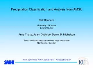
Some ideas about high frequencies and high latitude precipitation Ralf Bennartz University of Kansas. Outline Optical properties Some AMSU results Imaging capabilities for TMI-like radiometer. Different precipitation events. Graupel (Cold air outbreak). Frontal precipitation.

E N D
Some ideas about high frequencies and high latitude precipitation Ralf Bennartz University of Kansas
Outline • Optical properties • Some AMSU results • Imaging capabilities for TMI-like radiometer
Different precipitation events Graupel (Cold air outbreak) Frontal precipitation Thunderstorm Radar reflectivity [dBz]
Radar versus passive microwave precipitation estimate Graupel (Cold air outbreak) Frontal precipitation Thunderstorm
Observation geometry Altitude of radar beam (elevation 0.5°): @100km distance: 2.2 km @200km distance: 5.2 km 273 K isothermal typically at 2-3 km
Volume extinction at 85 GHz versus 150 GHz Bennartz and Petty (JAM, 2001)
Four classes of precipitation intensity from co-located radar data Rain rate Class 1: Precipitation-free 0.0 - 0.1 mm/h Class 2: Risk for precipitation 0.1- 0.5 mm/h Class 3: Light/moderate precipitation 0.5 - 5.0 mm/h Class 4: Intensive precipitation 5.0 - ... mm/h
Radar composite RGB AVHRR ch3,4,5 PC product RGB:red: very light green:light/moderate blue:intense NOAA12 overpass 13 September 2000, 05:48 UTC
150 GHz versus 89 GHz scattering index (land) Bennartz et al. (in press, Met. Apps) • 150 GHz enhances dynamic range of SI by a factor of 2 • About 15% of the precip free areas are falsely identified as raining at 89 GHz. This is reduced to 2.6% at 150 GHz.
Dual polarization at 150 GHz? • No results on that yet. • We frequently observe remaining polariztion differences in frontal type precip. Maybe due to oriented ice particles • There might be a potential to discriminate between frontal/convective events. • Has to be studied
Frequency IFOV (km Along track) IFOV (km Cross Track) EFOV (*) (km Cross Track) 10 GHz (TMI) 63.3 38.2 39.0 19 GHz (TMI) 30.4 18.4 19.9 21 GHz (TMI) 27.2 16.5 18.3 37 GHz (TMI) 16.0 9.7 12.6 85 GHz (TMI) 7.2 4.4 6.0 118 GHz (estimated) 5.2 3.2 5.0 150 GHz (estimated) 4.1 2.5 4.6 Field of view IFOV/EFOV for TMI-like radiometer with 118/150GHz channels (*) values from Bauer and Bennartz (Radio Sci. 1998) • Only about 30% along track coverage @ 150 GHz
Conclusions • Scattering signal shows good correlation to rain rate, • However, sensitivity varies strongly with type of precip event • High frequencies (AMSU 150 GHz) show much better response than lower (AMSU 89 GHz) • Polarization information might be valuable too • Use of 118 or 183 GHz might be even better than 150 GHz cause don‘t see the surface (no results on that yet).