Download

1 / 18
180 likes | 295 Vues
Building a GIS with Limited Resources. VILLAGE OF LOMBARD Daniel Price, GIS Technician David Dratnol, Village Engineer. About Lombard. 22 Miles from downtown Chicago 43,251 Residents (28th among 272 NIPC municipalities) 12,324 Parcels

E N D
Building a GIS with Limited Resources VILLAGE OF LOMBARD Daniel Price, GIS Technician David Dratnol, Village Engineer
About Lombard... • 22 Miles from downtown Chicago • 43,251 Residents (28th among 272 NIPC municipalities) • 12,324 Parcels • Bounded by I-355, I-88, IL Route 64, and Westmore-Meyers Rd.
About our GIS... • Consists of 1 Full time GIS person. • Based in Technical Services Department of Public Works. • Responsible for GIS related activities for entire village. • GIS budget consists of salaries and operating supplies
So…What is GIS??? • …”a system of computer software, hardware and data, used by personnel to help manipulate, analyze, and present information that is tied to a spatial location.” - www.gis.com • Intelligent Mapping. • Displays spatial data (parcel, manholes, hydrants, districts) based on the non-spatial data (address, valve size, population, zoning) you have collected.
VILLAGE OF LOMBARD STREET LIGHTING Features and data is collected & used in G.I.S. software
VILLAGE OF LOMBARD STREET LIGHTING Once a feature is selected, you can retrieve information.
VILLAGE OF LOMBARD STREET LIGHTING You can easily query your data
VILLAGE OF LOMBARD STREET LIGHTING The Results are immediately displayed
Relationship with DuPage County... • DuPage County has their own G.I.S. Department • Provide data to all their municipalities for a fee. • Parcels, Center Line, topos, orthophotos, real estate files, and much more is all delivered • Fee was recently waived with a data exchange agreement.
Need for Utility Information in our new GIS • As of 1995 all utility information in plat books as mylar (paper) format. • Original book dates as far back as mid- 1960’s , with updates to 1989. • Village purchases AutoCAD Map GIS software • Need for Mylar Utilities to be converted into digital (AutoCAD)format
Village Outsources Utility Data Conversion • Contractor sends mylars to Russia to be digitzed • Village now has digital CAD files of Stormwater, Wastewater & Water Distribution systems • Quality assurance went overlooked • Some areas missing, layers combined, many features duplicated
Using GPS to collect data • Utilities are in CAD format- No data Intelligence • Lights, Trees, Signs are non existent. • With GPS you can collect spatial data accurately. • You can also add non-spatial data on the fly Photo courtesy of www.trimble.com
1997- Fire Hydrants 1998- Street Lights 1999- Water Valves (stopped short) *2000- Multiple features in one quarter-section *2001- Multiple features in two entire sections *2002- Route 64 GPS project for IDOT Village of Lombard GPS projects *Due to budget and personnel constraints, GPS projects fail to get off the ground
Village decides to outsource plan for an Enterprise GIS • 1999- Technical Services Division devises G.I.N. Model • 2000-G.I.S. Management team nixes idea & hires consultant to design an “Enterprise G.I.S.” • Consultant Delivers G.I.S. conceptual design • Plan is 4 years old and yet to be funded
Village GIS looks into PDA based mapping solutions • ArcPad GIS software. • GIS Software fits on a Pocket PC • Pocket PC is brought out into field where mapping is done • Information is collected rapidly by a single user. • Pocket PC downloads data into PC for INSTANT use. • Cost for one system less than $1,000
Village GIS attempts to purchase ArcPad software & PDA • 2000- ArcPad & PDA are requested and budgeted • Not accepted • 2001- ArcPad & PDA are requested and budgeted • Not accepted • 2002- ArcPad & PDA are requested and budgeted • Not accepted • 2003- ArcPad presentation is made to Public Works Management • 6 units with ArcPad are purchased for entire PW
A successful GIS field mapping project • GIS field mapping project of collecting 19,000 trees in Summer of 2003 • 6 PDAs, 1 GIS Tech, 1 part time Engineering co-op, • Complete & updated tree inventory database • Between June and September 99% of trees are collected
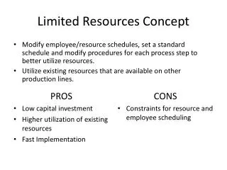
Summary • GIS is expensive. • Upper Management must realize big picture- Show Upper management how the benefits outweigh the costs in the long term. • Utilize existing employees that have some skills to collect data and have knowledge of the systems. • Don’t re-invent the wheel. • Collect data any way you can. • Avoid spending money on consultants to plan if you cannot follow through • Dan Price - priced@villageoflombard.org 630-620-5740