Download
1 / 16
160 likes | 350 Vues
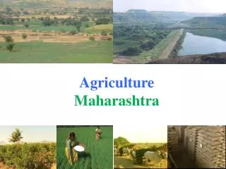
USE OF GEOSPATIAL TECHNIQUES IN HYDROGEOLOGICAL INVESTIGATIONS: A CASE STUDY FROM PURANDER TALUKA, PUNE DISTRICT, MAHARASHTRA, INDIA. Sampada Joshi, Vinit Phadnis, Gaurav Srivastava & Himanshu Kulkarni. INTRODUCTION.

E N D
USE OF GEOSPATIAL TECHNIQUES IN HYDROGEOLOGICAL INVESTIGATIONS: A CASE STUDY FROM PURANDER TALUKA, PUNE DISTRICT, MAHARASHTRA, INDIA. Sampada Joshi, Vinit Phadnis, Gaurav Srivastava & Himanshu Kulkarni Dr. Sampada Joshi
INTRODUCTION • Groundwater forms very crucial source of potable water supply and supplementary irrigation in arid and semi-arid regions of the world. • Many of these areas are underlain by “hard rocks” which form heterogeneous aquifers. • Aquifer storage as well as discharge is highly variable; therefore residence time, groundwater storage and aquifer response to drought bear a complex relationship with each other. Dr. Sampada Joshi
STUDY AREA • Two watersheds- Pimpri-Pandeshwar & Pondhe located in SE and Eastern parts of Purandar Taluka of Pune district of Maharashtra (SOI Toposheet Nos. 47/J/7/NW and 47/J/7/NE) covering five micro-watersheds admeasuring 14000 hectares. • The study defines hydro geological regime based on geological mapping and field studies with emphasis on monitoring wells in terms of water table fluctuation and water chemistry (pH, conductivity, salinity & TDS). Dr. Sampada Joshi
HYDROGEOLOGY OF THE AREA • Pandeshwar & Pondhe watersheds are underlain by Deccan Trap basalts which . • These lava ‘flows’ vary in thickness from a few meters up to 10s or even 100s of meters. • Basalt lavas from the area are ‘aa’ lava flows belonging to the Deveghat formation. • The basaltic rocks constitute the primary physical framework for both watersheds, which have been, traversed by fractures at places. • The overall hydrological and hydrogeological environment is essentially a “hard-rock” domain possessing low porosity and permeability or hydraulic conductivity. • They constitute groundwater systems showing uncertain well yields with an overall low aquifer-storage potential. Dr. Sampada Joshi
Contd… • Hydrogeological monitoring for Pimpri-pandeshwar watershed involved a detailed study of 30 odd large diameter wells. • In Pondhe watershed,16 odd large diameter wells were studied alongwith study of drainage lines and hydrogeochemical characters in relation to the local geology. Dr. Sampada Joshi
Geomorphology & Drainage Analysis • Both the watersheds are much gentler in relief. • The Pimpri-pandeshwar watershed gradually slopes towards the South-East while Pondhe watershed gradually slopes towards the East, the regional slope being towards the South. • Regional drainage pattern is sub dendritic. In the watershed, however, its expression is a weak combination of sub dendritic and rectilinear types. • Bifurcation ratios indicate a weak structural control. • Drainage densities in Pandeshwar and Pondhe watershed are much comparable to those for fourth order watersheds in the Deccan basalts. Dr. Sampada Joshi
Data collection and Analysis • Water level. • Depth of the well. • Surface elevation of each well. • Location of the well. • Pumping test Dr. Sampada Joshi
It is quite clear that groundwater flow is not uniformly distributed. Most of the flow lines point a direction towards the southern margin of the watershed. The monthly water level data (for 3 months) is only indicative of the post monsoon distribution of water levels in the area. Dr. Sampada Joshi
geochemical parameters: Pimpri - Pandeshwar watershed Dr. Sampada Joshi
Contd… • pH values are in range of 7.2 to 8.4 (range of neutral to alkaline nature). • Salinity is considerably high. • Most of the wells from the Pimpri-Pandeshwar watershed cross the limits of the potable water(500 mg/l for the TDS, pH < 8.) with very high salinity as well as EC values. Dr. Sampada Joshi
Water table elevations from Pondhe area. • Water table surfaces are more or less regular. • Groundwater flow is almost uniformly distributed. • The flow lines point a direction towards the southwestern and southeastern margin of the watershed indicating that the ground water flow is towards the stream moving out of the watershed. Dr. Sampada Joshi
Water table elevations from Pondhe area. • pH values are in range of 7.2 to 8.4( neutral to alkaline). • Salinity is considerably moderate indicating water quality for irrigation to be good to moderate. • Most of the wells from the Pondhe watershed are well within limits of potable water with acceptable salinity as well as EC values Dr. Sampada Joshi
Results & Conclusions • In a typical Deccan Volcanic Province, similar looking aquifers show differing values in TDS which could be attributed to the presence of alluvium and anomalies caused by salinity. • High TDS values in Pimpri –Pandeshwar watershed are due to presence of alluvium rather than hard rocks. • While Pondhe watershed shows normal values for pH, salinity as well as TDS (within permissible limits as per WHO). • Baseflow observed in Pimpri –Pandeshwar watershed is higher than Pondhe watershed indicating that the aquifer is feeding the streams and water table is higher. • Geospatial techniques were found to be effective means of mapping and analysis as it enhanced the speed of operations considerably. • The water table contour maps generated over three months and subsequent field visit data helped indicate groundwater recharge and discharge zones which would help guide new engineering structures and thus support decision making. • Further characterization of these watersheds is being done through continued monitoring and pumping tests. Dr. Sampada Joshi
THANK YOU!!! Dr. Sampada Joshi